Decision made, we’re staying put in Sawtooth Canyon campground for another day. It’s just to peaceful and beautiful here that we just want to stop for a day & catch our breath.
Panoramic shot from our campsite
To that end we sleep in until after 8:00am and had a very leisurely morning. Barb took care of researching and booking our next few nights (we now have reservations until Monday).
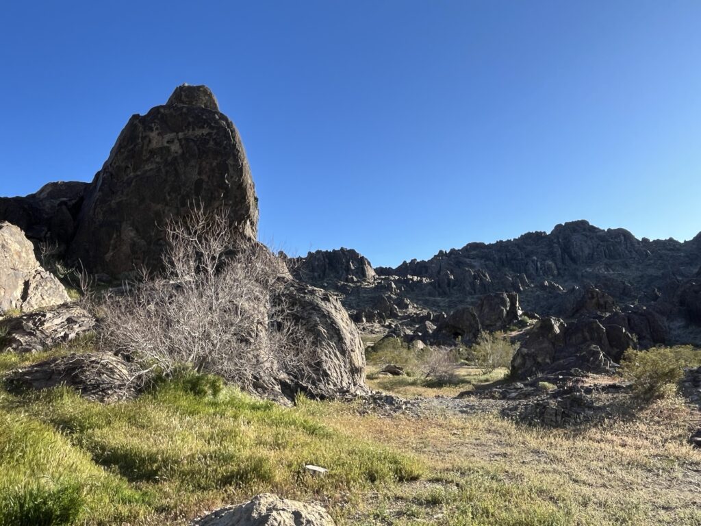
After lunch we went for a walk about the campground and a short hike into the surrounding hills.
A little about the areaBarb enjoying the hikeTony at the top of a scrambleNice viewTony returning from top of scrambleVegetation
Back at camp we settled in to read and enjoy a few snacks before making ‘breakfast for dinner’. The evening was spent relaxing in the van and watching a few videos.
California poppiesHole through rock
Tomorrow we’re heading to a serviced campground in preparation for the following two days which will be more remote.
After a great nights sleep in this amazing campground, (Willow Springs) we took advantage of the amazing shower facilities (9/10) before prepping for the road.
Departing Willow Springs campground
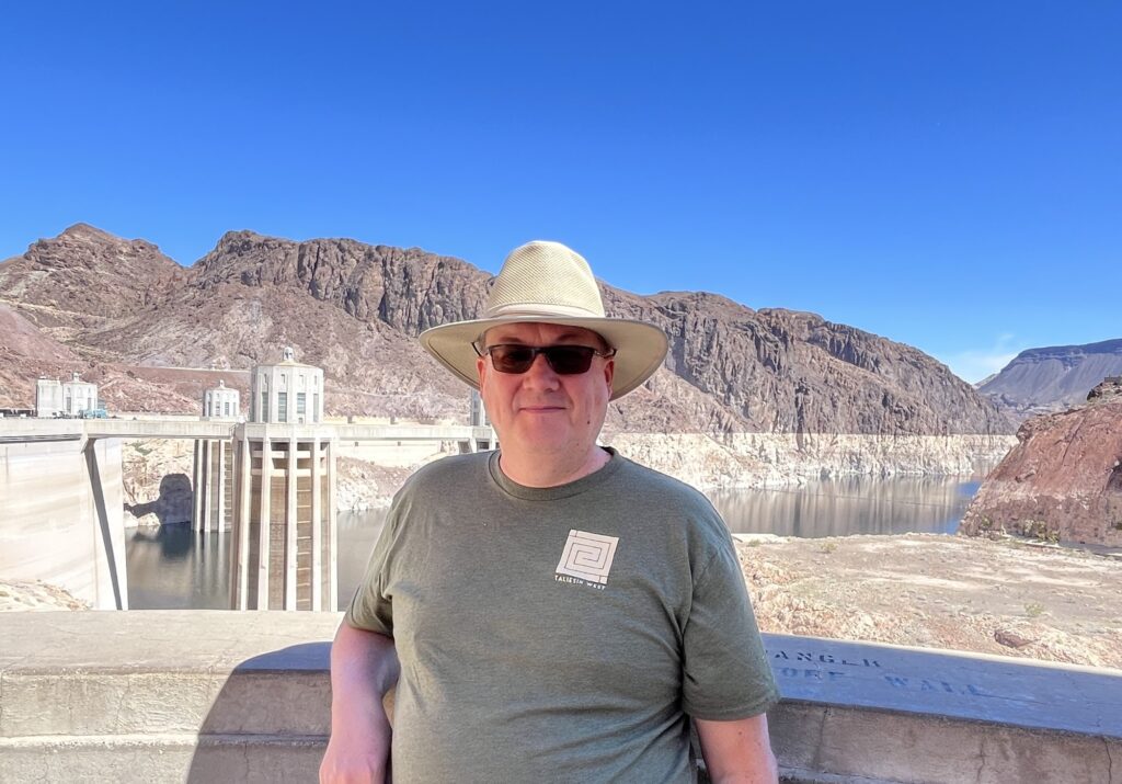
Our first stop was of course Hoover Dam. It was just 20 minutes from the campground and we arrived at about 10:30am. It was relatively quiet but I’d still recommend getting there earlier than we did in order to see everything you want.
Nevada state lineNew road bridge across Colorado RiverHoover Dam Visitors Center, NV
We took the shorter Power Plant tour as we still had a fair drive ahead of us. The tour was very good and we got to see the inside of one of the turbine rooms at the bottom of the dam.
Nevada Power Plant, Hoover Dam
There are tonnes of statistics about this dam that I won’t try to bore you with as others elsewhere online can share those better than I can. I will just say that the entire site is quite an engineering marvel given that it was built in the 1930’s and has been updated consistently since, including the construction of a new roadway bridge over the canyon which avoids having all highway traffic drive across the dam. We highly recommend visiting the Hoover Dam if you’re ever in this area, we’ll be back to take the longer Dam Tour the next time.
Lake Mead, Nevada/Arizona
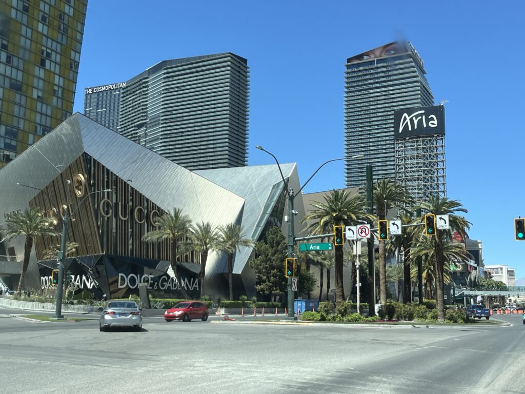
We left Hoover Dam at about 12:45pm and headed towards Las Vegas, NV. The drive was only about 45min and we headed to the ‘strip’.
Welcome to Las Vegas
We had no intentions of staying (at one point in our planning we had thought of camping near the strip but dropped that idea). Instead we were just going to drive down ‘the strip’ and take in the sights, sounds and aromas of Sin City. Barb took pictures and I concentrated on traffic and traffic signals. It took over half an hour to drive to the North end and back onto the interstate where we headed South on I-15 towards California.
The following are a few pictures from Las Vegas captured on our drive-through. We have plans to fly back to LV in the future and take in the city and the entertainment without worrying about our van and belongings.
Looking NorthNew York, New YorkMGM GrandAriaPlanet Hollywood with Gordon Ramsey BurgersParis Las VegasEiffel Tower, Vegas styleHarrah’sThe StratosphereFremont StreetLeaving Las Vegas
We stopped in Primm, NV to fill up with non-California priced fuel, or so we thought. Yours truly pulled the boneheaded move of the day by accidentally pressing the ‘Supreme’ button on the gas pump and paid $6.029/US gallon. Until today we’d been paying less than $4/US gallon. Ouch.
California state lineWorlds tallest thermometerJoshua tree
Crossing into California we drive along I-15 to Barstow where we exited and head South for about 20 miles to a Bureau of Land Management (BLM) campground. Sawtooth Canyon has no services and so you need to be self-sufficient while staying there. This includes packing out all garbage. Camping is free but there are only 13 sites available on a first-come first-served basis. We were lucky and got a fairly level site next to a large rock outcropping in the middle of the campground. So far it is VERY QUIET and relaxing. We might even stay here for a couple of nights.
Up early and showered! These time zone changes are making getting up early easier and easier. The showers at our campground were rating 3/10. Lots of hot water and a private lockable shower room but that’s it. Dirty, dilapidated, hard to set the perfect temp water. It got us clean, best possible outcome given the conditions.
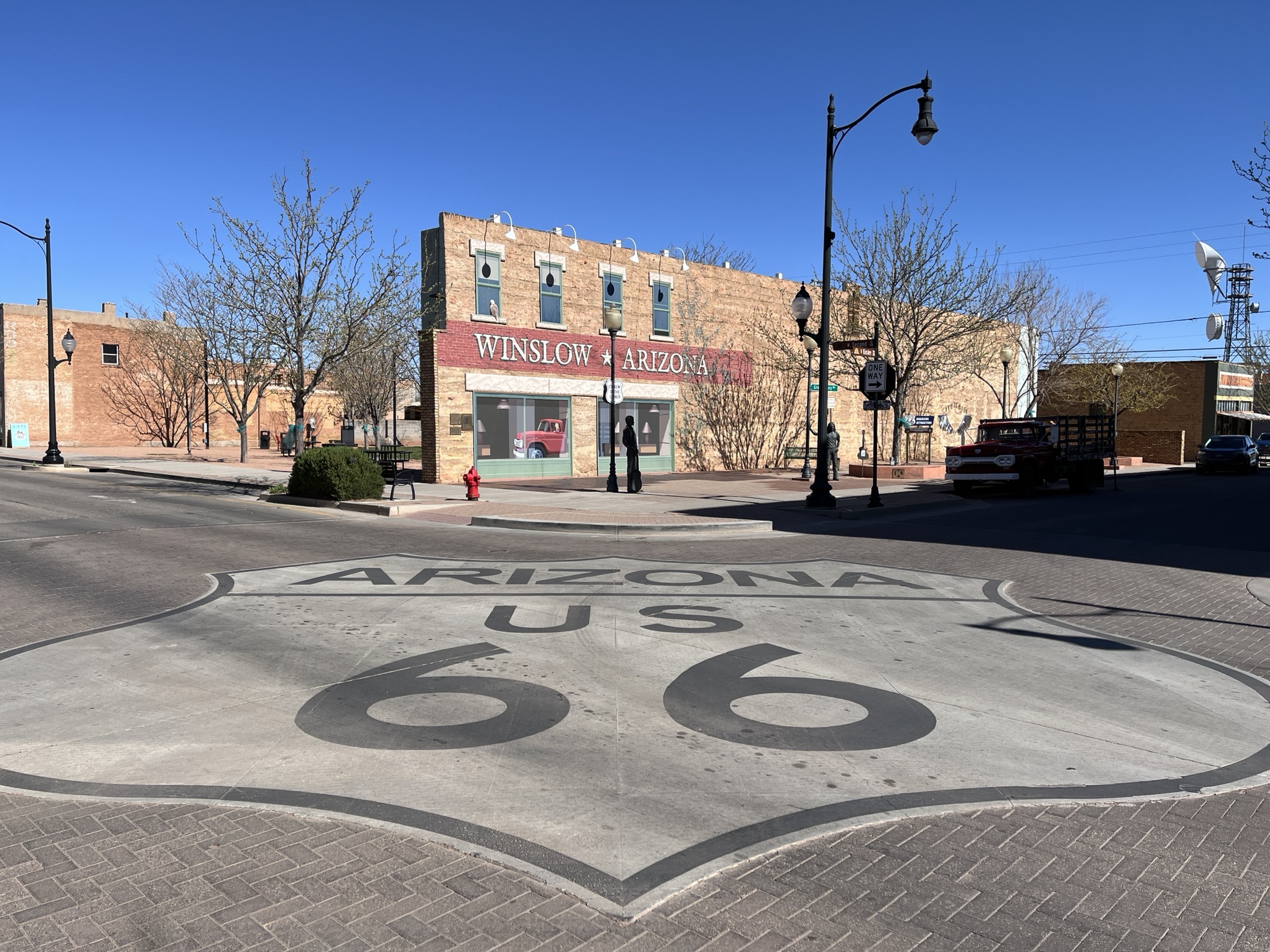
The campground was very quiet and the sites are spaced nicely apart. A great place to stop for a night if you’re near or passing by Winslow, AZ.
Speaking of Winslow, you might have guessed from yesterday’s blog that today we are starting our day by visiting Winslow to stand on a corner and admire a certain flatbed Ford. All of course references to the Eagles song “Take it Easy” in which Winslow is referenced and now visited by tens of thousands of each year from around the world.
We started our visit to Winslow by parking the van almost immediately behind ‘the’ flatbed Ford. It was early and the town was still quiet. We went to enjoy breakfast at “The Flatbed Cafe”. Barb ordered Enchiladas & Eggs while I orders Eggs Benedict. This was a treat and it was delicious.
Flatbed cafe, Winslow, AZ
Afterwards we went to take some pictures around the towns main attraction, the flatbed Ford. The town has made a very nice space for visitors such as us to take pictures including piping Eagles music throughout the area. As it was early we had the place almost to ourselves but we were assured that within an hour our so it would be bustling with people all trying to get the perfect picture. The only other people there were a couple originally from Markham, ON (small world) that now live in Los Angeles, CA.
Leaving town I realized that Winslow is a rarity for US-66, it’s prospering. Could this really be because it was referenced in a song some 52 years ago? Do/did the Eagles have that much of an effect? One wonders.
We head a little further West and take a detour to visit the Meteor Crater. This crater was formed almost 50,000 years ago when a huge meteor crashed into the Arizona landscape. It’s estimated the explosion equaled 20,000 tons of TNT.
Meteor Crater – almost 1 mile across
Today the crater is 550 ft deep and almost a mile across. It’s privately owned by the family that owns bar T bar ranch, the Barringer’s. There is a $27USD entrance fee that includes access to the observation walkways, a museum, theatre & guided tours. We did not take the guided tour or watch the movie in the theatre but did walk about on our own and visited the museum. This is a great place to visit, but in my opinion should not cost what it did. Maybe I’m just cheap. We both really enjoyed the visit.
550ft deepIt was very windyMeteor Crater, AZ
Returning to I-40 we headed towards Flagstaff and then onto Kingsman, AZ. Here we stopped for groceries at Bashas’ supermarket before heading out and turning away North from I-40 towards Lake Mead. We stopped for the night in the Lake Mead Recreational Area and are staying at the Willow Creek Campground & RV Park. Our site (D3) has a fabulous view of the Colorado River canyon as the river flows South away from Hoover Dam.
A few scenes from todayView from the foot of our campsite
We awake to look out across a lava field left by a volcano some 10,000 years ago. It seems alien in what can already be considered by many an alien landscape.
Lava from ancient volcano in Grants, NM
Oh, and we discovered that we have a mouse in the van as evidenced by buns having been nibbled as well as a banana. Traps were procured.
Argh, we have a mouse! Not happy campers.
New Mexico is harsh. It gets hot, very hot in the Summer but we awoke to 1C this morning. The sky is almost always bright blue, clouds just don’t seem to form here and yet when it does rain torrential floods can wash away bridges and towns. It’s dry today, no floods to worry about. As we drive we wonder what life is like day-to-day in this environment, one that doesn’t seem to have seasons where trees leaf and then fall, where every road seems to lead to the horizon and the only evidence that anyone knows about it is the large plume of dust they leave as they traverse the landscape. Harsh.
Our first stop today was the Continental Divide, the place in the Rockies where water either flows towards the Atlantic or the Pacific. There’s a small plaque that we stopped at to commemorate our passing from East to West.
Soon we crossed into Arizona, another time zone change. This time from Mountain Daylight Time (MDT) to Mountain Standard Time (MST). Arizona does not observe Daylight Savings Time. So, we are now at the same time as those on the West coast but not yet in the same time zone.
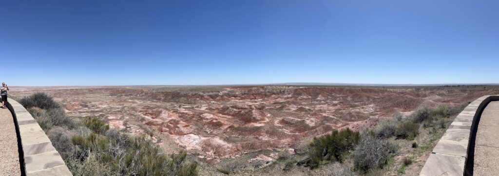
A little ways into Arizona we make a stop at the Petrified Forest National Park. We entered at the North gate and followed the 28 mile road through the park to the South Gate. In the North you get to explore the Painted Desert from overlooks that expose a wonderful array of colors in the hillsides.
Painted desert
As you travel South the landscape becomes more barren and moon-like before depositing you into the petrified forest. As you look about you see what appears to be rocks strewn about the landscape, but when you get close you realize that they are all petrified wood from trees that died 10’s of millions of years ago. We stopped in a few places and walked amongst these ‘logs’ and were amazed by the variety of colors of crystals that had replaced the original organic wood fibers. Some look like a lumberjack had recently felled the trees and cut the logs into short lengths but then left the logs instead of taking them away. To look at, it’s wood. To touch, it is rock.
Petrified Forest
After leaving the park we continue westward and stop for the night at Homolovi State Park near Winslow, AZ. A quiet spot in the desert to spend the end of the day amongst the sagebrush & tumbleweeds.
Tomorrow a certain flatbed Ford will be sought out and then onto western Arizona and into Nevada.
In the canyon we were sheltered from the sun’s earliest rays and the morning was brisk. We completed our morning routine, vacated our campsite and dumped the tanks (no mess on me).
Our route took us North into Amarillo where we again joined I-40West towards New Mexico. We soon passed the ‘Cadillac Ranch’ where we had stopped last year. The winds were light being early and there were many people adding to the spray paint on the cars embedded in the field.
We stopped again in Adrian, TX to visit the Midpoint Café and enjoy an early lunch. A 50’s style roadside café, they serve the BEST homemade hamburgers we’ve ever tasted.
Midpoint of Route 66Midpoint CaféMain St., Adrian, TXThe BEST burgers we’ve ever had!
As we leave Adrian, the landscape begins to change rapidly towards open rangeland. There are very few trees and endless expanses of grasslands.
We head towards New Mexico but stop just before entering at a small mostly vacated town called Glenrio, NM. It technically just across the state line and has 1 visibly operating business, a cannabis shop (now legal in NM).
We didn’t stop for that however, we stopped to look at a now abandoned Post Office and Cafe. Ghosts of a simpler time along old Route 66.
Glenrio, NM
As we head across New Mexico’s barren landscape the temperatures rise and hit 29C by early afternoon. The A/C is deployed. The pictures below don’t do the vastness of the spaces justice and at times you really wonder if you’ll reach to ridge on the distance and what could be beyond? Yep, more trains, plains & automobiles.
Below is a collection of pictures from the day. The sixth picture is of a mountain that we felt reminded us of ‘Jabba-the-Hutt’ from Star Wars. Yep, it was a long day in the sun.
We stopped in Grants, NM at the KOA Journey as a place to rest for the evening. To remind us that we are now at a higher elevation, the chip bag has puffed up due to the lower air pressure. Must remember to be careful opening other containers! (ask me how I know!)
Tomorrow we head into Arizona and make a few more Route 66 stops.