We left Miranda, CA at about 9:00am and head North along the ‘avenue of the giants’. This is a historical 32 mile stretch of US-101 lined with Redwood trees. It’s a great way to start our drive as we admire the sheer size of these trees that are at times right at the edge of the asphalt.
Avenue of the giants, Miranda, CA
Rejoining US-101 we drive North for about an hour admiring the forest all about us. Shortly after Eureka and Arcata, CA we turn into the small town of Trinidad, CA and drive to the beach. It’s a cool and overcast day but Barb was insistent that she wade into the ocean. We took a short walk onto the beach & Barb discovered how cold the ocean is at this time of the year.
Trinidad, CA
Leaving Trinidad we headed further along US-101 and stopped to make a coffee at the Trinidad rest stop. Again, the Redwood trees surround us.
Back on US-101 we detour into Redwood National Park and drive the scenic route. We stopped at Elk Meadows, see a herd of Elk and then go to the visitor center and pick up a pin for our collection. The visitor center is housed in a 1934 building constructed by the CCC when the park was originally being formed.
Driving on the scenic road, we stop to walk amongst the trees. They are magnificent, they are huge. Enough said.
Redwood National Park, CA
Returning to US-101 again we turn toward the Oregon state line.
Soon we arrive in Brookings, OR and immediately find ourselves stuck in a traffic jam. It took us an hour to arrive at a restaurant for lunch before we went on to get groceries and fuel. A few minutes further along the highway we arrive at Harris Beach State Park where we will be staying for the next three nights.
First impressions are very good. Barb walked on the beach and calls the park gorgeous. We’ll talk more about the park in our next post.
The SR-1 that was right at the foot of the space in which we slept was very quiet all night until about 6:30am when a few cars started to pass. We sorted the van and ate a breakfast of leftovers and prepared to leave by about 8:30am.
At Arena Point we took a short detour to see a lighthouse perched on the cliff edge. While visiting we stopped to watch the waves crash onto the rack along the shore.
The road North of Fort Ross was not as twisty as it was to the South. As such we made fairly good time as we ventured further along the coast.
Further along the coast we stopped in MacKerricher State Park near Fort Bragg, CA to dump our tanks and fill our water tank. We also took the opportunity to enjoy the day use parking area (free) where we enjoyed lunch and made Oregon campground reservations for the next week.
Back on the road SR-1 turns inland just North of Rockport, CA and head through a Redwood forest. The road climbs and descends quite a lot as it crosses the coastal mountain range. It also is super twisty and tight. This road would make a brilliant motorcycle cruise route IF it were repaved. This they are planning according to the roadside signs over the next two years.
Eventually we reach US-101 and turn North towards our destination in Miranda, CA. Tonight we are taking advantage of our ‘Boondockers Welcome’ membership (part of Harvest Hosts). BW hosts are homeowners or other locations that provide places to park for a night and don’t require any payment or purchases of any kind.
Our location tonight is on a small gravel area adjacent to the hosts laneway within the redwood forest adjacent to Humboldt Redwood State Park.
Tomorrow we plan on driving the remainder of US-101 as we cross into Oregon where we will be slowing down and enjoying a few Oregon State Parks.
Such a beautiful place to have spent a night and then to wake up to. The sun shines across the Napa valley and in the distance (no pictures) I watch about 10 hot air balloons gliding over the valley. One of our neighbors from last night told us that they were leaving early to go for a balloon ride and I wondered if one of the balloons I was seeing contained them.
Olive tree on our hosts farm
We took our time this morning as we could stay until noon if we wanted and our planned drive was only a few hours. We did finally head out at about 10am and headed West towards Petaluma, CA. The rolling hills had many farms and wineries. Some wineries looked like French chateaus dropped into the Californian landscape, we guessed that the winemaking business is doing nicely.
Heading West out of Napa, CA
We stopped in Petaluma for brunch and to get caught up with a few internet-based chores as our hosts for tonight had warned us that no cellular signals reached their location.
With a full tank of fuel we headed West toward Bodega Bay, a popular beachside town that was jammed with weekend visitors. This was our first view of the Pacific Ocean on this trip and we found a small parking area a little North of town to stop and take in the views and fresh air.
Pacific Coast north of Bodega Bay, CA
As we drove further along SR-1 (Pacific Coast Highway) the traffic slowly decreased but the twists and turns increased causing us to drive carefully around the cliff side curves. As we were driving North we were on the inside lane which reduced some of the scariness of the drive; however, at one point we did wind our way up a canyon where we were on the outside of the road. Don’t look down. It still amazes us that many of these twisty roads in California do not have guardrails.
PCH, note the lack of guardrails and heightsA few sights from along the way
Eventually we arrived in Jenner, CA and found another place to pull off and enjoy the view. As we were early yet to arrive at our hosts, we settled in and watched seals lounging on the beach below and kayakers and surfers enjoying the water.
The final few miles of driving today had us arrive in Fort Ross, CA where we are staying at our hosts, The Fort Ross Store. Another Harvest Host, this store is a general store general store, coffee shop, cafe. It is wonderful, as are the folks that work here. We have a large 20×30 concrete pad on the west side of the building to ourselves that has amazing views out to the ocean.
Our campsite and view for the night!
We are told that the road gets very quiet at night and are looking forward to a wonderful sunset.
Our camp hosts were very cordial and things got quiet by 9:00pm. It’s nice when things work out. We both slept really well and awoke at about 6:30am. A light breakfast and coffee before we packed up and left at 8:05am. Minutes later we drove out of Yosemite National Park.
Views along SR-120 on the way to Stockton, CA
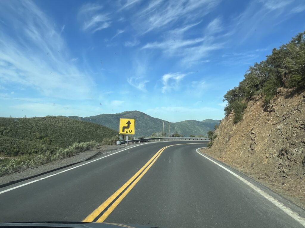
We were headed West along SR-120 towards Stockton, CA and descended down from the 5,000ft or so of the campground. At the town of Priest, CA there was a sign informing drivers that vehicles over 7,500lbs were restricted from taking the ‘old’ road and were required to take the ‘new’ road. We now know why, the old road is super steep for several miles whereas the new road is less steep for several miles more. The descent was super twisty and most corners were marked with either a 15 or 20mph suggested speed. Another MINI road in the van.
New Priest Grade Road
At the bottom of the decline we stopped in Copper Cove, CA for breakfast (2nd). Barb enjoyed a breakfast burrito and I had the country breakfast. It was delicious and a nice treat.
Continuing on, we drove through Stockton and onto Fairfield where we stopped for fuel and to do a little shopping. Next was Napa and a stop at RD Winery where we sampled some local wines and purchased a few bottles to enjoy at a later time.
Views as we drive across to Fairfield, CARD Winery, Napa, CA
Our night will be spent at Dan Dan farms just outside of Napa, overlooking the valley. It’s a beautiful spot with the farm keeping chickens and cattle while growing olives and producing Olive oil. This is a Harvest Host location and as such we purchased some eggs and a bottle of the Olive Oil as a thanks for allowing us to stay on their gorgeous farm overnight.
I was anxious. I was awake. It was 5:45am. We have plans to drive into Sequoia National Park to see the giant Sequoia trees, this means driving up the “General’s highway”, a road restricted to vehicles 22’ or shorter. Ours is 22’ plus the bike rack. We’ve been told by our camp host that it should be fine as long as I take my time. [Remember Tony, you’re not driving the MINI.]
Shortly after 8:00am we leave our campsite and immediately find a reason to pull over and stop… to clean the windshield that is. Expecting some epic views and vistas and wanted the glass to be as clean as I can get it with white vinegar and shop cloths (all we got).
The drive UP the General’s Highway is just that, UP. The drive to the Giant Forest Museum from our campsite is measured at 15 miles and should take about 40 minutes. The road rises to over 7,000 ft above sea level. There were too many switchbacks to count and all the time the road rose in front of us. It was narrow, tight & twisty, a perfect road for a MINI cruise, but I was in what felt like a huge lumbering truck. Slow and steady would get us there.
Drive UP the Generals Highway
The views were astounding, there are several nice pullouts where you can get out to take pictures. We see the flora around changing as the elevation increases, we pass through areas where wildfires have burnt the trees back to standing black poles devoid of all life. And then we arrive near the top of the climb and turn into a land of giant trees.
Into the grove of Giant Sequoia Trees
These are not your normal giant trees, these are Sequoias. We both expected large trees, it’s what we had come to see, but these are incredible. Thousands of years old and still standing on guard in groves near the tops of these mountains. Sequoias are not the tallest trees, that honor is reserved for the Redwoods, however, they hold the record for being the largest by mass with some estimated at being well over 1000 tons.
Leaving the museum we go on to find General Sherman, one of the largest Sequoias in the world. We park and walk down a nice trail to an enormous tree. It has to be well over 20 feet across and a few hundred feet tall. The trunks of the Sequoia tree do not narrow very much and so the trees feel more massive because of this. The bark can be up to 2 ft thick which help the largest trees in the event of fire as it would take a while to burn through this before exposing the sapwood that provides the nutrients to the upper portion of the tree.
General Sherman
Walking back up from General Sherman to the van we both feel the effects of exercising at over 7,000ft. It is tiring.
We now head out of Sequoia National Park towards Fresno, CA. A place to stop, get fuel and have lunch in the van. I take the time to upload yesterday’s blog post now that I have access to the internet.
We head North from Fresno along Hwy 41 towards Yosemite National Park. We have what we think is the last available site in the park reserved for one night. The drive is hilly and the road twisty causing for traffic to be inconsistent but as we get closer to the park traffic lightens and the drive is more enjoyable.
Heading North from Fresno, CA
Entering the park we save another $35USD because of our annual pass. The road continues to be twisty and we are now really gaining elevation again. The 30mile drive takes nearly an hour but the reward at the end!
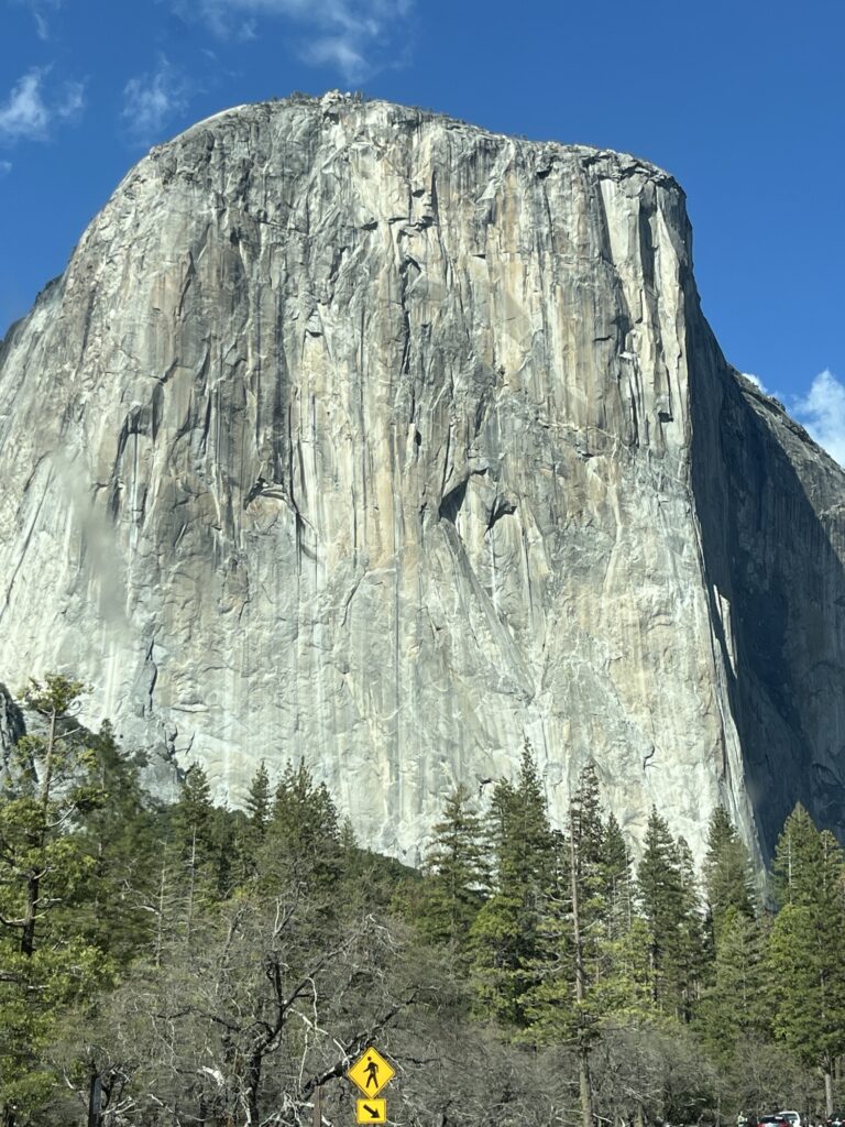
Our breathes were taken away as we turned a corner and looked right down into Yosemite Valley. Past El Capitan and the Bridal veil falls all the way to Half-Dome. This was a view that I had seen many times published by others or in TV documentaries now staring me right in the face. I yanked the van to stop and jumped out to capture some pictures. The sun was perfect, shining straight down the valley illuminating the rock surfaces and trees while causing a rainbow to appear at the base of the bridal veil falls.
Beautiful viewBridal Veil Falls with rainbow
We descended into the valley through a rock tunnel only just tall enough to clear the roof of our van. The valley was quiet. It’s April and the crowds have not yet descended upon the park. It’s not empty, I’m sure it never is, but there are parking spaces and room to move about. We enjoyed a drive along the valley to the end and then back to the road that will take us North out of the valley towards our campground for the night.
Into and out-of Yosemite Valley
The drive is up yet again along a twisty road that hugs the sides of the mountains. We eventually descend towards the campground and turn into Hodgdon Meadow campground.
Our campsite is not fancy or level. We do the best we can and set about having dinner. Our neighbors, the camp hosts seem to be having a party, hopefully it will wrap up before bedtime.
Our campsite at Hodgdon Meadow, Yosemite National Park, CA