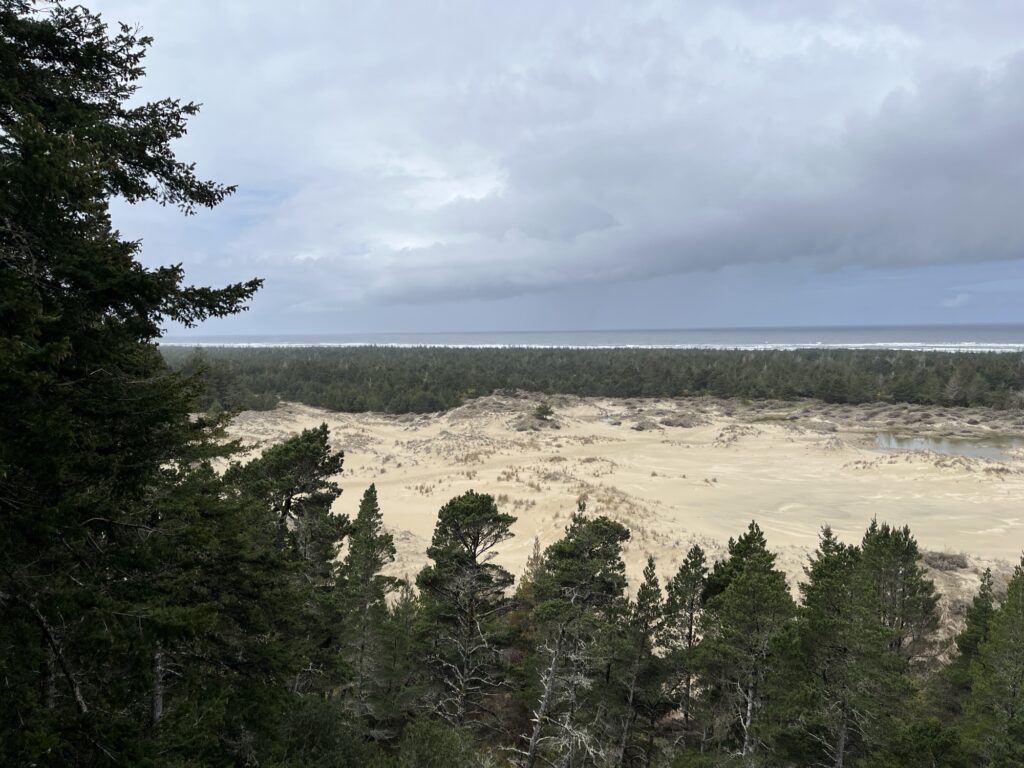
Oregon was wet, it rained a lot. Of course if you’ve been reading along you will have already observed this, but it does feel like I need to say it again, Oregon was wet.
Fort Stevens State Park has the best showers of the Oregon state parks we stayed at. 8/10. They only lose points for being push-button (timed) showers and bare concrete floors. All other requirements of a shower were easily met, especially privacy & cleanliness.
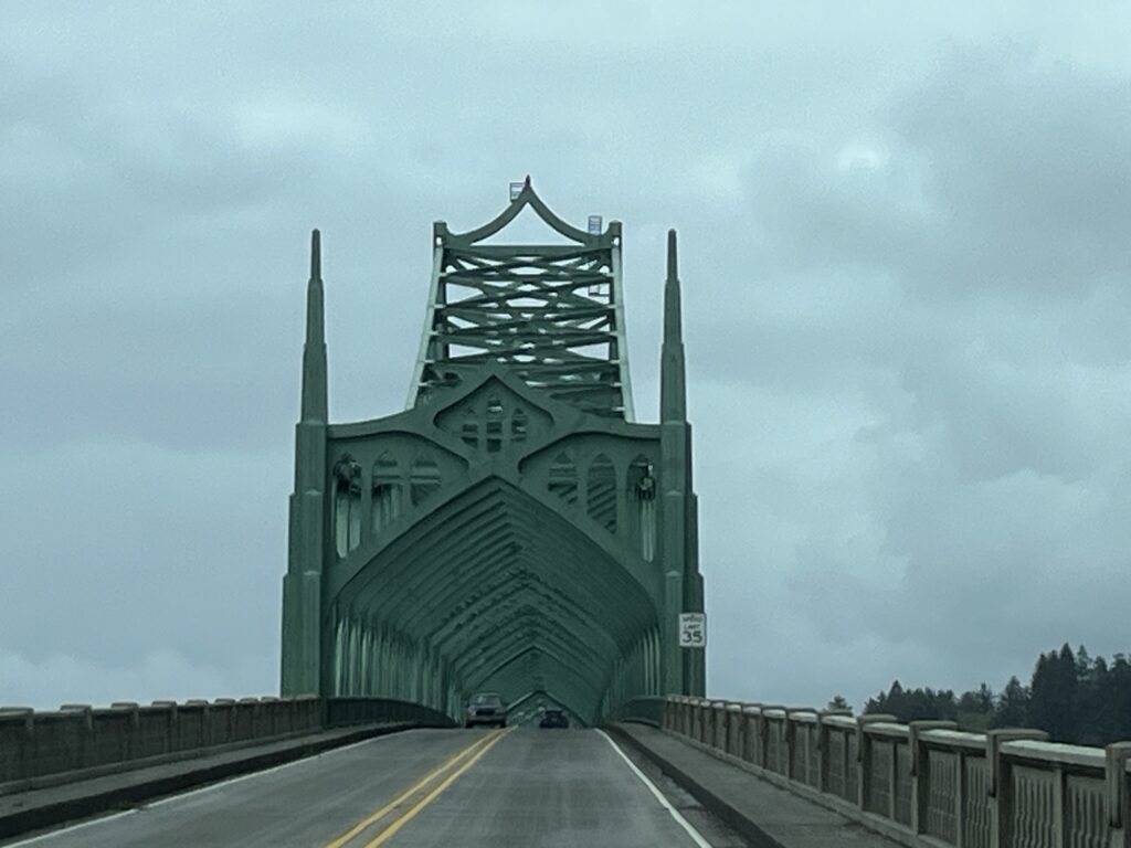
Today is a driving day, we leave Oregon and head across Washington to Port Angeles. Astoria, OR is the last town that we pass through on our way to Washington. Today there is a cruise ship docked in port, visitors are likely on a ‘Goonies’ sightseeing tour.
Bridge to Washington with cruise shipCruise ship BridgeDriving from bridge towards Washington
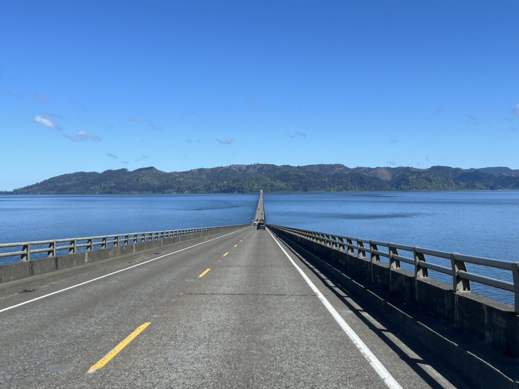
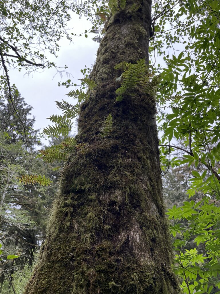
Washington state has a lot of trees, it’s about all you see as drive through it. We took pictures as you will see below, but didn’t stop at any touristy places. The drive was about the destination as it was 4 hours plus a break for lunch.
Arriving in Port Angeles we went down to the wharf and ate an early dinner at the Downriggers on the Water restaurant and enjoyed a clam chowder and a sandwich.
On our way to our campsite we topped off with fuel and then arrived at the KOA campground just East of town. Tonight we get everything in order to re-enter Canada.
CampsiteView from our campsite
Tomorrow will be an early morning as we are booked into the 8:20am ferry heading for Victoria, BC.
Our last day in the U.S. without driving anywhere. We slept in and enjoyed a relaxing morning while we waited for things to dry out from last nights rain. The sun was supposed to appear today and the afternoon was going to be glorious.
Barb prepared a delicious brunch fry-up after which I finished reading a second book on this trip and then we retrieved the bikes from the bike rack and prepared to go for a ride about the park.
Campsite at Fort Stevens State Park, OR
From our last visit here in 2022 we know that the park is laced with paved bike paths making cycling a great way to get about this rather large park. We started by heading towards the dunes and then cycling down to the beach access allowing us to ride on the beach. The tide was out and the sand wonderfully flat. The cool weather was keeping most people hunkered in their trailers, this meant that the cycling trails and the beach were very quiet.
Moss growing on treesPeter Iredale wreckWreck informationBeach looking NorthBeach looking SouthUs at the beachBeach panoramic
Oddly I was able to utilize 3 bars of 5G connectivity on the beach but only 1 bar of LTE while on our campsite. I took the opportunity to complete and post yesterday’s blog post from the beach while sitting on a driftwood log. The wind was biting (no sunshine) and so shortly after I had posted the entry we headed back inland toward the campground.
After securing the bikes back onto the bike rack we relaxed in the van for the afternoon as yet another brief shower passed over the area. For dinner, chicken fajitas were followed by an evening of TV. Tomorrow we head to Port Angeles, WA where we will spend our last night in the U.S.
One last leg along the Oregon coast awaits us today. Surprise! It rained overnight and continues to drizzle as we get ready for the day. Showers are the stock same as the other Oregon state parks but these seem to have been renovated slightly with new fittings and lights making them feel brighter and cleaner. Hot water (good) so they get a 7/10.
We depart our site at 10:00am and join the line-up to dump our tanks. We leave the park at 10:30am. Our first stop of the day is at “The Devils Punchbowl”. It’s a natural rock arch through which the waves break into what was a large cave before the roof collapsed. Now in certain conditions the waves break and shoot skyward. Not when we arrived however as the tide was not yet at its highest, although the weather and sea conditions made it look like it might have been quite a spectacle later in the day.
The Devils punchbowl
The road along this section of US-101 has at times subsided and as such it was quite bumpy and we had to pay attention to the warning signs regarding speed or suffer the consequences of our belongings being flung about the van.
Whale sculpture
Arriving in Tillamook, OR we stopped first at “The Blue Heron French Cheese Company” where we sampled some lovely cheeses and picked a few pieces up for eating later. We then, of course, made our way to the “Tillamook Creamery” where we visited their museum and viewed the creamery workers making and packaging cheese. The visit concluded with a trip through the gift shop and finally lunch at their cafe where cheese was prominent in all menu choices. Yummy!
The coast ‘softened’ as we headed further North with more of the coast now being wide open sandy beaches dotted with Summer getaway towns such as Rockaway Beach (not the one made famous by The Ramones). We made a stop at a viewpoint high on a cliff top and captured some beautiful shots of this portion of the coast.
We make a quick detour into Warrenton, OR to get a few groceries & fill up with fuel at Fred Meyers. Maybe, just maybe better than H.E.B. in Texas. Barb is smitten.
A short drive from Warrenton we arrive at Fort Stevens State Park where we will camp for the next two nights. This is our second time here as we camped here two years ago and had a great time.
Settling in the for the night under the trees. Good night everyone!
These Oregon State Parks are amazing and we’ve both been sleeping really well since arriving in the state. The rain woke us a couple of times overnight but had passed by the time we awoke. We took our time starting our day allowing the air and ground to dry out.
South Beach State Park, Newport, OR
After a lunch of nachos we set out on our bikes to explore the park. There are a number of paved trails that criss-cross the park that we enjoyed for an hour or so.
A little later in the afternoon we walked to the beach and enjoyed the sunshine that had finally broken through the cloud over of the past few days.
Grill cooked burgers for dinner and we settled in for the evening.
Tomorrow we head to Fort Stevens at the Northern end of Oregon.
Another driving day further North along the Oregon coast. First we enjoy a coffee and light breakfast and then go for a shower. Not quite as nice as the last park, but private and hot. The feeling was probably closer to prison shower than campground shower, 6/10.
It’s a misty day, not raining as such but not dry. We head out a little before 10:00am and shortly up the road the rain starts again. It’s on and off most of the morning which makes the roads a little slippery and so caution was used as we wound our way along the coast.
Coos Bay, OR was the first larger town we passed through. Clearly a logging town built around the railroad and harbour that still operates. We saw piles of lumber and pulp waiting to be shipped out. The rail yards still exist but seem not to be used as much anymore. I suspect that much of the wood is shipped to the far east from here.
Coos Bay, OR
North of Coos Bay the highway passes alongside the Oregon Dunes National Recreation Area. This is quite a long and large (31,500 acres) portion of this part of the coast that is comprised of sand dunes (some over 180’ high). Parts are open to buggies and ATVs but most is protected for wildlife and hiking. We stopped at a day use area but did not hike as the wind was cold and the rain intermittent.
Oregon Dunes National Recreation AreaSeal sculptures along the road
The highway at times is twisty and reminds us of the more casual parts of US-1 in California. The trees are right up to the roadside and overhang creating green tunnels for us to drive through. We stop briefly at Heceta Lighthouse where we had lunch in the van. It’s Sunday and many are here with dogs for a walk on the beach and up the trail to the lighthouse perched on the cliff top. We chose to be cheeky and just ate lunch and not pay the fee for parking.
Heceta lighthouseCape Cove below lighthouse
We arrive in Newport, OR and top off the fuel tank before going into the South Beach State Park where we are staying for the next two nights.
Bridge at NewportView of river emptying into PacificSouth Beach State Park from bridge
Our site is level and the park nowhere near capacity and so are expecting a quiet, albeit wet night. Until tomorrow, stay safe everyone.
Ah, to sleep-in. We both slept until almost 8:30am which is an indication of just how quiet this park is. This led to a slow morning as the rain slowly let up and moved away from the area. We enjoyed an egg and ham sandwich along with a coffee to start our day.
Our campsite (A04) at Bullards Beach State Park
The remainder of the morning was spent relaxing and reading as we waited for things to dry up outside. Shortly after noon we put on our hiking shoes and wind jackets and headed off for a walk about the campground and then onto the beach!
RhododendronBroomColorful Broom
The trail to the beach is sandy as it is shared trail with horse riders. We passed many plants that are now flowering that Barb had to take pictures of. Some of the trail is on boardwalks, one of which was just under water, shallow enough for us to wade through. There were a few other swampy sections that we also managed to go around thus keeping our feet dry.
Flooded boardwalkMossy treeShallonBarb climbing duneLooking out to sea
After about 30min we arrived at the dunes which we climbed over to arrive at a very long windswept beach. The wind was blowing at about 15mph and so we were well and truly coated in sea salt spray and sand by the time we had walked along the beach far enough to head back inland.
WindyScallop shellA walk along the beach
The waves being produced were impressive and the sea looked angry as it clawed at the sand relentlessly.
Wind and waves
Inland we found and followed a paved path that led back to the campground where we enjoyed a late lunch and then an afternoon nap before dinner.
A quiet walkBanana slugCamas
Tomorrow we move on again heading a little further North in Oregon to Newport.
Last night the rain continued and got quite heavy at times; however, by the time we awoke it had eased and we should be dry as we prepare to leave.
We had coffee and a light breakfast before heading to the showers and enjoying the wonderful facilities for one last time. Packing up the van went well and with a quick reposition we could also utilize the dump connection on-site.
So long! Harris Beach State Park
As we left the campground the skies opened again and we had rain as we head North towards Bandon, OR.
US-101 rose & fell while twisting & turning along the coast through forest to grass covered dunes. The scenery was amazing but the weather prevented us from stopping and enjoying the views.
Bridge over the Rogue River, Gold Beach, OR
We arrived in Bandon and our first stop was a laundromat. Yes, isn’t van life exciting? Once done we headed to a restaurant for lunch before we drove to Bullards Beach State Park and checked in.
Coquille River lighthouse, Bandon, OR
Our site is another fairly level paved site with electricity and water. Again it has nice shrubs around it to provide a sense of separation from the neighboring sites.
We relaxed for the afternoon watching a movie and then enjoyed a chicken curry on rice for dinner. The rain has stopped and we hope, based on the forecast, that tomorrow will be somewhat drier and we will be able to get out exploring. No driving tomorrow.
Today we spent the day at Harris Beach State Park again; however, this time we cowered in the van whilst it rained all day.
Tomorrow we head further North along the coast to another State Park. Hopefully the rain will subside a little to allow us to enjoy the outdoors a little.
We managed to snag three nights in this park on a fully serviced site large enough to accommodate a large Class-A motor home. It is paved and perfectly level, no blocking required. The services are convenient with the exception of the sewer dump which is at the back of the parking pad, quite possibly too far from our connection point which is midway along our van.
Each site in the campground is surrounded by a four or five foot hedge that is kept trimmed nicely. Our hedge includes a large flowering fuschia bush which adds some color and is nice for us northerners.
We slept in and took it very easy today. Once up & after coffee we went for a walk down on the beach. The tide was out and the sand was firm to walk on. Barb scoured the tidal pools for creatures.
Once back in camp we cooked a brunch of pancakes, bacon & eggs along with Canadian Maple Syrup that we had brought with us.
The afternoon was spent lounging and reading. A nap might also have occurred. Dinner was grilled Texas steak and asparagus served with potato salad and a mixed vegetable salad.
An after dinner walk around the campground and then to the clifftops to watch the sunset before returning to the van for tea & cake while watching a little TV.
We left Miranda, CA at about 9:00am and head North along the ‘avenue of the giants’. This is a historical 32 mile stretch of US-101 lined with Redwood trees. It’s a great way to start our drive as we admire the sheer size of these trees that are at times right at the edge of the asphalt.
Avenue of the giants, Miranda, CA
Rejoining US-101 we drive North for about an hour admiring the forest all about us. Shortly after Eureka and Arcata, CA we turn into the small town of Trinidad, CA and drive to the beach. It’s a cool and overcast day but Barb was insistent that she wade into the ocean. We took a short walk onto the beach & Barb discovered how cold the ocean is at this time of the year.
Trinidad, CA
Leaving Trinidad we headed further along US-101 and stopped to make a coffee at the Trinidad rest stop. Again, the Redwood trees surround us.
Back on US-101 we detour into Redwood National Park and drive the scenic route. We stopped at Elk Meadows, see a herd of Elk and then go to the visitor center and pick up a pin for our collection. The visitor center is housed in a 1934 building constructed by the CCC when the park was originally being formed.
Driving on the scenic road, we stop to walk amongst the trees. They are magnificent, they are huge. Enough said.
Redwood National Park, CA
Returning to US-101 again we turn toward the Oregon state line.
Soon we arrive in Brookings, OR and immediately find ourselves stuck in a traffic jam. It took us an hour to arrive at a restaurant for lunch before we went on to get groceries and fuel. A few minutes further along the highway we arrive at Harris Beach State Park where we will be staying for the next three nights.
First impressions are very good. Barb walked on the beach and calls the park gorgeous. We’ll talk more about the park in our next post.
Today we packed up our campsite and headed toward the Northern shore of the state of Washington. We would drive around Olympic National forest in which is Mount Olympia; however, the weather would not give us a chance to see the mountain as it started raining shortly after we left the campground and rained all day.
Leaving Warrenton and heading towards Astoria, ORColorful Astoria, OR
About an hour North of Astoria, Barb finds that South Bend, WA has a statue of the worlds largest oyster. We stopped and in the rain located the statue. Voila!
South Bend, WAOlympic National Park / Forest
We stopped in Forks, WA at the Timber Museum and ate lunch in the van before touring the museum. Although small they had some fascinating relics from the BIG timber days of 100 years or so ago.
Forks, WATreehouse
At the other end of the town of Forks, another museum displayed thousands of items that the owner, John, had collected over the past 47 years from the beaches in the area along the Washington coast. Although a high percentage of his collection is fishing floats, he also has a large collection of items from the 2011 Japanese tsunami that washes across the Pacific.
I managed to get up early this morning and go for an hour long walk. The first of the trip ☹️
The walk took me along the shore of a small lake near our campsite and then I headed toward the beach. It’s early so there was almost nobody about.
Coffenbury lake
I managed to get these two pictures of what remains of the wreck of the Peter Iredale. This was a 3-masted steel hulled barque that ran aground in 1906 during bad weather when trying to navigate into the Columbia River just a half mile North.
Peter Iredale – bowPeter Iredale -masts
After returning to the campsite, we spent a relaxing morning enjoying the sunshine albeit somewhat cool at just 14 degrees C.
After lunch we decided to take our bikes down onto the beach to ride them along the hard packed sand.
Riding South along the beachOur Rad Power Bikes RadMini’sTony found a much better cell signal and did some writing.Barb enjoying the experience of riding on the sand
For dinner we enjoyed steak, potatoes and grilled vegetables with some wine we picked up at Arcadian Moon Winery in Higginsville, Missouri. For the record, the mosquitoes were really bad and the citronella candle was required to have them leave us alone.
Today was the first of two full days we are spending at Fort Stevens State Park, a little downtime from traveling and time to enjoy the West coast a little.
View South along the beachWreck of the Peter Iredale (1906)We rode our bikes on trails to the Northern end of the beachWild Rhododendron View Eastward from the tops of the dunes and across the Columbia River toward the state of Washington
Last evening a small thunderstorm rolled through shortly after we had setup at the campground. This morning it is dry and we awoke early to use the showers, they were clean and the hot water was plentiful. Ahhh.
We ‘treated’ ourselves to a McDonald’s breakfast (our first fast food on the trip) and then we topped off on provisions at the Walmart before getting back onto the I-84 towards Portland,OR.
Leaving Pendleton the highway takes one last drop down into the Columbia river valley. For the next few hours we drive alongside this majestic river passing several large hydro-electric dams. Our route is shared with the railroads that also recognized this as a good route up from the ocean and into the heartland of the continent.
Columbia River
As we get closer to Portland we notice that the grasslands of the higher elevations have given way to more arable lands and then forests of tall cedars and firs. A clear indication that we are now on the West cost of the continent.
Mt. Hood Historic railwayHood River, OR
Along with these forests we witnessed a significant increase in the number of logging trucks on the road.
At Portland, we turn North and join I-5 into the state of Washington for a short drive to Longview, WA where we once again turn west and back into Oregon towards the coast. Longview is clearly a lumber town as we saw huge yards of logs being stored and awaiting shipping overseas where they will be turned into finished goods for shipping back to North America.
As we head towards Astoria, OR we realize that for the past two weeks we had been watching our elevation on the GPS rise from a few hundred meters to several thousand and now that we are near the coast, it is reading less than 50 meters. Before long this should be close to 0 meters as our target for the day is Fort Stevens State Park, OR.
Arriving in Astoria, we notice on Google maps that the primary bridge to the park is closed for maintenance and so Barb re-routes us across the town toward and alternate bridge. This new route through town turns out to be a 40% road upwards over the ridge and down the other side. I want you to think about San Francisco but in an RV. I head toward the hill now staring me in face and ask Barb, “are you sure?” To which the answer is “Yes” and so upwards we go, past the sign for ‘No trucks allowed’, up, up, up and over the top. Of course, the van made it and we were reminded of not blindly trusting what a map might suggest. We laughed at what the folks living on the street might have been thinking.
Arriving at Fort Stevens State Park we get ourselves settled as we are staying here for 3 nights to wind down and enjoy some time off-grid. Internet is not very reliable here and so a few days might go by before further posts are made. Back soon!
A dry morning awaited us as we looked out across the vineyard, today we are driving into Oregon.
We’ve learned that the Oregon trail passed through Glenn’s Ferry, so named because of the ferry service that once existed here. The Snake river at his point is fairly fast flowing and wide, and during the 1800’s many wagons and animals were lost attempting to cross the river at a point where three islands exist. This prompted the creation of a ferry service which existed for many years assisting those wagon trains heading westward to the coast. Although the ferry service no longer exists, it is remembered in the town name as does the 3 Islands crossing as many businesses use this name.
Our first stop of the day is in Boise, ID at an Oregon trail historical site. The area is now a park where many walk their dogs; but back in the 1800’s it was a crossing point of several trails and a location from which settlers would have had their first glimpses of the fertile Boise river plain. Many would call this far enough and today Boise is a prosperous city surrounded by lush farmland. Yes, they grow a lot of potatoes in this valley.
Oregon trail historical site
Leaving the Boise river valley, we climbed again into the hills and the land became more grassland and rolling. Stopping at a rest stop in one of these valleys, we enjoyed lunch in the van as we watched a variety of travelers exercise their dogs.
After lunch, we continued westward and the fauna changed again to coniferous forests. By mid-afternoon we were back at about 1500m and approaching Deadman Pass, a 6 mile 6% downhill grade that twists and turns it’s way out of the Oregon hills. We stopped at a viewing sight at the top where we could see the vehicles descend and appear to shrink into Tonka toys as they drove down the hill.
Deadman pass
Once at the bottom of the pass, we only had a few miles to drive before we arrived at Pendleton, OR. Tonight we are staying at the KOA in town and it is full, I think we got one of the last sites, but the full hookups and hot showers will be welcomed. Tomorrow we head to the coast.