After enjoying a very quiet night and the wonderful shower facilities at Cook’s RV Park, it was time to dump our tanks (no faecal matter on me 😎) and head back out onto the road.
Heading Southwest along US44 we soon arrive in Joplin, MO where we stopped to looked at a a Rt66 mural park that the city has installed.
Route 66 Mural Park
US44 beckoned and we returned to our Southwestern drive. The highway undulated with the landscape and soon we were nearing Tulsa, OK. The freeway had become a tollway and we were charged $5 to drive into Tulsa and then $5 to drive away from Tulsa towards Oklahoma City. The trees are fully leafed out here and the grass is starting to dry off as the sun is getting hotter as the days get longer.
Route 66 Historical Village, Tulsa, OK
After stopping for lunch in the van in Tulsa at the Route 66 Historical Village, we continued to Oklahoma City and then onto El Reno where we are staying at the Lake El Reno RV Park. This is a municipal park and is first-come-first-served. We had no issues getting a great campsite for the night. It is supposed to rain steadily tonight, but as you can see below we got to see a wonderful sunset from our site.
Sunset in El Reno, OK
Tomorrow we head into Texas. Good night all.
P.S. if you can think of a witty Oklahoma related catch-phrase for this post, send it my way & I might replace my placeholder above with it (giving you credit of course).
Despite reports of coyotes howling in the night, we slept well and did not hear any sounds at all. The Milddogs were up early and on the road by 9:00am heading toward their eclipse viewing location in Indiana. We departed the campsite shortly thereafter and headed towards St. Louis, MO.
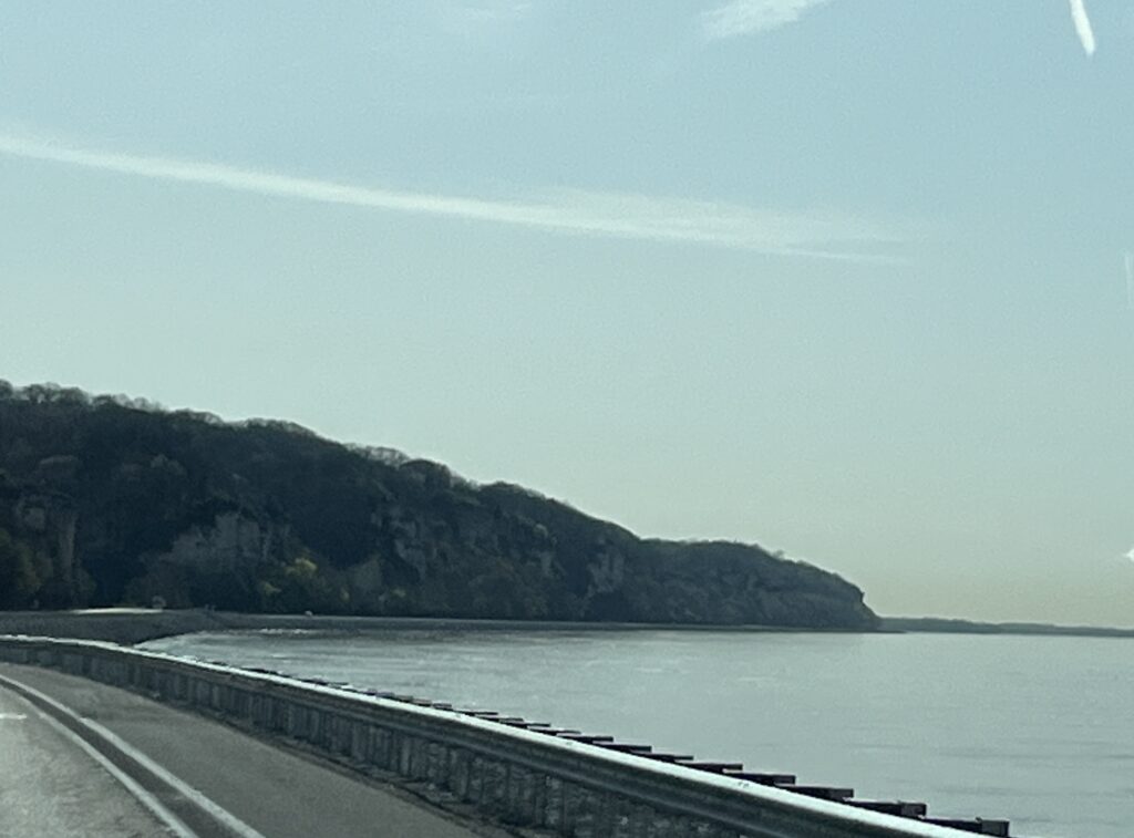
The drive along the shore of the Illinois River was beautiful and in Grafton, IL it converged with the Mississippi River. Together these two waterways had created a wide fast following watercourse that from here winds its way Southward to New Orleans, LA. We soon spotted the bridge that we would take across the Mississippi into Missouri from Alton, IL.
Bridge across the Mississippi River
Our route took us around St. Louis and so we did not see the Gateway Arch. We will stop one day. Heading away from the Mississippi River you climb into hilly and treed country. It seems that Missouri has many caves in the limestone rock and they all seem to advertise using large roadside billboards. Many seem to also include zip lines and animal preserves, one assumes because not all people would like to crawl around in the dark underground.
Nearing Springfield, MO it was time to find a spot to stop while the solar eclipse reached its peak. It was supposed to be reaching 97% totality in this area and we didn’t want to remain on the road during the event in case others chose to take their eyes off of the road.
The eclipse came, the sky got dimmer, the lights in the rest area parking lot came on and then it got lighter again. The picture below was taken at the point in time that it was at its peak and as you can see, 97% totality is not nearly enough to really notice a change.
97% totality during the solar eclipse
After enjoying our break (and lunch) we returned to the highway and continued on to Buc-ee’s in Springfield, MO. This one is smaller than others further South and in Texas, but it still had 63 gas pumps and a massive convenience store. It was however missing windshield squeegees at the gas pumps. Yep, not one at any of the 63. This was sad.
A few more miles down the road and we stopped for the night in Springfield at Cook’s RV Park. It’s a small family run park that has the best showers we have ever encountered.
Campsite at Cook’s RV Park, Springfield, MO
We spent the evening relaxing in the van catching up on some YouTube channels that we subscribe to. Tomorrow we head into Oklahoma.
An early rise to the day as I watch the sun appear through the trees that line to Cracker Barrel parking lot. It looks like it will be a clear and sunshiny day.
A full host of campers spent the night at Cracker Barrel
We started with breakfast at our host location and were on the road by 7:45am towards Springfield, IL. The sun had disappeared behind a large and grey looking bank of clouds. The forecast was now showing rain moving in our direction from the SouthWest. A quick stop before Springfield for fuel and then onwards.
We had a reservation for 9:30am and we were cutting it close. Our route took us into Springfield past some lesser maintained residences and delivered us downtown. Waze (my preferred choice for GPS routing) let me down and tried to route us down a street that no longer existed. Barb with Google maps to the rescue & we soon were arriving at our destination.
Susan Lawrence commissioned Frank Lloyd Wright to build her a home in 1904. At the time it was audacious at 12,500 sqft and included running water & electricity. A first for Springfield. FLW designed the home in his ‘Prairie Style’ that he had been developing in recent years. It is a masterpiece.
Dana Thomas house entrance
The home was used primarily for the hosting of social events comprising of, at times, hundreds of guests. The dining table when fully expanded can seat 40 and guests were entertained by live music played from one of three musical balconies.
Susan Lawrence married and took her husband’s surname of Dana. when he died at a young age shortly after their two infant children had also died, Susan lived in the home with her mother. After her mother had died and the city stopped providing steam as a heating source to residences, Susan moved into an adjacent cottage deciding that installing an alternate source of heat would be too expensive and thus leaving the home empty for two decades.
After Susan passed away and there being no hiers, the city put the house up for sale and auctioned off all of the belongings. We were told that FLW designed dining chairs were listed for sale at 50 cents. Most of Susan’s jewelry and other personal items were purchased; however, luckily for us today, the furniture was not popular and did not sell.
Publisher Charles C. Thomas stepped in and agreed to purchase the home on the condition that all unsold household items be returned to the home. He ran his publishing company from the home for many years before selling the house to the State of Illinois for $1M.
The home is known now as the Dana Thomas house in recognition of the two individuals that owned the home. It is open to the public and tours are free (reservation required).
Being a fan of FLW architecture we just had to stop and take a tour & are both so glad we did, it is an amazing story and wonderful home to witness first-hand. Photography indoors was prohibited but I did snap a few pictures of the outside and purchased a small photo book that showed some of the interior spaces.
Leaving Springfield we provisioned at a WalMart and then head onwards towards our camping spot for the night near Grafton, IL.
The driving was hard today, winds were strong and persistent from the SE often with gusts catching us unawares and causing some swerving in the lane. Our route dropped us down into the Illinois River valley and out of the wind for the last hour or so of our drive. This was welcomed as it allowed us to enjoy the scenery and winding river road.
Arriving at Pere Marquette State Park we pull into our campsite and who do we find but Dave, Liz & Amy! The Milddogs.
CampsitesOut for a walk The Illinois River???A blogging collaboration!
They are at the end of their Spring one month tour and we are just beginning ours. We enjoyed a walk together down to the shore of the Illinois River and shared stories and swapped tales well into the evening. Tomorrow we will each head our separate ways, but know that we shall soon meet again and enjoy each others company while reminiscing about that time in Illinois we camped under the trees.
After a couple of nice days visiting family in S. Ontario it was time to really start our adventure.
10:00am and we’re on the road heading towards Sarnia and the Bluewater bridge as our entry point into Michigan.
Bluewater bridge, Sarnia, ON
My brother had suggested that I try jumping the small gap that remains on the Gordie Howe bridge currently under construction in Windsor. I gave that a pass and instead we find ourselves lined up at the end of the Bluewater bridge waiting for a US customs agent.
Trucks lined up for US Customs, our lane is empty
The traffic moved fairly well and the agent had no issues with letting us into his country. The journey was now really underway.
We headed towards Lansing, MI and witnessed too many outcomes of deer vs. truck. We lost count of how many deer lost their battles in the short 75 mile stretch we drove. 😞
We stopped at a restaurant stop for a quick lunch in the van and then returned to the highway heading towards Kalamazoo, MI. We turned South and made a detour into Elkhart, IN the home of most of the largest RV builders in North America. 🚐
Downtown Elkhart, IN
We missed seeing the biggest of the factories because of how we entered the town, but did see one of the Thor assembly plants and Forest River facilities as we headed South out of town.
Driving the back roads allowed us to slow down and enjoy our surroundings, but it did add more than an hour to our overall drive time for the day. It was worth it. I mean, did you know that “Tippecanoe” is a real town in Indiana? Well it is & we’ve been there!
Tippecanoe, IN
Our back roads drive resulted in us meandering along US25 towards Logansport which is part of the Historic Michigan Road that was built in the 1830’s to connect the Ohio valley to Lake Michigan.
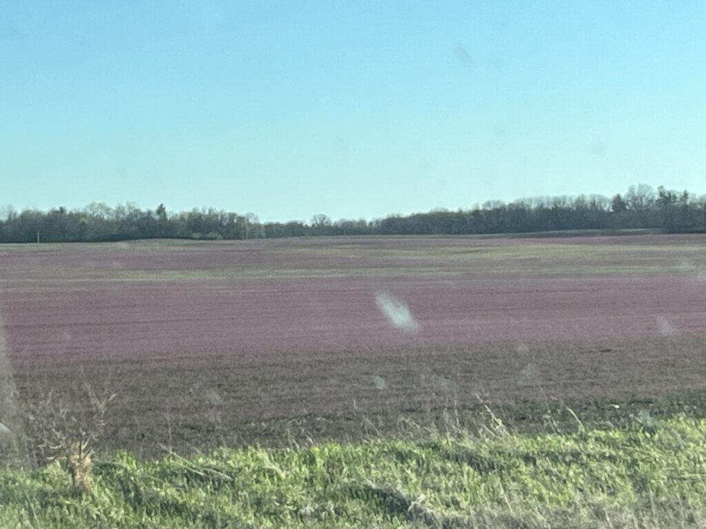
Purple Deadnettle
Our day ended with a Westward jaunt along I-74 towards Urbana, IL where we stopped for the night at a Cracker Barrel restaurant (Yes, they allow overnight stays for RVs).
Arriving in Illinois at sunset. Apologies for the bugs on the windshield.
Our day tomorrow will be much shorter than today and will include a special place to visit and a meetup to conclude the day.