Oregon was wet, it rained a lot. Of course if you’ve been reading along you will have already observed this, but it does feel like I need to say it again, Oregon was wet.
Fort Stevens State Park has the best showers of the Oregon state parks we stayed at. 8/10. They only lose points for being push-button (timed) showers and bare concrete floors. All other requirements of a shower were easily met, especially privacy & cleanliness.
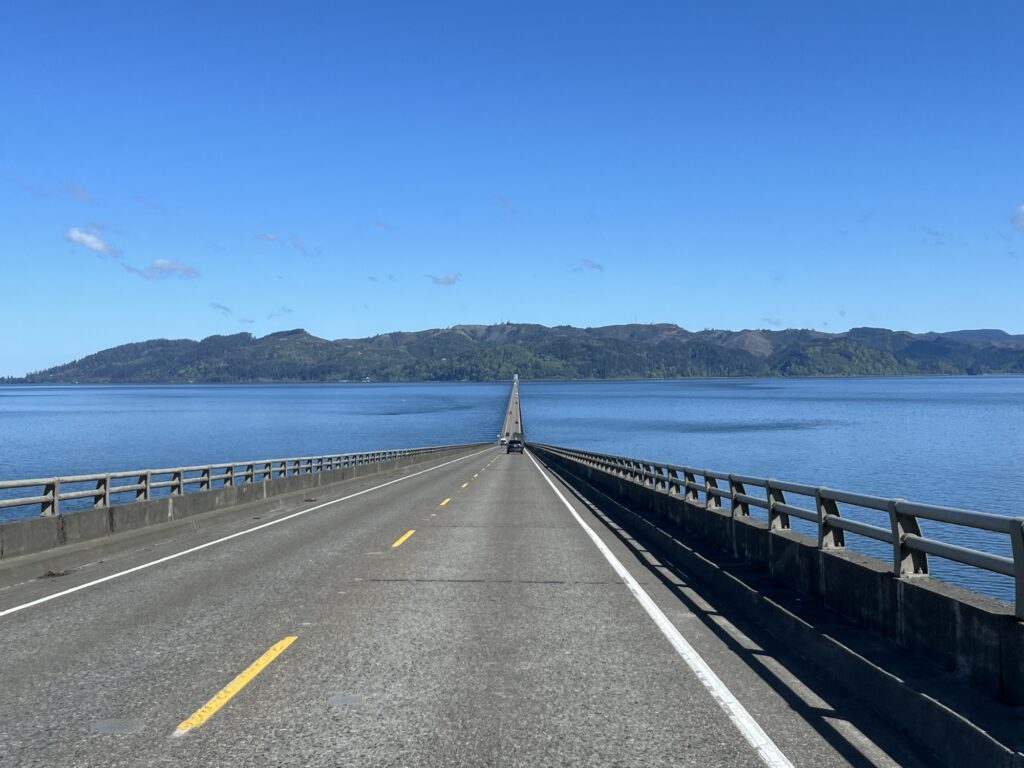
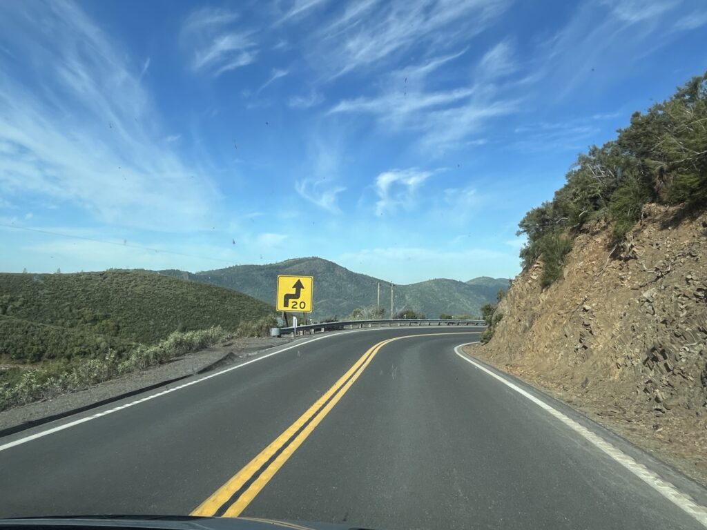
Today is a driving day, we leave Oregon and head across Washington to Port Angeles. Astoria, OR is the last town that we pass through on our way to Washington. Today there is a cruise ship docked in port, visitors are likely on a ‘Goonies’ sightseeing tour.
Bridge to Washington with cruise shipCruise ship BridgeDriving from bridge towards Washington
Washington state has a lot of trees, it’s about all you see as drive through it. We took pictures as you will see below, but didn’t stop at any touristy places. The drive was about the destination as it was 4 hours plus a break for lunch.
Arriving in Port Angeles we went down to the wharf and ate an early dinner at the Downriggers on the Water restaurant and enjoyed a clam chowder and a sandwich.
On our way to our campsite we topped off with fuel and then arrived at the KOA campground just East of town. Tonight we get everything in order to re-enter Canada.
CampsiteView from our campsite
Tomorrow will be an early morning as we are booked into the 8:20am ferry heading for Victoria, BC.
Our last day in the U.S. without driving anywhere. We slept in and enjoyed a relaxing morning while we waited for things to dry out from last nights rain. The sun was supposed to appear today and the afternoon was going to be glorious.
Barb prepared a delicious brunch fry-up after which I finished reading a second book on this trip and then we retrieved the bikes from the bike rack and prepared to go for a ride about the park.
Campsite at Fort Stevens State Park, OR
From our last visit here in 2022 we know that the park is laced with paved bike paths making cycling a great way to get about this rather large park. We started by heading towards the dunes and then cycling down to the beach access allowing us to ride on the beach. The tide was out and the sand wonderfully flat. The cool weather was keeping most people hunkered in their trailers, this meant that the cycling trails and the beach were very quiet.
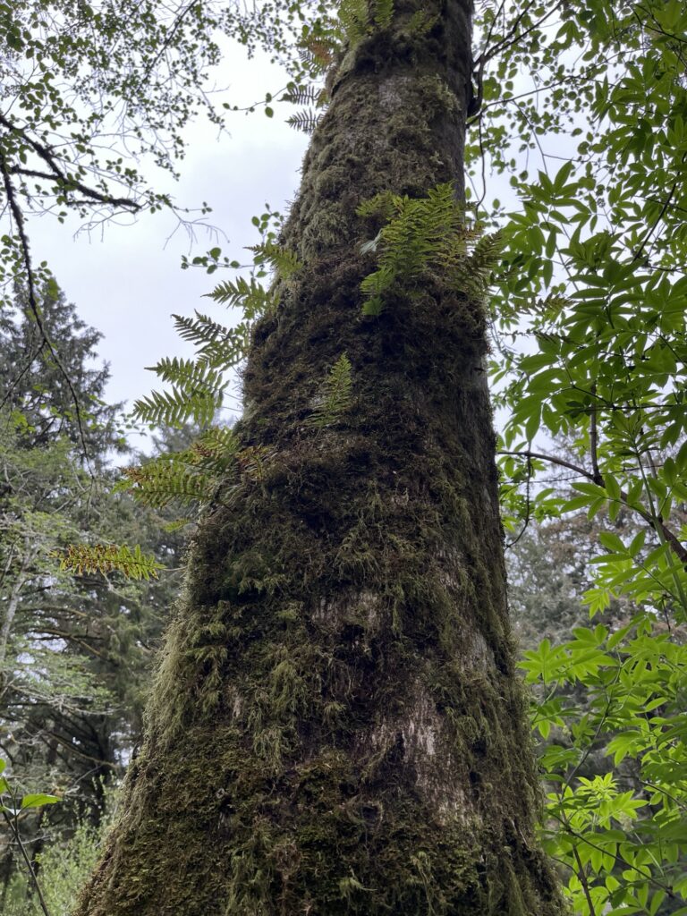
Moss growing on treesPeter Iredale wreckWreck informationBeach looking NorthBeach looking SouthUs at the beachBeach panoramic
Oddly I was able to utilize 3 bars of 5G connectivity on the beach but only 1 bar of LTE while on our campsite. I took the opportunity to complete and post yesterday’s blog post from the beach while sitting on a driftwood log. The wind was biting (no sunshine) and so shortly after I had posted the entry we headed back inland toward the campground.
After securing the bikes back onto the bike rack we relaxed in the van for the afternoon as yet another brief shower passed over the area. For dinner, chicken fajitas were followed by an evening of TV. Tomorrow we head to Port Angeles, WA where we will spend our last night in the U.S.
One last leg along the Oregon coast awaits us today. Surprise! It rained overnight and continues to drizzle as we get ready for the day. Showers are the stock same as the other Oregon state parks but these seem to have been renovated slightly with new fittings and lights making them feel brighter and cleaner. Hot water (good) so they get a 7/10.
We depart our site at 10:00am and join the line-up to dump our tanks. We leave the park at 10:30am. Our first stop of the day is at “The Devils Punchbowl”. It’s a natural rock arch through which the waves break into what was a large cave before the roof collapsed. Now in certain conditions the waves break and shoot skyward. Not when we arrived however as the tide was not yet at its highest, although the weather and sea conditions made it look like it might have been quite a spectacle later in the day.
The Devils punchbowl
The road along this section of US-101 has at times subsided and as such it was quite bumpy and we had to pay attention to the warning signs regarding speed or suffer the consequences of our belongings being flung about the van.
Whale sculpture
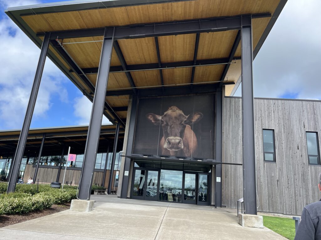
Arriving in Tillamook, OR we stopped first at “The Blue Heron French Cheese Company” where we sampled some lovely cheeses and picked a few pieces up for eating later. We then, of course, made our way to the “Tillamook Creamery” where we visited their museum and viewed the creamery workers making and packaging cheese. The visit concluded with a trip through the gift shop and finally lunch at their cafe where cheese was prominent in all menu choices. Yummy!
The coast ‘softened’ as we headed further North with more of the coast now being wide open sandy beaches dotted with Summer getaway towns such as Rockaway Beach (not the one made famous by The Ramones). We made a stop at a viewpoint high on a cliff top and captured some beautiful shots of this portion of the coast.
We make a quick detour into Warrenton, OR to get a few groceries & fill up with fuel at Fred Meyers. Maybe, just maybe better than H.E.B. in Texas. Barb is smitten.
A short drive from Warrenton we arrive at Fort Stevens State Park where we will camp for the next two nights. This is our second time here as we camped here two years ago and had a great time.
Settling in the for the night under the trees. Good night everyone!
These Oregon State Parks are amazing and we’ve both been sleeping really well since arriving in the state. The rain woke us a couple of times overnight but had passed by the time we awoke. We took our time starting our day allowing the air and ground to dry out.
South Beach State Park, Newport, OR
After a lunch of nachos we set out on our bikes to explore the park. There are a number of paved trails that criss-cross the park that we enjoyed for an hour or so.
A little later in the afternoon we walked to the beach and enjoyed the sunshine that had finally broken through the cloud over of the past few days.
Grill cooked burgers for dinner and we settled in for the evening.
Tomorrow we head to Fort Stevens at the Northern end of Oregon.
Another driving day further North along the Oregon coast. First we enjoy a coffee and light breakfast and then go for a shower. Not quite as nice as the last park, but private and hot. The feeling was probably closer to prison shower than campground shower, 6/10.
It’s a misty day, not raining as such but not dry. We head out a little before 10:00am and shortly up the road the rain starts again. It’s on and off most of the morning which makes the roads a little slippery and so caution was used as we wound our way along the coast.
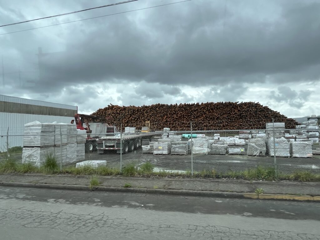
Coos Bay, OR was the first larger town we passed through. Clearly a logging town built around the railroad and harbour that still operates. We saw piles of lumber and pulp waiting to be shipped out. The rail yards still exist but seem not to be used as much anymore. I suspect that much of the wood is shipped to the far east from here.
Coos Bay, OR
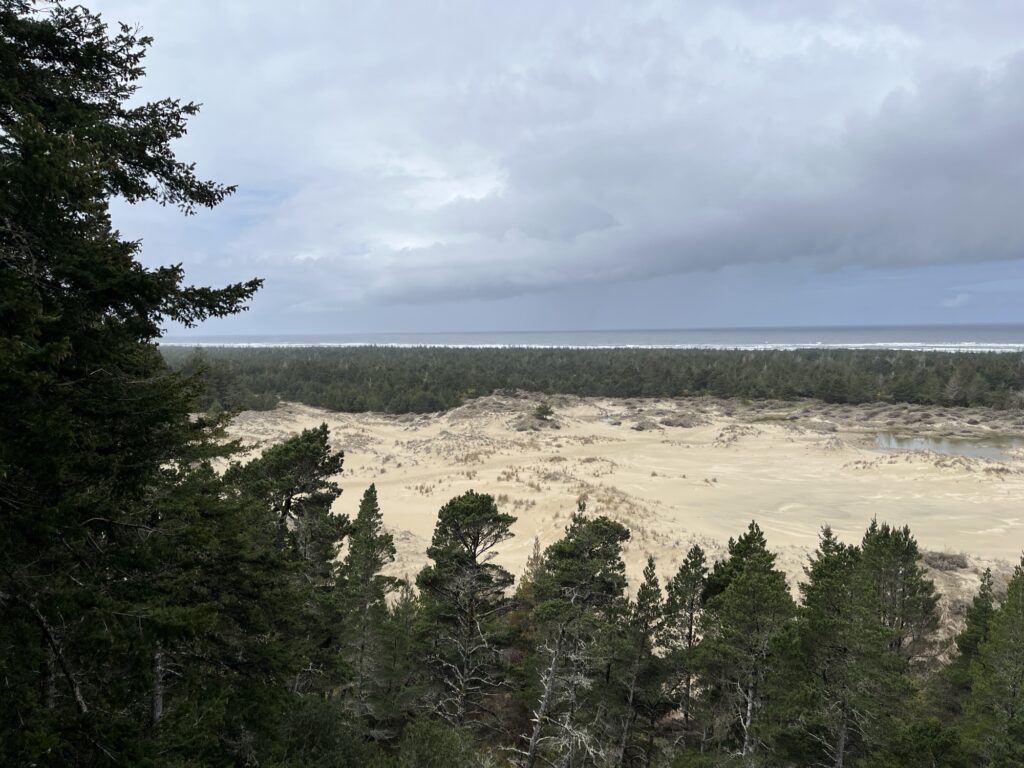
North of Coos Bay the highway passes alongside the Oregon Dunes National Recreation Area. This is quite a long and large (31,500 acres) portion of this part of the coast that is comprised of sand dunes (some over 180’ high). Parts are open to buggies and ATVs but most is protected for wildlife and hiking. We stopped at a day use area but did not hike as the wind was cold and the rain intermittent.
Oregon Dunes National Recreation AreaSeal sculptures along the road
The highway at times is twisty and reminds us of the more casual parts of US-1 in California. The trees are right up to the roadside and overhang creating green tunnels for us to drive through. We stop briefly at Heceta Lighthouse where we had lunch in the van. It’s Sunday and many are here with dogs for a walk on the beach and up the trail to the lighthouse perched on the cliff top. We chose to be cheeky and just ate lunch and not pay the fee for parking.
Heceta lighthouseCape Cove below lighthouse
We arrive in Newport, OR and top off the fuel tank before going into the South Beach State Park where we are staying for the next two nights.
Bridge at NewportView of river emptying into PacificSouth Beach State Park from bridge
Our site is level and the park nowhere near capacity and so are expecting a quiet, albeit wet night. Until tomorrow, stay safe everyone.
Ah, to sleep-in. We both slept until almost 8:30am which is an indication of just how quiet this park is. This led to a slow morning as the rain slowly let up and moved away from the area. We enjoyed an egg and ham sandwich along with a coffee to start our day.
Our campsite (A04) at Bullards Beach State Park
The remainder of the morning was spent relaxing and reading as we waited for things to dry up outside. Shortly after noon we put on our hiking shoes and wind jackets and headed off for a walk about the campground and then onto the beach!
RhododendronBroomColorful Broom
The trail to the beach is sandy as it is shared trail with horse riders. We passed many plants that are now flowering that Barb had to take pictures of. Some of the trail is on boardwalks, one of which was just under water, shallow enough for us to wade through. There were a few other swampy sections that we also managed to go around thus keeping our feet dry.
Flooded boardwalkMossy treeShallonBarb climbing duneLooking out to sea
After about 30min we arrived at the dunes which we climbed over to arrive at a very long windswept beach. The wind was blowing at about 15mph and so we were well and truly coated in sea salt spray and sand by the time we had walked along the beach far enough to head back inland.
WindyScallop shellA walk along the beach
The waves being produced were impressive and the sea looked angry as it clawed at the sand relentlessly.
Wind and waves
Inland we found and followed a paved path that led back to the campground where we enjoyed a late lunch and then an afternoon nap before dinner.
A quiet walkBanana slugCamas
Tomorrow we move on again heading a little further North in Oregon to Newport.
Last night the rain continued and got quite heavy at times; however, by the time we awoke it had eased and we should be dry as we prepare to leave.
We had coffee and a light breakfast before heading to the showers and enjoying the wonderful facilities for one last time. Packing up the van went well and with a quick reposition we could also utilize the dump connection on-site.
So long! Harris Beach State Park
As we left the campground the skies opened again and we had rain as we head North towards Bandon, OR.
US-101 rose & fell while twisting & turning along the coast through forest to grass covered dunes. The scenery was amazing but the weather prevented us from stopping and enjoying the views.
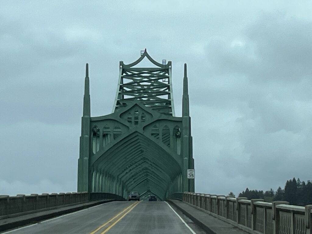
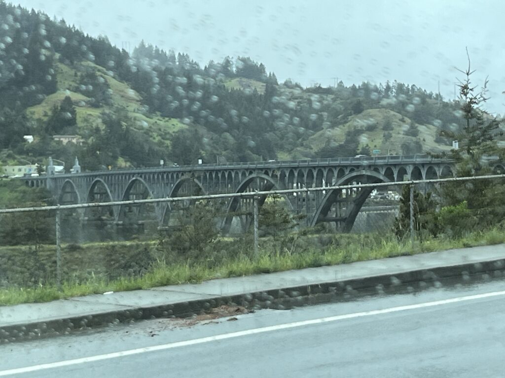
Bridge over the Rogue River, Gold Beach, OR
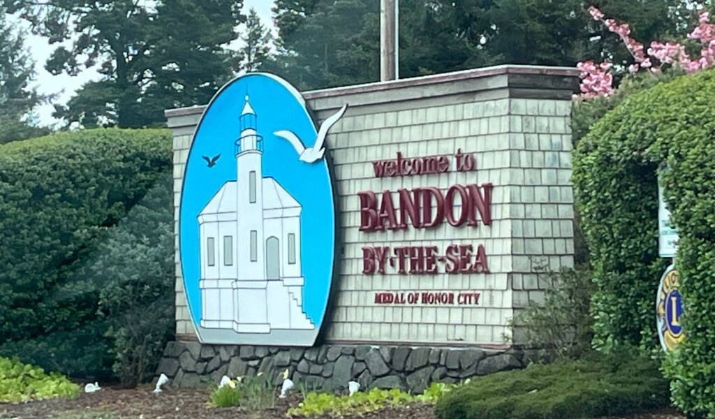
We arrived in Bandon and our first stop was a laundromat. Yes, isn’t van life exciting? Once done we headed to a restaurant for lunch before we drove to Bullards Beach State Park and checked in.
Coquille River lighthouse, Bandon, OR
Our site is another fairly level paved site with electricity and water. Again it has nice shrubs around it to provide a sense of separation from the neighboring sites.
We relaxed for the afternoon watching a movie and then enjoyed a chicken curry on rice for dinner. The rain has stopped and we hope, based on the forecast, that tomorrow will be somewhat drier and we will be able to get out exploring. No driving tomorrow.
Today we spent the day at Harris Beach State Park again; however, this time we cowered in the van whilst it rained all day.
Tomorrow we head further North along the coast to another State Park. Hopefully the rain will subside a little to allow us to enjoy the outdoors a little.
We managed to snag three nights in this park on a fully serviced site large enough to accommodate a large Class-A motor home. It is paved and perfectly level, no blocking required. The services are convenient with the exception of the sewer dump which is at the back of the parking pad, quite possibly too far from our connection point which is midway along our van.
Each site in the campground is surrounded by a four or five foot hedge that is kept trimmed nicely. Our hedge includes a large flowering fuschia bush which adds some color and is nice for us northerners.
We slept in and took it very easy today. Once up & after coffee we went for a walk down on the beach. The tide was out and the sand was firm to walk on. Barb scoured the tidal pools for creatures.
Once back in camp we cooked a brunch of pancakes, bacon & eggs along with Canadian Maple Syrup that we had brought with us.
The afternoon was spent lounging and reading. A nap might also have occurred. Dinner was grilled Texas steak and asparagus served with potato salad and a mixed vegetable salad.
An after dinner walk around the campground and then to the clifftops to watch the sunset before returning to the van for tea & cake while watching a little TV.
We left Miranda, CA at about 9:00am and head North along the ‘avenue of the giants’. This is a historical 32 mile stretch of US-101 lined with Redwood trees. It’s a great way to start our drive as we admire the sheer size of these trees that are at times right at the edge of the asphalt.
Avenue of the giants, Miranda, CA
Rejoining US-101 we drive North for about an hour admiring the forest all about us. Shortly after Eureka and Arcata, CA we turn into the small town of Trinidad, CA and drive to the beach. It’s a cool and overcast day but Barb was insistent that she wade into the ocean. We took a short walk onto the beach & Barb discovered how cold the ocean is at this time of the year.
Trinidad, CA
Leaving Trinidad we headed further along US-101 and stopped to make a coffee at the Trinidad rest stop. Again, the Redwood trees surround us.
Back on US-101 we detour into Redwood National Park and drive the scenic route. We stopped at Elk Meadows, see a herd of Elk and then go to the visitor center and pick up a pin for our collection. The visitor center is housed in a 1934 building constructed by the CCC when the park was originally being formed.
Driving on the scenic road, we stop to walk amongst the trees. They are magnificent, they are huge. Enough said.
Redwood National Park, CA
Returning to US-101 again we turn toward the Oregon state line.
Soon we arrive in Brookings, OR and immediately find ourselves stuck in a traffic jam. It took us an hour to arrive at a restaurant for lunch before we went on to get groceries and fuel. A few minutes further along the highway we arrive at Harris Beach State Park where we will be staying for the next three nights.
First impressions are very good. Barb walked on the beach and calls the park gorgeous. We’ll talk more about the park in our next post.
The SR-1 that was right at the foot of the space in which we slept was very quiet all night until about 6:30am when a few cars started to pass. We sorted the van and ate a breakfast of leftovers and prepared to leave by about 8:30am.
At Arena Point we took a short detour to see a lighthouse perched on the cliff edge. While visiting we stopped to watch the waves crash onto the rack along the shore.
The road North of Fort Ross was not as twisty as it was to the South. As such we made fairly good time as we ventured further along the coast.
Further along the coast we stopped in MacKerricher State Park near Fort Bragg, CA to dump our tanks and fill our water tank. We also took the opportunity to enjoy the day use parking area (free) where we enjoyed lunch and made Oregon campground reservations for the next week.
Back on the road SR-1 turns inland just North of Rockport, CA and head through a Redwood forest. The road climbs and descends quite a lot as it crosses the coastal mountain range. It also is super twisty and tight. This road would make a brilliant motorcycle cruise route IF it were repaved. This they are planning according to the roadside signs over the next two years.
Eventually we reach US-101 and turn North towards our destination in Miranda, CA. Tonight we are taking advantage of our ‘Boondockers Welcome’ membership (part of Harvest Hosts). BW hosts are homeowners or other locations that provide places to park for a night and don’t require any payment or purchases of any kind.
Our location tonight is on a small gravel area adjacent to the hosts laneway within the redwood forest adjacent to Humboldt Redwood State Park.
Tomorrow we plan on driving the remainder of US-101 as we cross into Oregon where we will be slowing down and enjoying a few Oregon State Parks.
Such a beautiful place to have spent a night and then to wake up to. The sun shines across the Napa valley and in the distance (no pictures) I watch about 10 hot air balloons gliding over the valley. One of our neighbors from last night told us that they were leaving early to go for a balloon ride and I wondered if one of the balloons I was seeing contained them.
Olive tree on our hosts farm
We took our time this morning as we could stay until noon if we wanted and our planned drive was only a few hours. We did finally head out at about 10am and headed West towards Petaluma, CA. The rolling hills had many farms and wineries. Some wineries looked like French chateaus dropped into the Californian landscape, we guessed that the winemaking business is doing nicely.
Heading West out of Napa, CA
We stopped in Petaluma for brunch and to get caught up with a few internet-based chores as our hosts for tonight had warned us that no cellular signals reached their location.
With a full tank of fuel we headed West toward Bodega Bay, a popular beachside town that was jammed with weekend visitors. This was our first view of the Pacific Ocean on this trip and we found a small parking area a little North of town to stop and take in the views and fresh air.
Pacific Coast north of Bodega Bay, CA
As we drove further along SR-1 (Pacific Coast Highway) the traffic slowly decreased but the twists and turns increased causing us to drive carefully around the cliff side curves. As we were driving North we were on the inside lane which reduced some of the scariness of the drive; however, at one point we did wind our way up a canyon where we were on the outside of the road. Don’t look down. It still amazes us that many of these twisty roads in California do not have guardrails.
PCH, note the lack of guardrails and heightsA few sights from along the way
Eventually we arrived in Jenner, CA and found another place to pull off and enjoy the view. As we were early yet to arrive at our hosts, we settled in and watched seals lounging on the beach below and kayakers and surfers enjoying the water.
The final few miles of driving today had us arrive in Fort Ross, CA where we are staying at our hosts, The Fort Ross Store. Another Harvest Host, this store is a general store general store, coffee shop, cafe. It is wonderful, as are the folks that work here. We have a large 20×30 concrete pad on the west side of the building to ourselves that has amazing views out to the ocean.
Our campsite and view for the night!
We are told that the road gets very quiet at night and are looking forward to a wonderful sunset.
Our camp hosts were very cordial and things got quiet by 9:00pm. It’s nice when things work out. We both slept really well and awoke at about 6:30am. A light breakfast and coffee before we packed up and left at 8:05am. Minutes later we drove out of Yosemite National Park.
Views along SR-120 on the way to Stockton, CA
We were headed West along SR-120 towards Stockton, CA and descended down from the 5,000ft or so of the campground. At the town of Priest, CA there was a sign informing drivers that vehicles over 7,500lbs were restricted from taking the ‘old’ road and were required to take the ‘new’ road. We now know why, the old road is super steep for several miles whereas the new road is less steep for several miles more. The descent was super twisty and most corners were marked with either a 15 or 20mph suggested speed. Another MINI road in the van.
New Priest Grade Road
At the bottom of the decline we stopped in Copper Cove, CA for breakfast (2nd). Barb enjoyed a breakfast burrito and I had the country breakfast. It was delicious and a nice treat.
Continuing on, we drove through Stockton and onto Fairfield where we stopped for fuel and to do a little shopping. Next was Napa and a stop at RD Winery where we sampled some local wines and purchased a few bottles to enjoy at a later time.
Views as we drive across to Fairfield, CARD Winery, Napa, CA
Our night will be spent at Dan Dan farms just outside of Napa, overlooking the valley. It’s a beautiful spot with the farm keeping chickens and cattle while growing olives and producing Olive oil. This is a Harvest Host location and as such we purchased some eggs and a bottle of the Olive Oil as a thanks for allowing us to stay on their gorgeous farm overnight.
I was anxious. I was awake. It was 5:45am. We have plans to drive into Sequoia National Park to see the giant Sequoia trees, this means driving up the “General’s highway”, a road restricted to vehicles 22’ or shorter. Ours is 22’ plus the bike rack. We’ve been told by our camp host that it should be fine as long as I take my time. [Remember Tony, you’re not driving the MINI.]
Shortly after 8:00am we leave our campsite and immediately find a reason to pull over and stop… to clean the windshield that is. Expecting some epic views and vistas and wanted the glass to be as clean as I can get it with white vinegar and shop cloths (all we got).
The drive UP the General’s Highway is just that, UP. The drive to the Giant Forest Museum from our campsite is measured at 15 miles and should take about 40 minutes. The road rises to over 7,000 ft above sea level. There were too many switchbacks to count and all the time the road rose in front of us. It was narrow, tight & twisty, a perfect road for a MINI cruise, but I was in what felt like a huge lumbering truck. Slow and steady would get us there.
Drive UP the Generals Highway
The views were astounding, there are several nice pullouts where you can get out to take pictures. We see the flora around changing as the elevation increases, we pass through areas where wildfires have burnt the trees back to standing black poles devoid of all life. And then we arrive near the top of the climb and turn into a land of giant trees.
Into the grove of Giant Sequoia Trees
These are not your normal giant trees, these are Sequoias. We both expected large trees, it’s what we had come to see, but these are incredible. Thousands of years old and still standing on guard in groves near the tops of these mountains. Sequoias are not the tallest trees, that honor is reserved for the Redwoods, however, they hold the record for being the largest by mass with some estimated at being well over 1000 tons.
Leaving the museum we go on to find General Sherman, one of the largest Sequoias in the world. We park and walk down a nice trail to an enormous tree. It has to be well over 20 feet across and a few hundred feet tall. The trunks of the Sequoia tree do not narrow very much and so the trees feel more massive because of this. The bark can be up to 2 ft thick which help the largest trees in the event of fire as it would take a while to burn through this before exposing the sapwood that provides the nutrients to the upper portion of the tree.
General Sherman
Walking back up from General Sherman to the van we both feel the effects of exercising at over 7,000ft. It is tiring.
We now head out of Sequoia National Park towards Fresno, CA. A place to stop, get fuel and have lunch in the van. I take the time to upload yesterday’s blog post now that I have access to the internet.
We head North from Fresno along Hwy 41 towards Yosemite National Park. We have what we think is the last available site in the park reserved for one night. The drive is hilly and the road twisty causing for traffic to be inconsistent but as we get closer to the park traffic lightens and the drive is more enjoyable.
Heading North from Fresno, CA
Entering the park we save another $35USD because of our annual pass. The road continues to be twisty and we are now really gaining elevation again. The 30mile drive takes nearly an hour but the reward at the end!
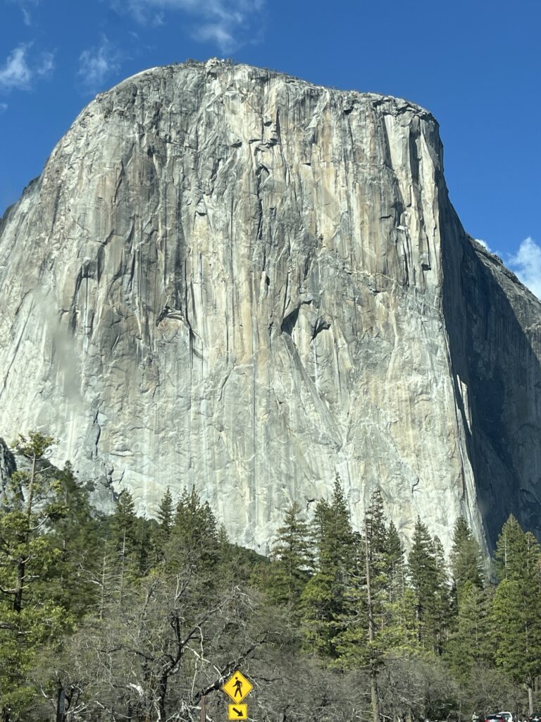
Our breathes were taken away as we turned a corner and looked right down into Yosemite Valley. Past El Capitan and the Bridal veil falls all the way to Half-Dome. This was a view that I had seen many times published by others or in TV documentaries now staring me right in the face. I yanked the van to stop and jumped out to capture some pictures. The sun was perfect, shining straight down the valley illuminating the rock surfaces and trees while causing a rainbow to appear at the base of the bridal veil falls.
Beautiful viewBridal Veil Falls with rainbow
We descended into the valley through a rock tunnel only just tall enough to clear the roof of our van. The valley was quiet. It’s April and the crowds have not yet descended upon the park. It’s not empty, I’m sure it never is, but there are parking spaces and room to move about. We enjoyed a drive along the valley to the end and then back to the road that will take us North out of the valley towards our campground for the night.
Into and out-of Yosemite Valley
The drive is up yet again along a twisty road that hugs the sides of the mountains. We eventually descend towards the campground and turn into Hodgdon Meadow campground.
Our campsite is not fancy or level. We do the best we can and set about having dinner. Our neighbors, the camp hosts seem to be having a party, hopefully it will wrap up before bedtime.
Our campsite at Hodgdon Meadow, Yosemite National Park, CA
Up early to shower. The KOA Bakersfield succeeds. The showers are wonderful and have earned a 9/10 from the both of us. High praise, I know.
KOA Bakersfield, CA
We watched a few rigs preparing to leave as we ourselves would be doing as soon as the yoghurt, banana and coffee had been consumed. We packed up, dumped our tanks (all good) and were on our way.
It was shortly before 9:30am and we were headed North. We took Hwy 65 to Porterville, CA where we stopped for a few provisions. Continuing northward we passed Exeter, CA where we turned East towards Sequoia National Park.
Various views along our way to Sequoia National Park
We have reserved one night in the only open campground located in the foothills of the Sierra Nevada mountain range. We arrive shortly after noon to a line-up of vehicles entering the park. This is the third park at which we can use the ‘America the beautiful’ pass allowing us entry free of charge and today saving us $35USD. At this point the card has paid for itself and any future National Parks, forests or other supported locations we visit will be truly free of charge.
First views of Sequoia National Park
The campground is smaller with only about 40 sites and is primarily targeted at tent campers and smaller vehicles. The road to access the campground is restricted to vehicles 24’ or less.
It’s nice to be amongst the trees after several days in the desert. We went for a hike up the river canyon adjacent to the campground and captured some beautiful shots of the river and hillsides.
On a hike and then returning to see deer in the campground
Bears frequent the area and everyone is required to store any foodstuffs normally left out in their vehicles overnight in the provided bearproof boxes on their campsite. So, bananas, oranges, etc are currently tucked away outside of the van so as not to attract night time visitors.
Settling in for an off-the-grid (internet free) evening. Tomorrow we head further into Sequoia National Park to see the towering trees and other sights the park has to offer.
We awoke to another quiet morning. We don’t have a long drive today and so took our time getting ready for the day and packing up. We were on the road shortly after 11:00am. We are sad to say goodbye to Sawtooth Canyon as it has been a very tranquil place to spend a couple of days.
We started with a short drove North to Barstow before heading west on I-15 and then NW towards Bakersfield, CA on Hwy 58. The campsite for the past couple of nights was the most southerly point on this journey as we now head North through California.
Heading towards Bakersfield, we pass Boron, CA the home of the largest Borax mine in the world. The open pit mine is owned and operated by Rio Tinto. Hwy 58 also takes us past Edward’s AFB where the Space Shuttle conducted many of its landings and Chuck Yeager broke the sound barrier in the Bell X-1. We couldn’t see much but still cool to think about the aerospace history that took place here.
A little further along the highway we pass Mojave, CA the home of Virgin Galactic. They fly their aircraft from the Mojave airport which then launches the Unity rocket powered craft from the air towards space. If you are wealthy you can book a seat and earn your astronaut wings.
Virgin Galactic, Mojave, CA
We stop for fuel in Tehachapi, CA and then drive to Keene, CA where we detour to see the Tehachapi Loop overlook. We see a long BNSF train hauling freight eastward up ‘the hill’ and around the loop. The loop has a 1200ft diameter and rises 77ft. The trains that arrive here are traveling from Bakersfield (400ft elev) and arrive at the loop which is 4028ft elev in a distance of just over 60 miles. The locomotives were working hard as they rounded the loop still with several miles to go to the top.
The landscape west of the mountains is vastly different. Gone is the flat sandy desert to be replaced with rolling hillsides. Covered in grasses and trees.
We descend towards Bakersfield, CA and find ourselves in a lush citrus growing valley.
San Joaquin valley, CACitrus trees trimmed for mechanical harvesting
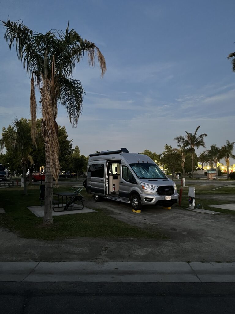
We arrive in Bakersfield mid-afternoon to stay at the KOA Journey in town. The place is immaculate, grassy and park like. They have a pool & hot tub as well as an onsite restaurant that we have chosen to enjoy this evening.
KOA Bakersfield, CA
It is warm and I’m thinking of firing up the rooftop A/C unit. Will wait until the evening settles in before making that decision.
The sky is clear and the moon is up. It’s going to be a beautiful evening. Check back tomorrow to see where we go from here.
Stay happy. Be positive!
P.S. Note that limited internet access may result in the next couple of posts not being posted on the day that they represent. Check back often and we shall post as soon as we can.
Decision made, we’re staying put in Sawtooth Canyon campground for another day. It’s just to peaceful and beautiful here that we just want to stop for a day & catch our breath.
Panoramic shot from our campsite
To that end we sleep in until after 8:00am and had a very leisurely morning. Barb took care of researching and booking our next few nights (we now have reservations until Monday).
After lunch we went for a walk about the campground and a short hike into the surrounding hills.
A little about the areaBarb enjoying the hikeTony at the top of a scrambleNice viewTony returning from top of scrambleVegetation
Back at camp we settled in to read and enjoy a few snacks before making ‘breakfast for dinner’. The evening was spent relaxing in the van and watching a few videos.
California poppiesHole through rock
Tomorrow we’re heading to a serviced campground in preparation for the following two days which will be more remote.
After a great nights sleep in this amazing campground, (Willow Springs) we took advantage of the amazing shower facilities (9/10) before prepping for the road.
Departing Willow Springs campground
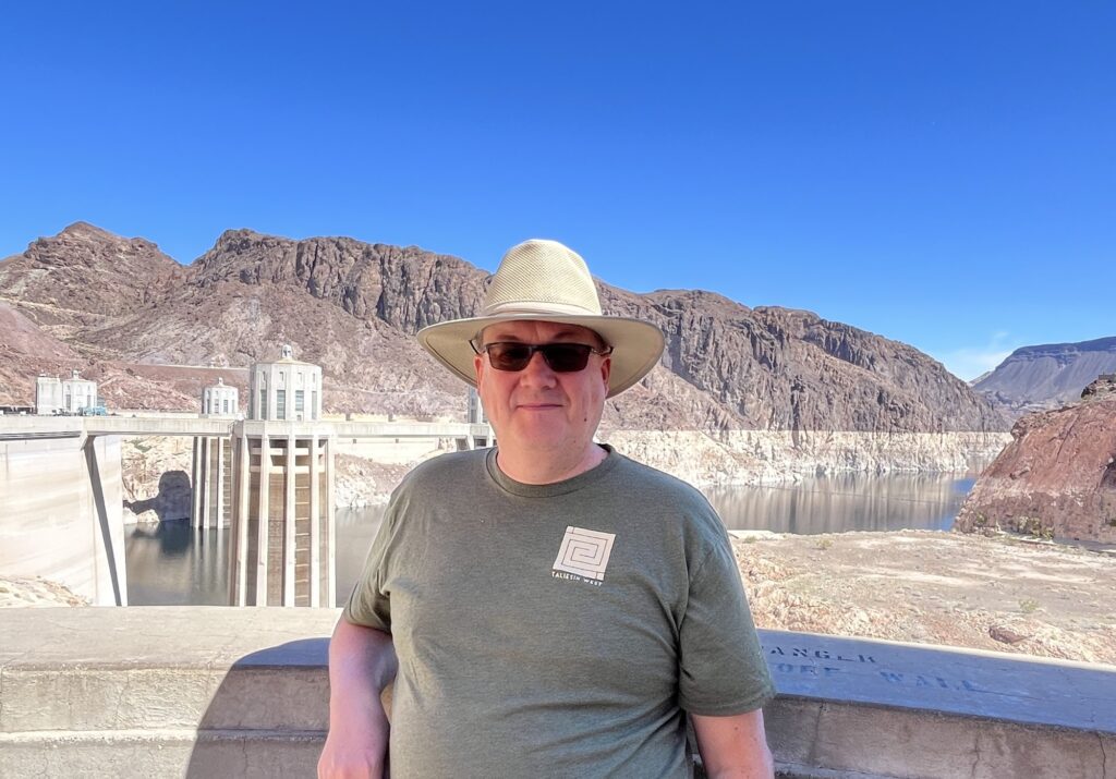
Our first stop was of course Hoover Dam. It was just 20 minutes from the campground and we arrived at about 10:30am. It was relatively quiet but I’d still recommend getting there earlier than we did in order to see everything you want.
Nevada state lineNew road bridge across Colorado RiverHoover Dam Visitors Center, NV
We took the shorter Power Plant tour as we still had a fair drive ahead of us. The tour was very good and we got to see the inside of one of the turbine rooms at the bottom of the dam.
Nevada Power Plant, Hoover Dam
There are tonnes of statistics about this dam that I won’t try to bore you with as others elsewhere online can share those better than I can. I will just say that the entire site is quite an engineering marvel given that it was built in the 1930’s and has been updated consistently since, including the construction of a new roadway bridge over the canyon which avoids having all highway traffic drive across the dam. We highly recommend visiting the Hoover Dam if you’re ever in this area, we’ll be back to take the longer Dam Tour the next time.
Lake Mead, Nevada/Arizona
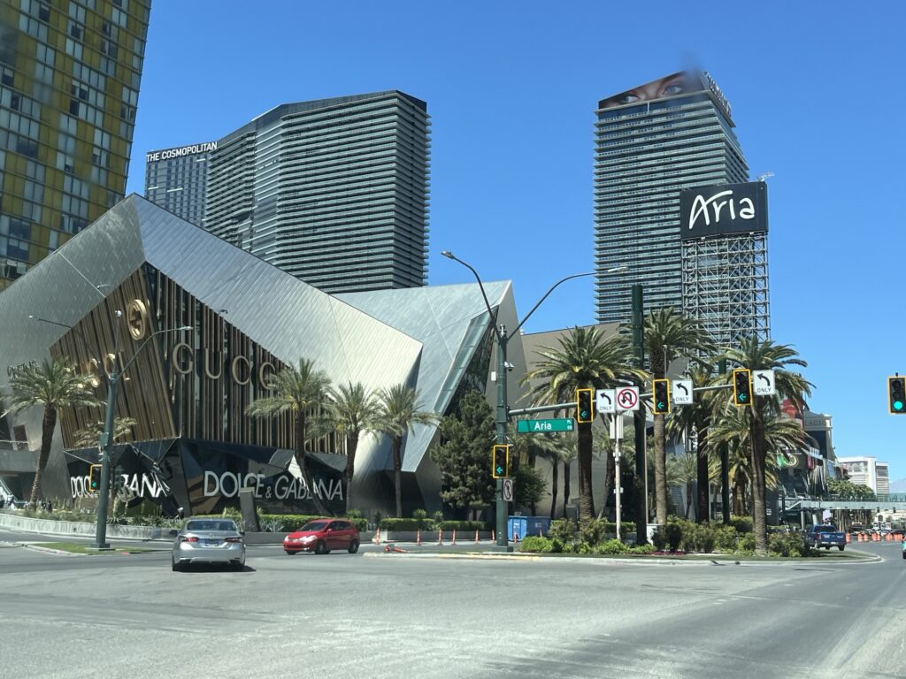
We left Hoover Dam at about 12:45pm and headed towards Las Vegas, NV. The drive was only about 45min and we headed to the ‘strip’.
Welcome to Las Vegas
We had no intentions of staying (at one point in our planning we had thought of camping near the strip but dropped that idea). Instead we were just going to drive down ‘the strip’ and take in the sights, sounds and aromas of Sin City. Barb took pictures and I concentrated on traffic and traffic signals. It took over half an hour to drive to the North end and back onto the interstate where we headed South on I-15 towards California.
The following are a few pictures from Las Vegas captured on our drive-through. We have plans to fly back to LV in the future and take in the city and the entertainment without worrying about our van and belongings.
Looking NorthNew York, New YorkMGM GrandAriaPlanet Hollywood with Gordon Ramsey BurgersParis Las VegasEiffel Tower, Vegas styleHarrah’sThe StratosphereFremont StreetLeaving Las Vegas
We stopped in Primm, NV to fill up with non-California priced fuel, or so we thought. Yours truly pulled the boneheaded move of the day by accidentally pressing the ‘Supreme’ button on the gas pump and paid $6.029/US gallon. Until today we’d been paying less than $4/US gallon. Ouch.
California state lineWorlds tallest thermometerJoshua tree
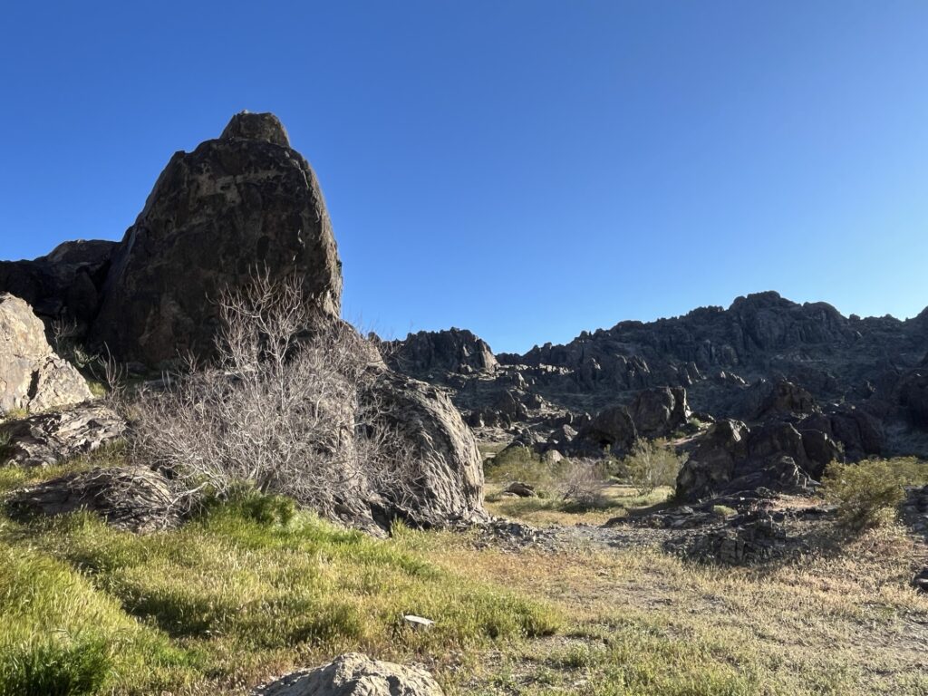
Crossing into California we drive along I-15 to Barstow where we exited and head South for about 20 miles to a Bureau of Land Management (BLM) campground. Sawtooth Canyon has no services and so you need to be self-sufficient while staying there. This includes packing out all garbage. Camping is free but there are only 13 sites available on a first-come first-served basis. We were lucky and got a fairly level site next to a large rock outcropping in the middle of the campground. So far it is VERY QUIET and relaxing. We might even stay here for a couple of nights.
Up early and showered! These time zone changes are making getting up early easier and easier. The showers at our campground were rating 3/10. Lots of hot water and a private lockable shower room but that’s it. Dirty, dilapidated, hard to set the perfect temp water. It got us clean, best possible outcome given the conditions.
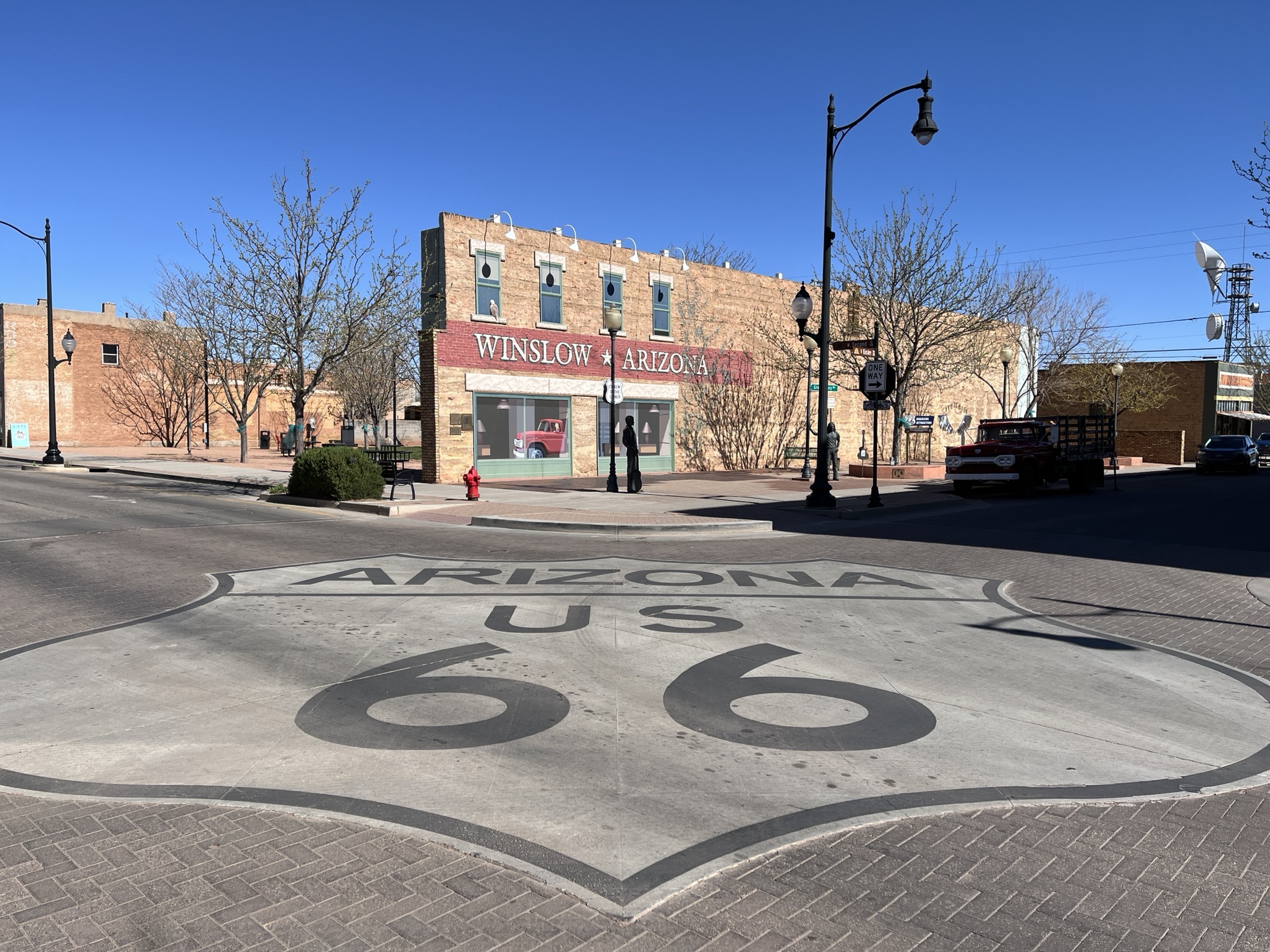
The campground was very quiet and the sites are spaced nicely apart. A great place to stop for a night if you’re near or passing by Winslow, AZ.
Speaking of Winslow, you might have guessed from yesterday’s blog that today we are starting our day by visiting Winslow to stand on a corner and admire a certain flatbed Ford. All of course references to the Eagles song “Take it Easy” in which Winslow is referenced and now visited by tens of thousands of each year from around the world.
We started our visit to Winslow by parking the van almost immediately behind ‘the’ flatbed Ford. It was early and the town was still quiet. We went to enjoy breakfast at “The Flatbed Cafe”. Barb ordered Enchiladas & Eggs while I orders Eggs Benedict. This was a treat and it was delicious.
Flatbed cafe, Winslow, AZ
Afterwards we went to take some pictures around the towns main attraction, the flatbed Ford. The town has made a very nice space for visitors such as us to take pictures including piping Eagles music throughout the area. As it was early we had the place almost to ourselves but we were assured that within an hour our so it would be bustling with people all trying to get the perfect picture. The only other people there were a couple originally from Markham, ON (small world) that now live in Los Angeles, CA.
Leaving town I realized that Winslow is a rarity for US-66, it’s prospering. Could this really be because it was referenced in a song some 52 years ago? Do/did the Eagles have that much of an effect? One wonders.
We head a little further West and take a detour to visit the Meteor Crater. This crater was formed almost 50,000 years ago when a huge meteor crashed into the Arizona landscape. It’s estimated the explosion equaled 20,000 tons of TNT.
Meteor Crater – almost 1 mile across
Today the crater is 550 ft deep and almost a mile across. It’s privately owned by the family that owns bar T bar ranch, the Barringer’s. There is a $27USD entrance fee that includes access to the observation walkways, a museum, theatre & guided tours. We did not take the guided tour or watch the movie in the theatre but did walk about on our own and visited the museum. This is a great place to visit, but in my opinion should not cost what it did. Maybe I’m just cheap. We both really enjoyed the visit.
550ft deepIt was very windyMeteor Crater, AZ
Returning to I-40 we headed towards Flagstaff and then onto Kingsman, AZ. Here we stopped for groceries at Bashas’ supermarket before heading out and turning away North from I-40 towards Lake Mead. We stopped for the night in the Lake Mead Recreational Area and are staying at the Willow Creek Campground & RV Park. Our site (D3) has a fabulous view of the Colorado River canyon as the river flows South away from Hoover Dam.
A few scenes from todayView from the foot of our campsite
We awake to look out across a lava field left by a volcano some 10,000 years ago. It seems alien in what can already be considered by many an alien landscape.
Lava from ancient volcano in Grants, NM
Oh, and we discovered that we have a mouse in the van as evidenced by buns having been nibbled as well as a banana. Traps were procured.
Argh, we have a mouse! Not happy campers.
New Mexico is harsh. It gets hot, very hot in the Summer but we awoke to 1C this morning. The sky is almost always bright blue, clouds just don’t seem to form here and yet when it does rain torrential floods can wash away bridges and towns. It’s dry today, no floods to worry about. As we drive we wonder what life is like day-to-day in this environment, one that doesn’t seem to have seasons where trees leaf and then fall, where every road seems to lead to the horizon and the only evidence that anyone knows about it is the large plume of dust they leave as they traverse the landscape. Harsh.
Our first stop today was the Continental Divide, the place in the Rockies where water either flows towards the Atlantic or the Pacific. There’s a small plaque that we stopped at to commemorate our passing from East to West.
Soon we crossed into Arizona, another time zone change. This time from Mountain Daylight Time (MDT) to Mountain Standard Time (MST). Arizona does not observe Daylight Savings Time. So, we are now at the same time as those on the West coast but not yet in the same time zone.
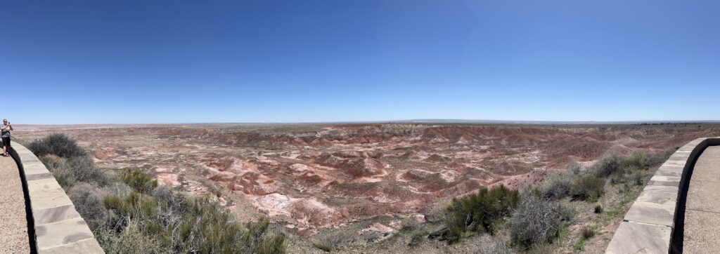
A little ways into Arizona we make a stop at the Petrified Forest National Park. We entered at the North gate and followed the 28 mile road through the park to the South Gate. In the North you get to explore the Painted Desert from overlooks that expose a wonderful array of colors in the hillsides.
Painted desert
As you travel South the landscape becomes more barren and moon-like before depositing you into the petrified forest. As you look about you see what appears to be rocks strewn about the landscape, but when you get close you realize that they are all petrified wood from trees that died 10’s of millions of years ago. We stopped in a few places and walked amongst these ‘logs’ and were amazed by the variety of colors of crystals that had replaced the original organic wood fibers. Some look like a lumberjack had recently felled the trees and cut the logs into short lengths but then left the logs instead of taking them away. To look at, it’s wood. To touch, it is rock.
Petrified Forest
After leaving the park we continue westward and stop for the night at Homolovi State Park near Winslow, AZ. A quiet spot in the desert to spend the end of the day amongst the sagebrush & tumbleweeds.
Tomorrow a certain flatbed Ford will be sought out and then onto western Arizona and into Nevada.