After enjoying a very quiet night and the wonderful shower facilities at Cook’s RV Park, it was time to dump our tanks (no faecal matter on me 😎) and head back out onto the road.
Heading Southwest along US44 we soon arrive in Joplin, MO where we stopped to looked at a a Rt66 mural park that the city has installed.
Route 66 Mural Park
US44 beckoned and we returned to our Southwestern drive. The highway undulated with the landscape and soon we were nearing Tulsa, OK. The freeway had become a tollway and we were charged $5 to drive into Tulsa and then $5 to drive away from Tulsa towards Oklahoma City. The trees are fully leafed out here and the grass is starting to dry off as the sun is getting hotter as the days get longer.
Route 66 Historical Village, Tulsa, OK
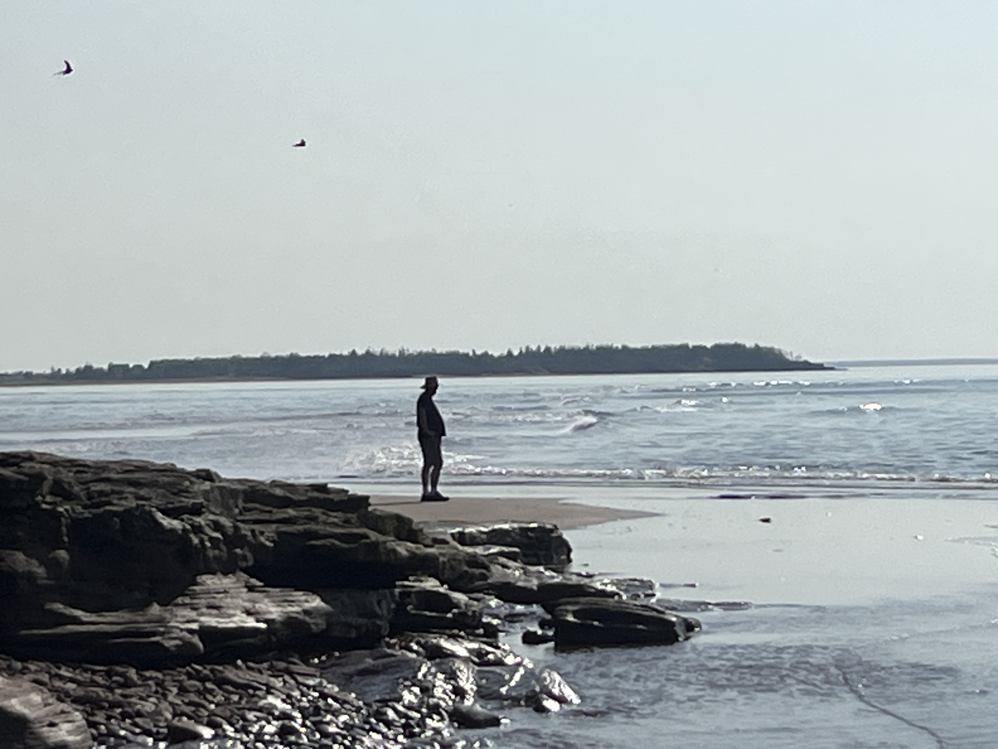
After stopping for lunch in the van in Tulsa at the Route 66 Historical Village, we continued to Oklahoma City and then onto El Reno where we are staying at the Lake El Reno RV Park. This is a municipal park and is first-come-first-served. We had no issues getting a great campsite for the night. It is supposed to rain steadily tonight, but as you can see below we got to see a wonderful sunset from our site.
Sunset in El Reno, OK
Tomorrow we head into Texas. Good night all.
P.S. if you can think of a witty Oklahoma related catch-phrase for this post, send it my way & I might replace my placeholder above with it (giving you credit of course).
Despite reports of coyotes howling in the night, we slept well and did not hear any sounds at all. The Milddogs were up early and on the road by 9:00am heading toward their eclipse viewing location in Indiana. We departed the campsite shortly thereafter and headed towards St. Louis, MO.
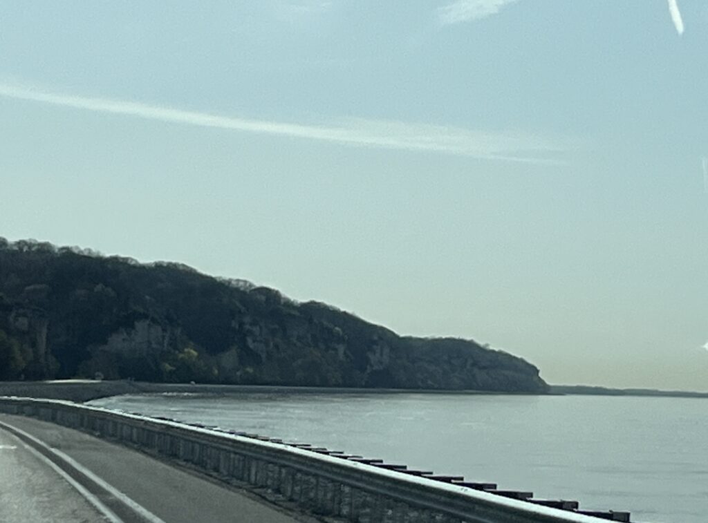
The drive along the shore of the Illinois River was beautiful and in Grafton, IL it converged with the Mississippi River. Together these two waterways had created a wide fast following watercourse that from here winds its way Southward to New Orleans, LA. We soon spotted the bridge that we would take across the Mississippi into Missouri from Alton, IL.
Bridge across the Mississippi River
Our route took us around St. Louis and so we did not see the Gateway Arch. We will stop one day. Heading away from the Mississippi River you climb into hilly and treed country. It seems that Missouri has many caves in the limestone rock and they all seem to advertise using large roadside billboards. Many seem to also include zip lines and animal preserves, one assumes because not all people would like to crawl around in the dark underground.
Nearing Springfield, MO it was time to find a spot to stop while the solar eclipse reached its peak. It was supposed to be reaching 97% totality in this area and we didn’t want to remain on the road during the event in case others chose to take their eyes off of the road.
The eclipse came, the sky got dimmer, the lights in the rest area parking lot came on and then it got lighter again. The picture below was taken at the point in time that it was at its peak and as you can see, 97% totality is not nearly enough to really notice a change.
97% totality during the solar eclipse
After enjoying our break (and lunch) we returned to the highway and continued on to Buc-ee’s in Springfield, MO. This one is smaller than others further South and in Texas, but it still had 63 gas pumps and a massive convenience store. It was however missing windshield squeegees at the gas pumps. Yep, not one at any of the 63. This was sad.
A few more miles down the road and we stopped for the night in Springfield at Cook’s RV Park. It’s a small family run park that has the best showers we have ever encountered.
Campsite at Cook’s RV Park, Springfield, MO
We spent the evening relaxing in the van catching up on some YouTube channels that we subscribe to. Tomorrow we head into Oklahoma.
An early rise to the day as I watch the sun appear through the trees that line to Cracker Barrel parking lot. It looks like it will be a clear and sunshiny day.
A full host of campers spent the night at Cracker Barrel
We started with breakfast at our host location and were on the road by 7:45am towards Springfield, IL. The sun had disappeared behind a large and grey looking bank of clouds. The forecast was now showing rain moving in our direction from the SouthWest. A quick stop before Springfield for fuel and then onwards.
We had a reservation for 9:30am and we were cutting it close. Our route took us into Springfield past some lesser maintained residences and delivered us downtown. Waze (my preferred choice for GPS routing) let me down and tried to route us down a street that no longer existed. Barb with Google maps to the rescue & we soon were arriving at our destination.
Susan Lawrence commissioned Frank Lloyd Wright to build her a home in 1904. At the time it was audacious at 12,500 sqft and included running water & electricity. A first for Springfield. FLW designed the home in his ‘Prairie Style’ that he had been developing in recent years. It is a masterpiece.
Dana Thomas house entrance
The home was used primarily for the hosting of social events comprising of, at times, hundreds of guests. The dining table when fully expanded can seat 40 and guests were entertained by live music played from one of three musical balconies.
Susan Lawrence married and took her husband’s surname of Dana. when he died at a young age shortly after their two infant children had also died, Susan lived in the home with her mother. After her mother had died and the city stopped providing steam as a heating source to residences, Susan moved into an adjacent cottage deciding that installing an alternate source of heat would be too expensive and thus leaving the home empty for two decades.
After Susan passed away and there being no hiers, the city put the house up for sale and auctioned off all of the belongings. We were told that FLW designed dining chairs were listed for sale at 50 cents. Most of Susan’s jewelry and other personal items were purchased; however, luckily for us today, the furniture was not popular and did not sell.
Publisher Charles C. Thomas stepped in and agreed to purchase the home on the condition that all unsold household items be returned to the home. He ran his publishing company from the home for many years before selling the house to the State of Illinois for $1M.
The home is known now as the Dana Thomas house in recognition of the two individuals that owned the home. It is open to the public and tours are free (reservation required).
Being a fan of FLW architecture we just had to stop and take a tour & are both so glad we did, it is an amazing story and wonderful home to witness first-hand. Photography indoors was prohibited but I did snap a few pictures of the outside and purchased a small photo book that showed some of the interior spaces.
Leaving Springfield we provisioned at a WalMart and then head onwards towards our camping spot for the night near Grafton, IL.
The driving was hard today, winds were strong and persistent from the SE often with gusts catching us unawares and causing some swerving in the lane. Our route dropped us down into the Illinois River valley and out of the wind for the last hour or so of our drive. This was welcomed as it allowed us to enjoy the scenery and winding river road.
Arriving at Pere Marquette State Park we pull into our campsite and who do we find but Dave, Liz & Amy! The Milddogs.
CampsitesOut for a walk The Illinois River???A blogging collaboration!
They are at the end of their Spring one month tour and we are just beginning ours. We enjoyed a walk together down to the shore of the Illinois River and shared stories and swapped tales well into the evening. Tomorrow we will each head our separate ways, but know that we shall soon meet again and enjoy each others company while reminiscing about that time in Illinois we camped under the trees.
After a couple of nice days visiting family in S. Ontario it was time to really start our adventure.
10:00am and we’re on the road heading towards Sarnia and the Bluewater bridge as our entry point into Michigan.
Bluewater bridge, Sarnia, ON
My brother had suggested that I try jumping the small gap that remains on the Gordie Howe bridge currently under construction in Windsor. I gave that a pass and instead we find ourselves lined up at the end of the Bluewater bridge waiting for a US customs agent.
Trucks lined up for US Customs, our lane is empty
The traffic moved fairly well and the agent had no issues with letting us into his country. The journey was now really underway.
We headed towards Lansing, MI and witnessed too many outcomes of deer vs. truck. We lost count of how many deer lost their battles in the short 75 mile stretch we drove. 😞
We stopped at a restaurant stop for a quick lunch in the van and then returned to the highway heading towards Kalamazoo, MI. We turned South and made a detour into Elkhart, IN the home of most of the largest RV builders in North America. 🚐
Downtown Elkhart, IN
We missed seeing the biggest of the factories because of how we entered the town, but did see one of the Thor assembly plants and Forest River facilities as we headed South out of town.
Driving the back roads allowed us to slow down and enjoy our surroundings, but it did add more than an hour to our overall drive time for the day. It was worth it. I mean, did you know that “Tippecanoe” is a real town in Indiana? Well it is & we’ve been there!
Tippecanoe, IN
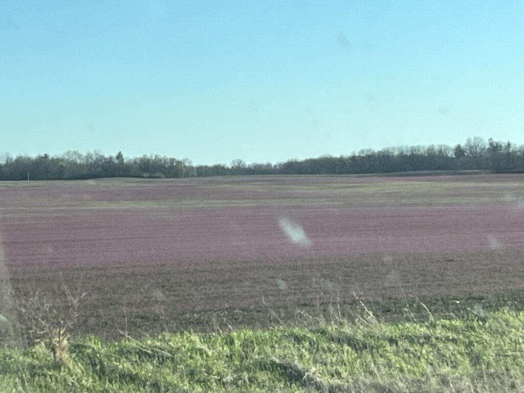
Our back roads drive resulted in us meandering along US25 towards Logansport which is part of the Historic Michigan Road that was built in the 1830’s to connect the Ohio valley to Lake Michigan.
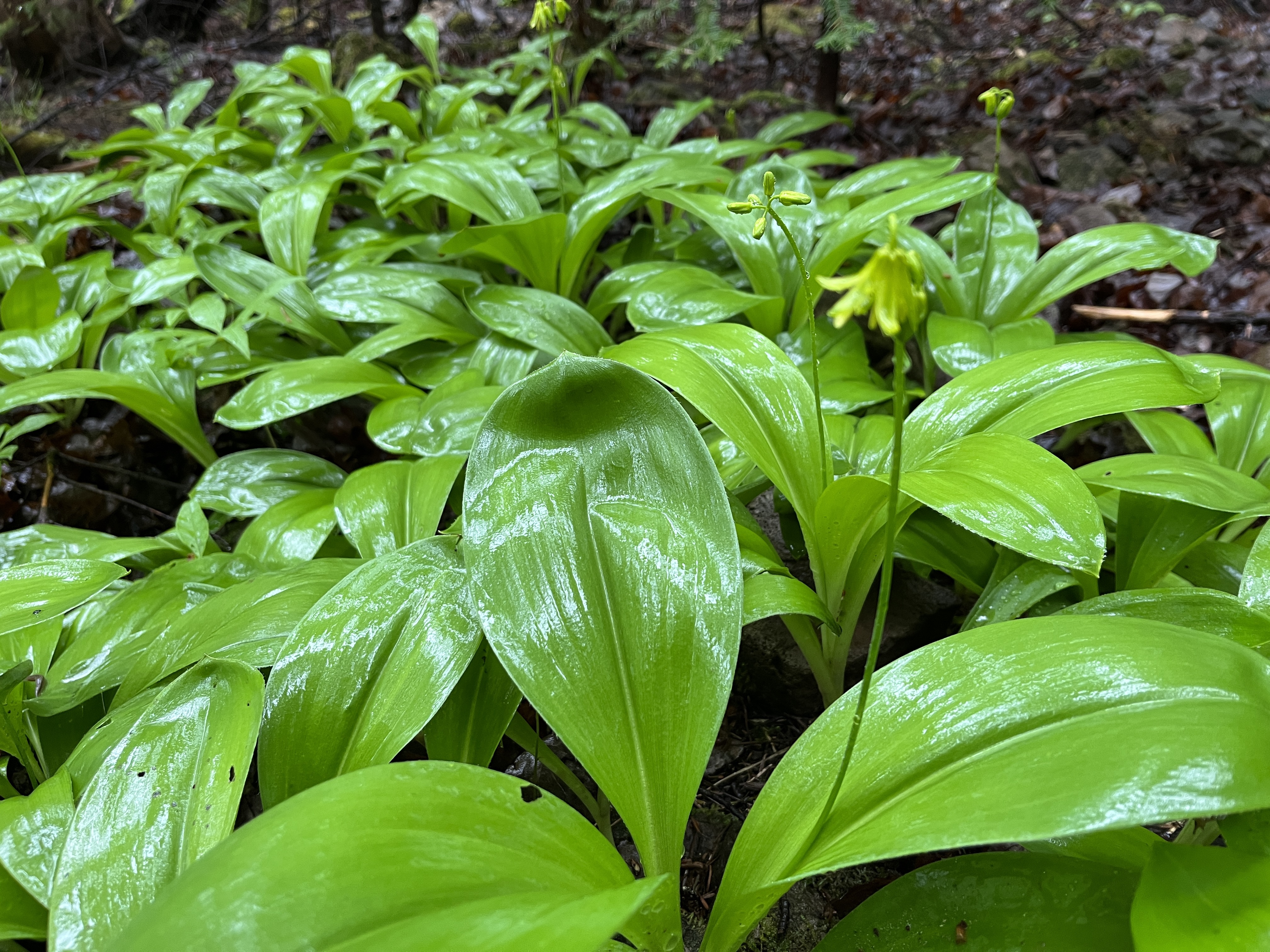
Purple Deadnettle
Our day ended with a Westward jaunt along I-74 towards Urbana, IL where we stopped for the night at a Cracker Barrel restaurant (Yes, they allow overnight stays for RVs).
Arriving in Illinois at sunset. Apologies for the bugs on the windshield.
Our day tomorrow will be much shorter than today and will include a special place to visit and a meetup to conclude the day.
We’re off again. This time the plan is to get to California and then head North into the Sierra Nevada mountains before turning West to the Pacific coast and continuing North into Canada. The final leg will bring us back across the continent through the Northern states before again returning to Canada at Sault-Ste-Marie.
The van is packed and we’re on the road shortly after 10am. The weather forecast was for rain turning into snow later in the day, we are hoping to arrive in Southern Ontario before the temperature gets cold enough for snow to form.
The drive along Highway 401 started dry but before long the rain began and intensified significantly. By the time we arrived in Toronto, it was difficult to see more than a few vehicles ahead. Road spray did not help with visibility and driving slowed to a crawl.
We arrived at our destination by 5:00pm and settled in for the night. We are visiting family for the next few days and our plan is to cross into the US on Saturday, this will be our next post.
Looking forward to having everyone follow us again on our adventures via this blog.
It’s been a while since my last post in June. Since that time we enjoyed Summer at home while taking a couple of shorter trips with the van to local camping spots along the St. Lawrence River and Provincial Parks. We also headed to Southern Ontario on a roadtrip in September that included a week in Prince Edward County enjoying the beach and the local wineries and restaurants the county has to offer. We also visited the Kawartha region before heading to Georgian bay to visit family. Our three weeks ended with some driveway camping visiting family before we came home.
As you can see from the picture above, the van is now nicely tucked away for the impending Winter having had a service and all waterlines drained & winterized. This shelter has kept the van safe for the past two Winters and I hope that it will get us through another as the roof is starting to become quite worn from exposure to the sun. Fingers-crossed!
It’s been a great year of camping that started early in March and ran until late September. We are already making plans for 2024 so stop by again to see what we have planned and to catch-up with our travels.
It wasn’t supposed to be a long day but it turned out to be the longest of this trip. Here’s how it all came to be.
The day started with us enjoying a slow start to the day. We had a light breakfast and then went to the beach expecting to see the tide in but it was out again exposing a long stretch of beautiful beach sand. The pictures below are taken 15min apart and show the influx of elementary school children on the beach enjoying what we assume was an end-of-school outing.
New River Beach Provincial Park, NB
We left the campground at 10:30am and headed West towards St. Stephen where we turned North towards Fredericton. The pictures below show some of the backwoods beauty of this province.
After joining Hwy 2 and driving North for a few minutes, we decided to leave the highway and drive along the side of the Saint John River on the old highway. This led us to seeing a black bear cub as he climbed over the guardrail towards the road in front of us. Yikes! 😳 Brake hard, he sees us & returns to the safety of the trees. Phew. No pictures as it was all over in a second. We stopped in Meductic and ate lunch in the van overlooking the river.
Saint John River
Shortly after lunch we stopped in Hartland to look at the worlds longest covered wooden bridge. It was closed for construction and as no traffic was able to cross it gave me an excellent chance to view the inside of the bridge by standing in the roadway.
Hartland Covered Bridge, Hartland, NB
Just North of Hartland we passed a more modern crossing of the river and then we rejoined Hwy 2 towards Edmundston, NB.
Saint John River crossing, Perth-Andover, NB
We pulled into the Grey Rock Casino in Edmundston at about 3:30pm. We were supposed to end our day here and camp out in the parking lot for the night but decided that it was too early to stop and so just picked up a cup of coffee and rejoined the highway.
Our initial thought was to return to the campground in Rivière-du-Loup; however, as it was only 90min North and we were going to cross back into Eastern time, we would arrive at 4:00pm EDT so we looked towards Levis and found a Craft brewery near St. Pascal that welcomes campers. New destination entered into the GPS.
It was a short while later that I realized that rather than stop just to sleep and then continue, why not simply continue? Home was only 7hrs away. We stopped in Levis for fuel and then continued to Drummondville where we stopped at a rest stop and had a quick meal in the van. Still feeling awake and energetic, we continued onwards towards Montreal where we left autoroute 20 and joined autoroute 30 which would take us around the south shore of Montreal. Below are a few picture of the sunset that we saw shortly before Montreal.
By the time we get around Montreal and cross the St. Lawrence River we were just 90min from home. We turned West onto autoroute 20 towards Cornwall, ON. After Cornwall we continued to Hwy31 where we turned North towards Winchester. At this point we were almost home and would arrive by 11:30pm. It turned out to be a 12 hour day with time taken out for stops and eating. In all I figured we drove for about 10 hours in which time we left the Bay of Fundy and returned to Eastern Ontario. A distance of about 1100km.
This concludes our East Coast Tour for this year. We have places we want to go back to as well as places yet to visit, as such we will make the drive again, when? We’re not sure yet, maybe a year or so.
Today I celebrate the completion of 60 trips around the sun. I get to spend it near and on the ocean. This day will be epic.
We complete our morning routines and prepare the campervan for a day of travel and head out shortly after 10:00am. Our first stop is at the local fish market where Barb picks up a bag of frozen Digby scallops and haddock to take home. Then a short drive along Water St to the Admiral Digby Museum which is across the street from the Digby Baptist Church.
The baptist church sits on the site of a home once owned by one of Barb’s ancestors, William McDormand Jr. After his death in 1806, his 2nd wife opened their home to host baptist congregations. Eventually the hose was replaced by the church.
Digby Baptist Church
A guide within the museum showed us about their collection and then took to their genealogy archive where we spoke for a time with the archivist about the McDormand’s as they arrived in this area in 1761. There are now descendants across North America. We need to complete more research in Ontario in order to definitively link Barb’s ancestor, John Dorman to one of the McDormand family’s in Nova Scotia. Another reason to return to this area.
After getting a few groceries and filling the vans fuel tank we had time to take a short drive to Gulliver’s Bay (Hole). A small bay just a few miles West of Digby, it was here that the McDormand families first settled in Nova Scotia after coming North from New England.
Gulliver’s Bay, NS
After enjoying a quiet lunch in the van and doing a little reading, it was time to head toward our ferry. However, first a quick detour to Prim’s Point lighthouse that guards the entrance to the Annapolis Basin from the Bay of Fundy.
Prim’s Point, Digby, NS
After walking about Prim’s Point it was now time to head to the ferry that would take us across the Bay of Fundy to Saint John, NB.
Digby Ferry Terminal
We arrived at the terminal about 1 1/2hrs before departure (they asked for 1 hr) and boarding began at 3:00pm. The ferry departed at 3:55pm, 5min ahead of schedule. In just a few minutes the ferry had turned to face across the Bay of Fundy and we were out of the Annapolis Basin and on our way.
Views astern and of Prim’s Point lighthouse
We began by enjoying a little time on deck in the sunshine and took a few pictures (above and below).
As the ferry crossing would take about 2 1/2hrs, we decided to grab a light dinner onboard. Barb ordered fish & chips and I had a burger & fries. Whilst ordering I happened to mention to the staff serving us that it was my 60th birthday. This resulted in them singing “Happy Birthday” to me and then adding a piece of free mud pie dessert to my tray when they delivered it to our table!!!
After enjoying our meals we settled into one of the very comfortable lounges onboard and did some reading to wile away the time. Shortly after 6:00pm we pulled into Saint John harbour and drove ashore.
Saint John, NB
We headed West out of Saint John to our overnight destination, New River Beach Provincial Park. It was only about a 30min drive from the ferry and appears to be very quiet amongst the trees a short distance from the waters edge.
New River Beach Provincial Park
After setting up for the night, Barb wandered off to the beach while I wrote this post in the van. Here are the pictures Barb took before being chased from the beach by black flies.
Tomorrow we head North in New Brunswick, come back to see what we discover.
We’ve spent that past two days (3 nights) in Digby, NS at the Digby Campground. This is a wonderful place to camp as you can easily walk the trail into town in a matter of a few minutes.
On our first full day (Sunday) we wandered into town to look about the harbour and to get some lunch. It was overcast and cool, but not raining. Being Sunday it was quiet about town (also probably due to it being Fathers Day) and most shops were closed.
Digby harbourPublic art
We enjoyed a seafood lunch at The Crow’s Nest restaurant. Being Father’s Day we were lucky to get a table without a reservation but someone hadn’t shown up and so the table was ours. Barb enjoyed a half-lobster roll and seafood chowder while I had the seafood platter with haddock, scallops and clams. Need I tell you that we really enjoyed them both? Fresh seafood is amazing.
Sights about town
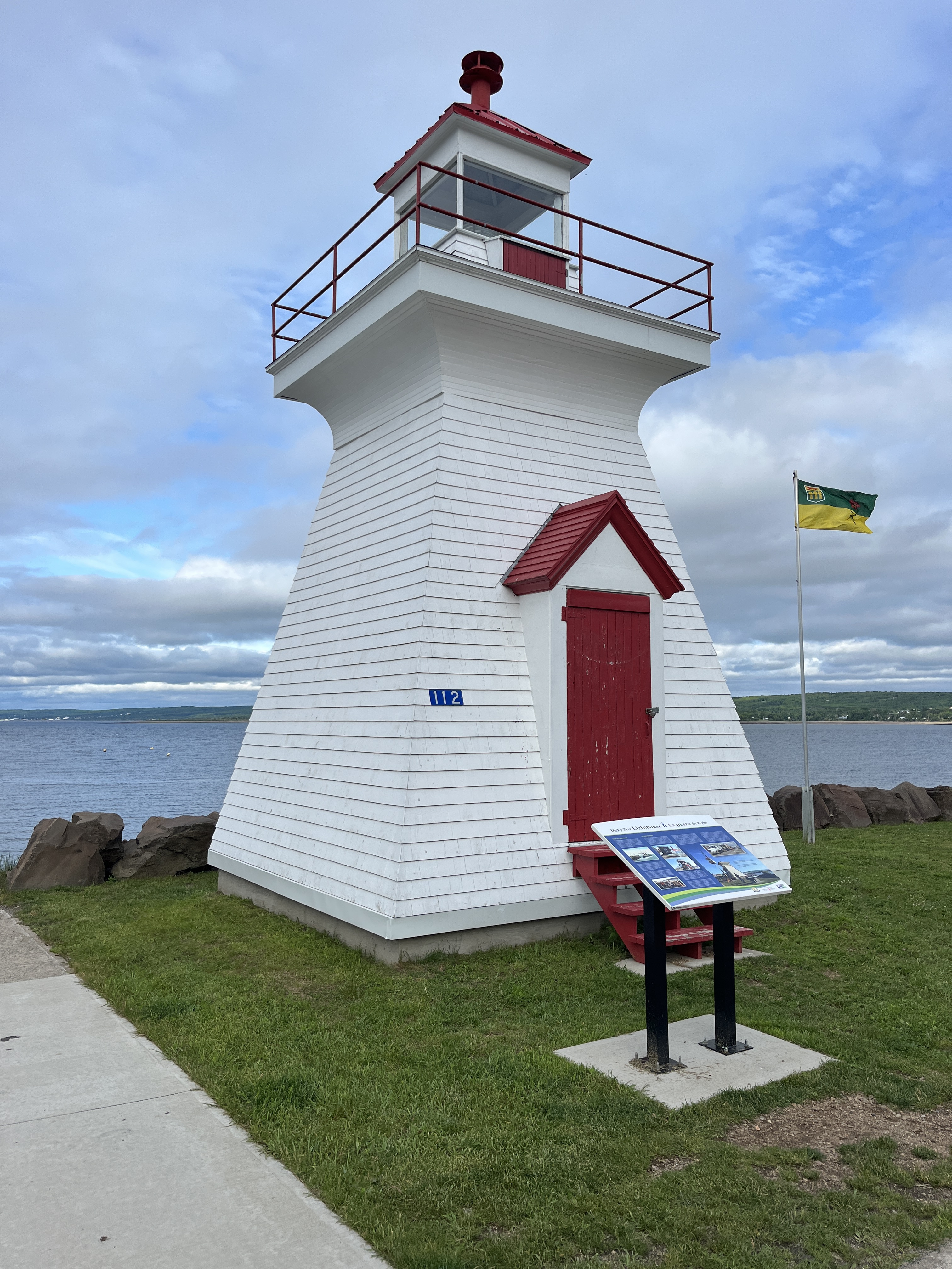
After lunch we wandered along the waterfront and past the Digby lighthouse. It was originally installed out at the end of the wharf but was sold to Saint John, NB when it was no longer needed. It sat in Saint John for many years rotting away until a few years ago the town of Digby asked for it back. Saint John agreed and it’s now returned and restored and standing on the waterfront.
Digby lighthouse
Monday was a rainy day and we spent most of it in the van reading and relaxing. The rain stopped and the clouds began to breakup just as we headed back into town to have dinner at The Fundy Restaurant. Tonight we both enjoyed a surf and turf (steak, scallops & shrimp with roasted potatoes and fresh veggies) along with a glass of Nova Scotia red wine which we followed up by sharing a homemade strawberry shortcake. Mmm.
The Fundy Restaurant
The picture below on the left is a communal patio in the campground where the hosts will have a bonfire and campers can gather around chatting the evening away. The picture on the right is a view across the Annapolis basin from near the campground on the road to the nearest fish market.
We’ve really enjoyed Digby and have both agreed that we need to return as part of a future trip. Tomorrow is a big day!
The brewery was a nice quiet place to spend the night and we awoke refreshed and ready for the day. Our first stop of the day would be Annapolis Royal, but before that, how’s this for a view?
Views such as this are commonplace in the Annapolis valley, it’s hard to express how tranquil and beautiful this part of Nova Scotia is.
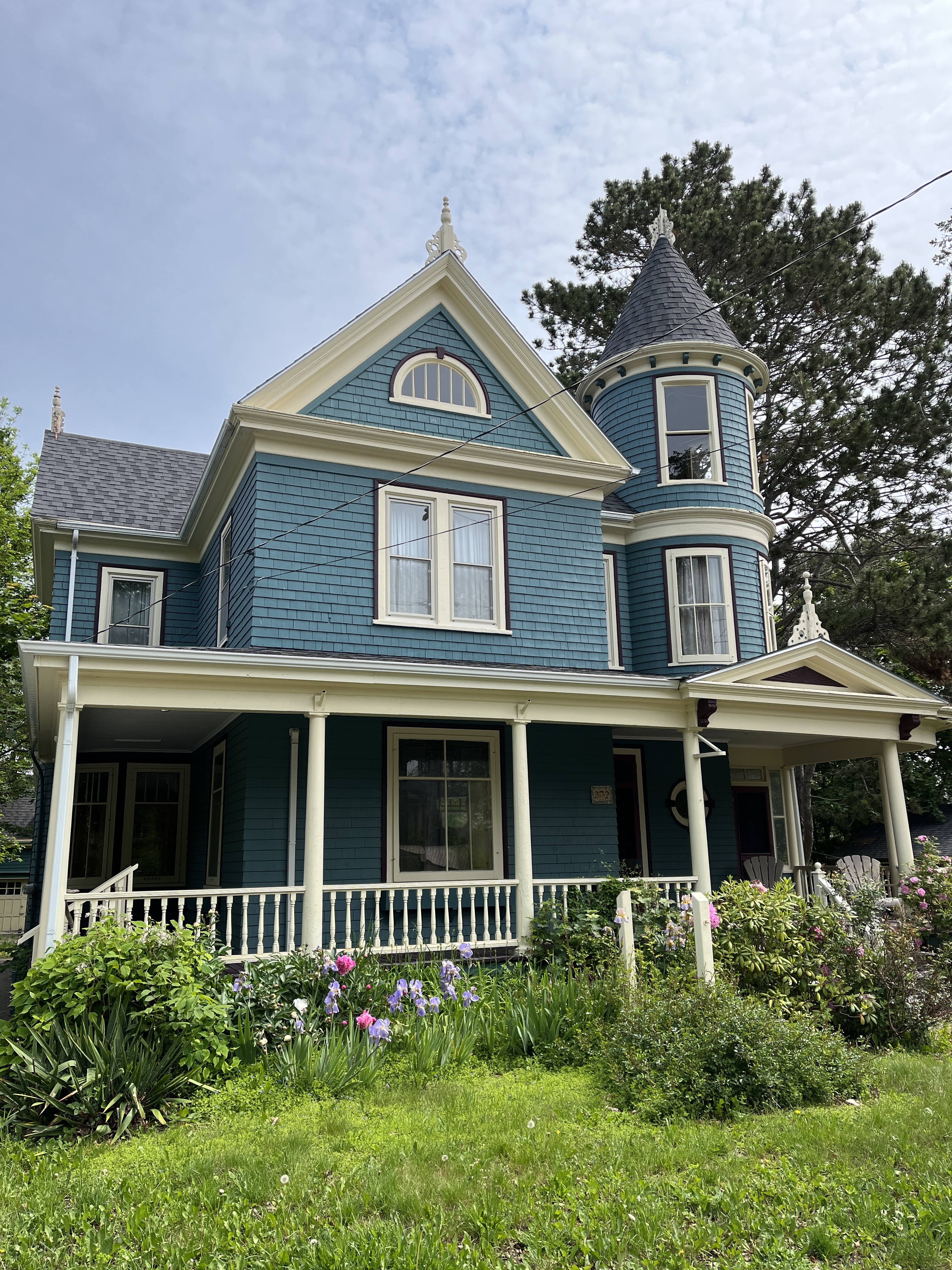
As we pulled into Annapolis Royal the mature maple trees that lined the narrow streets and plentiful flowering shrubs next to historic old houses told us that this is a special town.
We maneuvered the van downtown and noticed that it was very busy with many parking spaces filled along the roads. I was about to start casting doubt as to whether we would find a space into which we would fit when out of the corner of my eye I spotted an opening in a small public parking lot, I turned hard left and entered via the exit turned about and parked facing the exit of the lot. Voila, parking done. And it’s free!
Below are a few pictures from downtown showing some of the wonderful old buildings.
We walked back toward Fort Anne that we passed on the way in. It is a Parks Canada property that you can wander around for free paying an entry fee only if you wanted to tour the officers building on-site. The fort was established in 1629 on mik’maq land. Over the years it was occupied by both the French and the English as they fought over control of the land in the area. It is a four-bastion fort that has a clear view down the Annapolis River toward Digby making it easily defendable from waterborne attack.
We enjoyed walking about the grassy defenses and took a quick look in the semi buried powder magazine where gunpowder was stored. The building is the oldest that Parks Canada owns anywhere in Canada having been built in 1708. The officers building is from the late 1700’s.
Below is an example of one Rhododendron that we spotted in town, there were others equally as beautiful. We can only wish to grow such a plant in Ontario.
From the fort we wandered back along the Main Street and stumbled upon the cause of the traffic, Saturday morning market! It was nice to see the local producers and artisans setup and the townspeople out enjoying what was a welcomed spot of sunshine and nice weather. We purchased a couple of savory pies and enjoyed them waterside.
After lunch we returned to the van and headed out of town heading towards Digby, NS. Digby is a fishing port world renowned for the size and quality of the scallops caught. Yumm!
We will be spending three nights at the Digby campground which is on the edge of town next to a walking trail along the abandoned railway line that we can follow into the downtown therefore avoiding the worst of the hills. Here we are shortly after arriving, relaxing and enjoying what would be the last of the sunshine we’d see for a couple of days.
Barb took a short walk down to the waters edge and wandered along the tidal flats looking for shells and took a few photos that I’ve shared below.
Our next post will be in a couple of days in which we will summarize our two days about town.
Although predicted, the overnight rain did not materialize and we had a peaceful sleep. We slept in as our first stop of the day was to watch the tidal bore arrive in Truro, NS. It was scheduled for 11:58am. This gave us time for a shower and relaxing drive to a restaurant for a cooked breakfast.
We knew to arrive early at the viewing point as the published times are at best guesses based upon past arrivals of the tide. The tidal bore today arrived at 11:37am. Although not the largest I’m sure, the power of the water was quite evident when watching it hit the soft sandy banks of the river.
Tidal Bore at Truro, NS
We were headed toward Windsor, NS and the GPS app proposed a route through Halifax and then back to the North shore. We chose not to drive across the province twice and instead took Hwy236 from Truro to Windsor. It is a wonderfully twisty and hilly drive through some marvelous farmland that took about the same length of time as the initially proposed route but was so much more interesting and fun to drive, I wish I was in my MINI instead of the van. 😜
Leaving Truro and heading into the Annapolis valley
At Windsor we joined Hwy101 to Wolfville where we drove up into the hills to locate Luckett Vineyard. The property is beautiful and the view from the bistro has to be seen to be believed as they have a clear view across the Minas Basin. We took a few pictures and share them below.
We cheekily enjoyed lunch in our van (Cheese scones with Crab spread and locally grown strawberries). We did also pickup a few vineyard produced products to take home with us.
Luckett Vineyards, Wolfville, NS
We drove a further hour towards Lawrencetown, NS where we had made a reservation to stay at the Lunn’s Mill Beer Company for the night. A Harvest Host location that is a craft brewery with a great selection of beers and an amazing food menu.
I enjoyed an English Style Bitter while Barb tried their Lager. We split an order of Poutine and Barb enjoyed the chicken wings and I had a burger. All around a delicious meal that we were able to enjoy outside in their beer garden.
Lunn’s Mill Beer Company, Lawrencetown, NS
Tomorrow we head to Digby, NS where we will be staying for a few days. Good night one and all.
We awoke to rain and mosquitoes. The idea of hiding away inside our van for the day was not appealing, so we left Panmure Island Provincial Park even though we had paid for a second night. We figured the weather had to be better elsewhere.
We started by driving from the campground onto Panmure Island to take a look at the lighthouse, the oldest wooden lighthouse on the island!
Panmure Island, PEIPanmure Island lighthouse, PEI
From Panmure we headed South and the East to look at Cape Bear lighthouse. As you can see, the sun came out.
Cape Bear lighthouse, PEI
Along the way we passed lots of lilacs still in full bloom and potato fields with the plants now appearing above the soil in nice neat rows.
Scenes from PEI
As our plans had always been to leave PEI by ferry because it was something we’d not done on our last trip here many years ago, so we headed to Woods Islands to look at the lighthouse and check ferry availability.
Woods Islands lighthouse, PEI
The lighthouse did not disappoint, but the ferry did. They only had overflow available for the 3:00pm ferry or we could reserve for the 6:00pm ferry. It was 12:30pm and so we decided to drive back to the bridge and take it instead.
Along the way we stopped at Point Prim to look at the lighthouse. It is the oldest lighthouse in PEI and is built of masonry, is round and finished with wood shingles. It was completed in 1845 as an aid to sailors entering the Charlottetown harbour.
Point Prim, PEIPoint Prim lighthouse, PEI
Crossing the Confederation Bridge took us from PEI and back to New Brunswick. We were stopped for road repairs on the bridge which gave us a good opportunity to look about and observe that concrete bridges also flex under the load of moving vehicles. Hmmm.
Confederation Bridge
Entering into Nova Scotia we stopped at the visitor center and we’re welcomed by a piper. The light rains we’re about to get worse according to the darkening skies under which we were soon driving.
We were headed to Colchester, NS and were driving up and around Westchester mountain when the skies became really dark and the winds picked up. We paid the toll at the Cobequid Pass toll plaza and then the rains came. The windshield wipers were on full and the rain covered highway shone like an ice covered pond. We slowed (obviously) to about half the posted speed limit and luckily the worst was over in just a few minutes.
We stopped for fuel, dinner (fish & chips) and a few groceries at the Masstown Market. Quite a place that has just about everything you could want in one stop.
Masstown Market Fish market
From the Masstown Market we drove 2km to the Elm River Campground as it had been a long day. Below is our site and a quiet one we are hoping it shall be. Good night.
Today we left Twin Shores and travelled East across the island. We started by stopping in Cavendish and Barb did a little souvenir shopping and bought a COWS ice cream cone. It was just 10:30am.
We drove East across the center of the island and then out towards East point. Here a few pictures of things we saw along the way.
We also saw the crushing aftermath of hurricane Fiona (Sept 2022) in scenes like the one below where an entire forest appears to have just been blown over. Sad.
We eventually made it to the East Point lighthouse. The gift shop building now stands next to the lighthouse as erosion has undermined its old foundations. In the right hand picture below our silver van is parked next to the old concrete pad that the gift shop used to be on. It is currently hanging over nothin and could fall into the sea in a matter of weeks.
The pictures below are taken 23 years apart. We last visited in 2000 with our children and posed for a picture at the top of the lighthouse. The picture on the left was taken on our first digital camera, a Kodak 1MegaPixel wonder. The picture on the right is taken with an iPhone13 12MP camera.
Leaving East Point we headed along the South shore towards Souris. It is from here that you can catch a ferry to the Îles-de-la-Madeleine. We drove past the ferry terminal and stopped to briefly look at the Souris lighthouse. As you can see it was raining again.
We arrived at a very wet Panmure Island Provincial Park after driving around the area looking for a place to have dinner without any luck. We setup our campsite and retreated into the van avoiding the rush of mosquitoes that wanted to join us.
As you can see below the campground was not busy and we shared our section with one other van (Roadtrek) from Quebec, although we didn’t actually see anyone enter or leave the van while we were there.
All for now. We are scheduled to stay here for two nights but are talking of possibly leaving early due to the weather. Check back tomorrow to see what we decided. Happy trails.
We’ve spent the past two days relaxing at Twin Shores Campground on the North shore of PEI. This is a large campground with hundreds of campsites able to accommodate everything for tents to the largest RV rig. Trees or open sites, electrical, water and sewage available in differing combinations suiting whatever one might need or want. The park also has several snack shacks and a café as well as gift shop / camp shop should you have forgotten something. Doggie park and wash for those with pets, games arcade, mining exhibit, bike rentals for those with kids. They’ll even rent you a golf cart if you find walking around the park a little too much.
The owners put a lot into this park, right down to keeping small flowerbeds about the park like the one shown below between a couple of campsites. If back this way we will stay here again. As June is just out of prime season it was quiet and yet we had access to most of the amenities available in the prime summer months. Thumbs up from us!!
Of course, the star of the show at the campground has to be the amazing red sand beach. Below are a few pictures we took while walking one afternoon.
And of course, here’s a selfie to prove that it was actually us at the beach taking these pictures.
In the earlier morning hours you can watch the lobster fishing just off the beach, or on the other inner side of the park you can watch the oyster/mussel farm being tended to from your campsite.
Above you can see Barb enjoying the afternoon sun stretched out on the beach while reading her latest Coleen Hoover novel.
The weather was great while we here, we timed it just right it would seem. Tomorrow we head East across the island to spot a few more lighthouses. Have a great day!
Another quiet night and I’m early to go for a walk. Yep, for the first time in a few days it’s dry enough and warm enough to convince me to get out there. I complete a short 4km loop outside of the park on local roads and am passed by 0 cars during the walk. Quiet country roads are so nice early in the day.
Breakfast, shower, prep for the road. And we’re off. Today we will visit the North cape lighthouse and then make our way back toward the center of the island on the North shore to the campground we will be staying at for the next three nights.
We take the scenic coastal road along the west side of North cape and see some stunning vistas across the Northumberland strait to New Brunswick. The road dips and turns as it follows the red cliffs and hidden coves.
We arrive at the North cape and take a walk around the lighthouse which is over 150years old. As you can see in the following photos, the sun has finally made an appearance.
North cape lighthouse
We drive south along the eastern shore of the cape towards Tignish Shore where we stop to take a look at the decommissioned lighthouse that stands there. We also take the time to enjoy a quick lunch in the van before heading further south where we pass over several inlets where we see oyster farms in the quieter waters.
After passing Summerside we turn North towards the Twin Shores campground. A few miles before arriving we pass the following church which has, for its size, an enormous wind vane balancing on its steeple.
Twin Shores campground is easily the largest campground in which we have yet stayed, and yet our campsite is quiet and yet close to the beach.
After setting up we take a late afternoon walk down to the beach. It is a huge red sand beach with shallow water that would be perfect for younger children to play in. Barb has to take off her sandals and wade into the water, it is cool but not frigid as she expected.
We find a flock of swallows nesting in the cliff tops and they dart above our heads, clearly not happy that we are there.
As you can see below, the beach is not busy, one of the key advantages of visiting ahead of the main summer camping season.
Barb revisited the beach after our hamburger dinner and caught the following sunset. This will do nicely for the next couple of days.
It’s still grey and overcast when we wake, the forecast is for better days ahead, will today be the day we find the sun? Or it finds us?
The morning is the typical routine, awaken slowly and too early to be of much use for anything ahead of the morning coffee. Coffee, banana and a yogurt and we’re feeling the day. Clean up the interior of the van, disconnect the electrical service, remove the leveling blocks and we’re away. Today we head to Prince Edward Island, or PEI we are used to referring to it as.
We head toward the Confederation Bridge, the 12.9km (8miles) long concrete structure that connects mainland Canada to its smallest province. Opened in 1997 the bridge has made it significantly easier to visit (and leave) PEI. The toll is $50.25CAD (in 2023) which is paid upon leaving the island.
You can above that from our van we had a very good view from the bridge, those driving cars will barely see above the concrete wall that forms the edge of the bridge deck.
We stop at the PEI visitors center at the far end of the bridge and pickup a lighthouse map and few souvenirs as well as a few alcoholic beverages from the liquor store.
We head to the West across the island stopping in Summerside for groceries. The potato crop is just being planted and we take note of the fact that trees are 3-4 weeks behind Ontario. The same is true of people’s yards as the garden centers are doing a booming business and people are busy planting their gardens.
Potatoes recently planted
Leaving Summerside we drive westward towards West Point where we will camp for the night at Cedar Dunes Provincial Park. We get setup on our site and after a short rest in the van take a walk to the West Point lighthouse.
This is our second time here, the last being in 2000 when we visited with our children and camped in a tent that we carried in our minivan. The park was damaged quite extensively by hurricane Fiona in 2022 with many of the cedar trees being uprooted. There are still some around but the damaged areas are easily spotted and will take many years to recover. As you can see below, our site had a spruce tree on it but it was one of very few. The beach is beautiful and in the summer the water very warm as it faces south. A very nice smaller park to stop at with family for some beach time.
We spent Thursday relaxing and reading in the van whilst the rain showers continued. We did get out for a walk from the campground to the bottom of the ski hills (they don’t allow hiking up them for some reason) and I’ve include a few pictures below.
Sugarloaf Provincial Park, Campbellton,NBSugarloaf campsite.
Friday we packed up and headed out of Campbellton towards Cap-Luminiere, NB. We had no planned stop for the night but there are a couple of campgrounds right on the shore that we felt should have some space.
Mirimichi, NB
We stopped at near Bathurst at a Tim Horton’s for a coffee and sandwich before heading on to Mirimichi where we pulled into town and stopped by the river next to the marina. It was raining again. The town claims to be Canada’s Irish Capital, something that I will need to research as this was news to us. It was while stopped by the river that we changed our plans for the night and decided to continue on to Shediac, NB. It is only a little further than our original destination and we’d get to see the worlds largest lobster!
A short drive later and we’re pulling into Shediac, and there’s the lobster! It is rather large. We stop to take the required photos. It’s stopped raining but is windy and cold.
Shediac, NB
The town of Shediac is clearly very popular with summertime tourists and the town has some very nice looking stores to browse through. We cross town and pull into Parlee Provincial Park. They have lots of camping sites available and decent, clean restrooms and showers (although it takes a $1 coin for the shower to run for 5min). Shower skipped as we showered at Sugarloaf.
Parlee campsite.
We got setup and walked about 1.5km to a nearby restaurant where we enjoyed bacon-wrapped scallops, clam chowder and a lobster club sandwich each. Yummy! The walk back to our campsite was welcomed to allow dinner to settle before tucking in for the night.
The weather forecast is for sunnier days ahead and we’re about to drive over to Prince Edward Island so fingers crossed that we can spend a little more time outdoors in the upcoming days.
Good morning. Power at the campground is still out but we have full coach batteries and so are fine. By 10am we have eaten breakfast and organized the van. It is a till raining but we have reservations in PEI for Saturday and so need to move along a little in order to keep the driving days reasonable.
We’re aiming for a campground in Percé, QC with views of Percé rock. It’s one of the most picturesque places along this coast and in the Summertime can become quite crowded with tourists. We’re hoping the weather eases somewhat as per the forecast.
The drive along the coast is slow and relaxing, albeit wet. We arrive in the town of Gaspé and stop for some lunch. We enjoyed homemade soup and seafood at the Brise Bise restaurant before heading to the Oh les Pains bakery for a few baked treats to take on the road. A quick stop for fuel on the way out of town and back on the road.
Lunch!
Any hopes of the weather breaking are coming coming to an end. The clouds are so low that for most of the drive we can barely see the shoreline or treetops from the van. Corners on road appear out of nowhere as do the hills. We arrive in Percé and it becomes clear watching those outside that it is not a day to sightsee. The campground with a view has none and we decide not to spend money on something we couldn’t see. The weather is not supposed to improve much here over the next 24 hours and as such we decide to push on. We will have to return another year when it’s drier and warmer.
I think there’s a lighthouse somewhere out there.
We aim for Sugarloaf Provincial Park in Campbellton, NB. The forecast looks to be better with only light drizzle, let’s go find out.
The drive along the South shore of the Gaspé peninsula is completely different from the North shore. It is far more populated with many small towns along the way. Agriculture is much more prevalent and the terrain is flatter and not as high. Carleton-sur-mer appeared to be the main touristy center along the coast with a large harbour.
Boutillier Brothers museum, Pasbébiac, QC
A couple of hours along the coast and we’ve turned South to cross into New Brunswick, Canada’s only officially bilingual province. We stop to top off the fuel tank and head just out of Campbellton to Sugarloaf Provincial Park where we plan to stay for the next couple of nights. The campground is only just getting going for the Summer and there is lots of room for us even without a reservation. The site is level and treed, a good place to kick back while we wait for the last of the rainy weather to move out.
Although we grumble about the rain, our thoughts are with friends and family in Ontario suffering with the smoke from the Quebec forest fires. Hoping that everyone is OK and staying safe.