Our camp hosts were very cordial and things got quiet by 9:00pm. It’s nice when things work out. We both slept really well and awoke at about 6:30am. A light breakfast and coffee before we packed up and left at 8:05am. Minutes later we drove out of Yosemite National Park.
Views along SR-120 on the way to Stockton, CA
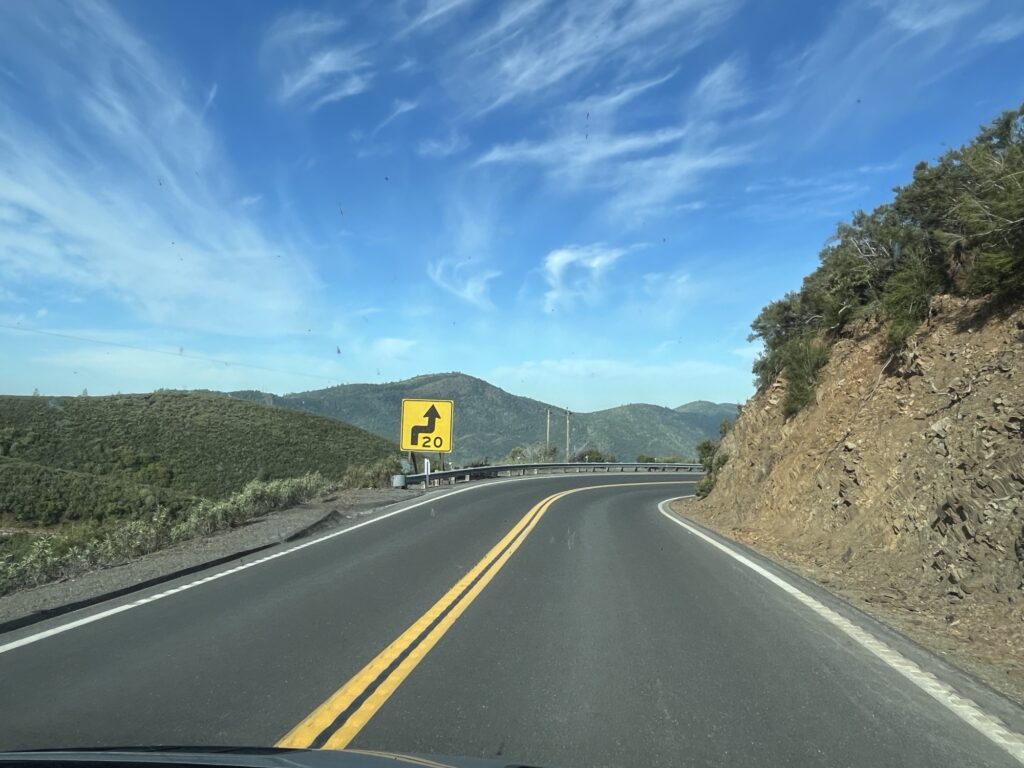
We were headed West along SR-120 towards Stockton, CA and descended down from the 5,000ft or so of the campground. At the town of Priest, CA there was a sign informing drivers that vehicles over 7,500lbs were restricted from taking the ‘old’ road and were required to take the ‘new’ road. We now know why, the old road is super steep for several miles whereas the new road is less steep for several miles more. The descent was super twisty and most corners were marked with either a 15 or 20mph suggested speed. Another MINI road in the van.
New Priest Grade Road
At the bottom of the decline we stopped in Copper Cove, CA for breakfast (2nd). Barb enjoyed a breakfast burrito and I had the country breakfast. It was delicious and a nice treat.
Continuing on, we drove through Stockton and onto Fairfield where we stopped for fuel and to do a little shopping. Next was Napa and a stop at RD Winery where we sampled some local wines and purchased a few bottles to enjoy at a later time.
Views as we drive across to Fairfield, CARD Winery, Napa, CA
Our night will be spent at Dan Dan farms just outside of Napa, overlooking the valley. It’s a beautiful spot with the farm keeping chickens and cattle while growing olives and producing Olive oil. This is a Harvest Host location and as such we purchased some eggs and a bottle of the Olive Oil as a thanks for allowing us to stay on their gorgeous farm overnight.
I was anxious. I was awake. It was 5:45am. We have plans to drive into Sequoia National Park to see the giant Sequoia trees, this means driving up the “General’s highway”, a road restricted to vehicles 22’ or shorter. Ours is 22’ plus the bike rack. We’ve been told by our camp host that it should be fine as long as I take my time. [Remember Tony, you’re not driving the MINI.]
Shortly after 8:00am we leave our campsite and immediately find a reason to pull over and stop… to clean the windshield that is. Expecting some epic views and vistas and wanted the glass to be as clean as I can get it with white vinegar and shop cloths (all we got).
The drive UP the General’s Highway is just that, UP. The drive to the Giant Forest Museum from our campsite is measured at 15 miles and should take about 40 minutes. The road rises to over 7,000 ft above sea level. There were too many switchbacks to count and all the time the road rose in front of us. It was narrow, tight & twisty, a perfect road for a MINI cruise, but I was in what felt like a huge lumbering truck. Slow and steady would get us there.
Drive UP the Generals Highway
The views were astounding, there are several nice pullouts where you can get out to take pictures. We see the flora around changing as the elevation increases, we pass through areas where wildfires have burnt the trees back to standing black poles devoid of all life. And then we arrive near the top of the climb and turn into a land of giant trees.
Into the grove of Giant Sequoia Trees
These are not your normal giant trees, these are Sequoias. We both expected large trees, it’s what we had come to see, but these are incredible. Thousands of years old and still standing on guard in groves near the tops of these mountains. Sequoias are not the tallest trees, that honor is reserved for the Redwoods, however, they hold the record for being the largest by mass with some estimated at being well over 1000 tons.
Leaving the museum we go on to find General Sherman, one of the largest Sequoias in the world. We park and walk down a nice trail to an enormous tree. It has to be well over 20 feet across and a few hundred feet tall. The trunks of the Sequoia tree do not narrow very much and so the trees feel more massive because of this. The bark can be up to 2 ft thick which help the largest trees in the event of fire as it would take a while to burn through this before exposing the sapwood that provides the nutrients to the upper portion of the tree.
General Sherman
Walking back up from General Sherman to the van we both feel the effects of exercising at over 7,000ft. It is tiring.
We now head out of Sequoia National Park towards Fresno, CA. A place to stop, get fuel and have lunch in the van. I take the time to upload yesterday’s blog post now that I have access to the internet.
We head North from Fresno along Hwy 41 towards Yosemite National Park. We have what we think is the last available site in the park reserved for one night. The drive is hilly and the road twisty causing for traffic to be inconsistent but as we get closer to the park traffic lightens and the drive is more enjoyable.
Heading North from Fresno, CA
Entering the park we save another $35USD because of our annual pass. The road continues to be twisty and we are now really gaining elevation again. The 30mile drive takes nearly an hour but the reward at the end!
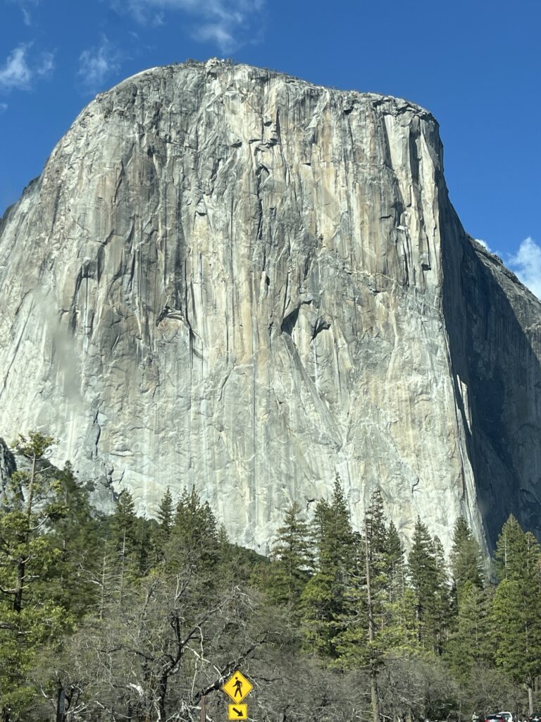
Our breathes were taken away as we turned a corner and looked right down into Yosemite Valley. Past El Capitan and the Bridal veil falls all the way to Half-Dome. This was a view that I had seen many times published by others or in TV documentaries now staring me right in the face. I yanked the van to stop and jumped out to capture some pictures. The sun was perfect, shining straight down the valley illuminating the rock surfaces and trees while causing a rainbow to appear at the base of the bridal veil falls.
Beautiful viewBridal Veil Falls with rainbow
We descended into the valley through a rock tunnel only just tall enough to clear the roof of our van. The valley was quiet. It’s April and the crowds have not yet descended upon the park. It’s not empty, I’m sure it never is, but there are parking spaces and room to move about. We enjoyed a drive along the valley to the end and then back to the road that will take us North out of the valley towards our campground for the night.
Into and out-of Yosemite Valley
The drive is up yet again along a twisty road that hugs the sides of the mountains. We eventually descend towards the campground and turn into Hodgdon Meadow campground.
Our campsite is not fancy or level. We do the best we can and set about having dinner. Our neighbors, the camp hosts seem to be having a party, hopefully it will wrap up before bedtime.
Our campsite at Hodgdon Meadow, Yosemite National Park, CA
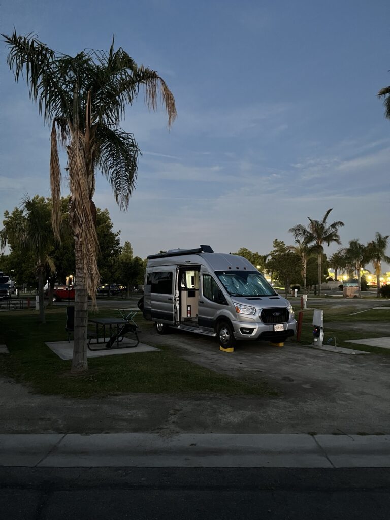
Up early to shower. The KOA Bakersfield succeeds. The showers are wonderful and have earned a 9/10 from the both of us. High praise, I know.
KOA Bakersfield, CA
We watched a few rigs preparing to leave as we ourselves would be doing as soon as the yoghurt, banana and coffee had been consumed. We packed up, dumped our tanks (all good) and were on our way.
It was shortly before 9:30am and we were headed North. We took Hwy 65 to Porterville, CA where we stopped for a few provisions. Continuing northward we passed Exeter, CA where we turned East towards Sequoia National Park.
Various views along our way to Sequoia National Park
We have reserved one night in the only open campground located in the foothills of the Sierra Nevada mountain range. We arrive shortly after noon to a line-up of vehicles entering the park. This is the third park at which we can use the ‘America the beautiful’ pass allowing us entry free of charge and today saving us $35USD. At this point the card has paid for itself and any future National Parks, forests or other supported locations we visit will be truly free of charge.
First views of Sequoia National Park
The campground is smaller with only about 40 sites and is primarily targeted at tent campers and smaller vehicles. The road to access the campground is restricted to vehicles 24’ or less.
It’s nice to be amongst the trees after several days in the desert. We went for a hike up the river canyon adjacent to the campground and captured some beautiful shots of the river and hillsides.
On a hike and then returning to see deer in the campground
Bears frequent the area and everyone is required to store any foodstuffs normally left out in their vehicles overnight in the provided bearproof boxes on their campsite. So, bananas, oranges, etc are currently tucked away outside of the van so as not to attract night time visitors.
Settling in for an off-the-grid (internet free) evening. Tomorrow we head further into Sequoia National Park to see the towering trees and other sights the park has to offer.
We awoke to another quiet morning. We don’t have a long drive today and so took our time getting ready for the day and packing up. We were on the road shortly after 11:00am. We are sad to say goodbye to Sawtooth Canyon as it has been a very tranquil place to spend a couple of days.
We started with a short drove North to Barstow before heading west on I-15 and then NW towards Bakersfield, CA on Hwy 58. The campsite for the past couple of nights was the most southerly point on this journey as we now head North through California.
Heading towards Bakersfield, we pass Boron, CA the home of the largest Borax mine in the world. The open pit mine is owned and operated by Rio Tinto. Hwy 58 also takes us past Edward’s AFB where the Space Shuttle conducted many of its landings and Chuck Yeager broke the sound barrier in the Bell X-1. We couldn’t see much but still cool to think about the aerospace history that took place here.
A little further along the highway we pass Mojave, CA the home of Virgin Galactic. They fly their aircraft from the Mojave airport which then launches the Unity rocket powered craft from the air towards space. If you are wealthy you can book a seat and earn your astronaut wings.
Virgin Galactic, Mojave, CA
We stop for fuel in Tehachapi, CA and then drive to Keene, CA where we detour to see the Tehachapi Loop overlook. We see a long BNSF train hauling freight eastward up ‘the hill’ and around the loop. The loop has a 1200ft diameter and rises 77ft. The trains that arrive here are traveling from Bakersfield (400ft elev) and arrive at the loop which is 4028ft elev in a distance of just over 60 miles. The locomotives were working hard as they rounded the loop still with several miles to go to the top.
The landscape west of the mountains is vastly different. Gone is the flat sandy desert to be replaced with rolling hillsides. Covered in grasses and trees.
We descend towards Bakersfield, CA and find ourselves in a lush citrus growing valley.
San Joaquin valley, CACitrus trees trimmed for mechanical harvesting
We arrive in Bakersfield mid-afternoon to stay at the KOA Journey in town. The place is immaculate, grassy and park like. They have a pool & hot tub as well as an onsite restaurant that we have chosen to enjoy this evening.
KOA Bakersfield, CA
It is warm and I’m thinking of firing up the rooftop A/C unit. Will wait until the evening settles in before making that decision.
The sky is clear and the moon is up. It’s going to be a beautiful evening. Check back tomorrow to see where we go from here.
Stay happy. Be positive!
P.S. Note that limited internet access may result in the next couple of posts not being posted on the day that they represent. Check back often and we shall post as soon as we can.
Decision made, we’re staying put in Sawtooth Canyon campground for another day. It’s just to peaceful and beautiful here that we just want to stop for a day & catch our breath.
Panoramic shot from our campsite
To that end we sleep in until after 8:00am and had a very leisurely morning. Barb took care of researching and booking our next few nights (we now have reservations until Monday).
After lunch we went for a walk about the campground and a short hike into the surrounding hills.
A little about the areaBarb enjoying the hikeTony at the top of a scrambleNice viewTony returning from top of scrambleVegetation
Back at camp we settled in to read and enjoy a few snacks before making ‘breakfast for dinner’. The evening was spent relaxing in the van and watching a few videos.
California poppiesHole through rock
Tomorrow we’re heading to a serviced campground in preparation for the following two days which will be more remote.