Tag: Vanlife

  • Day 05: The search for whales continues

    Day 05: The search for whales continues

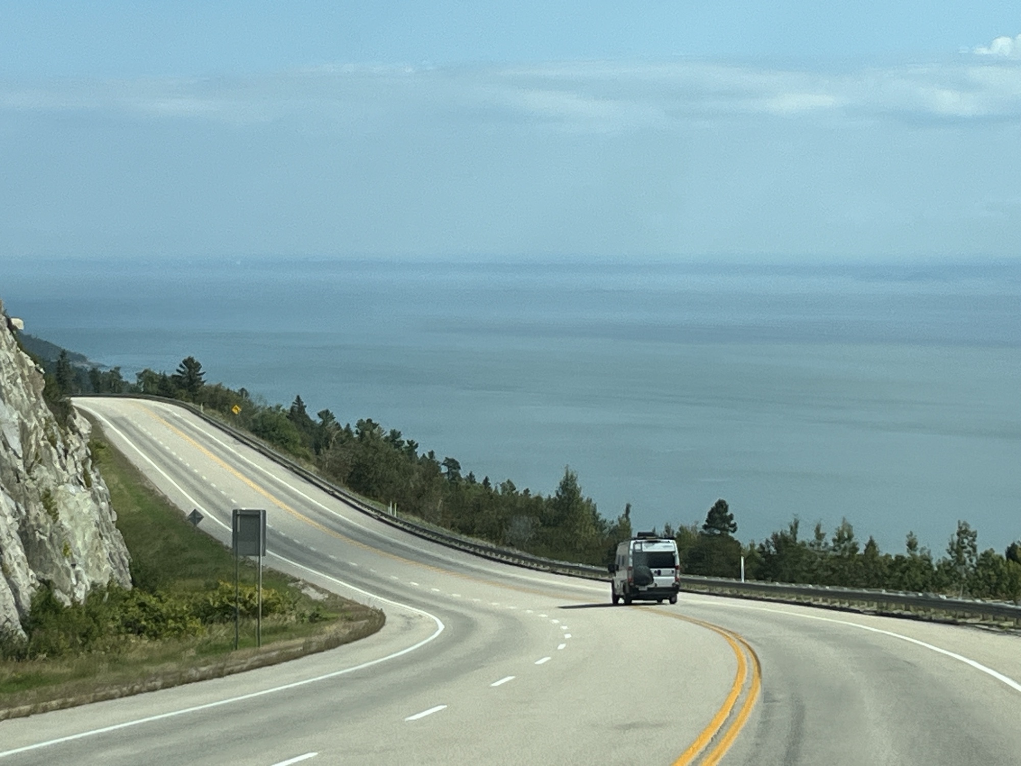
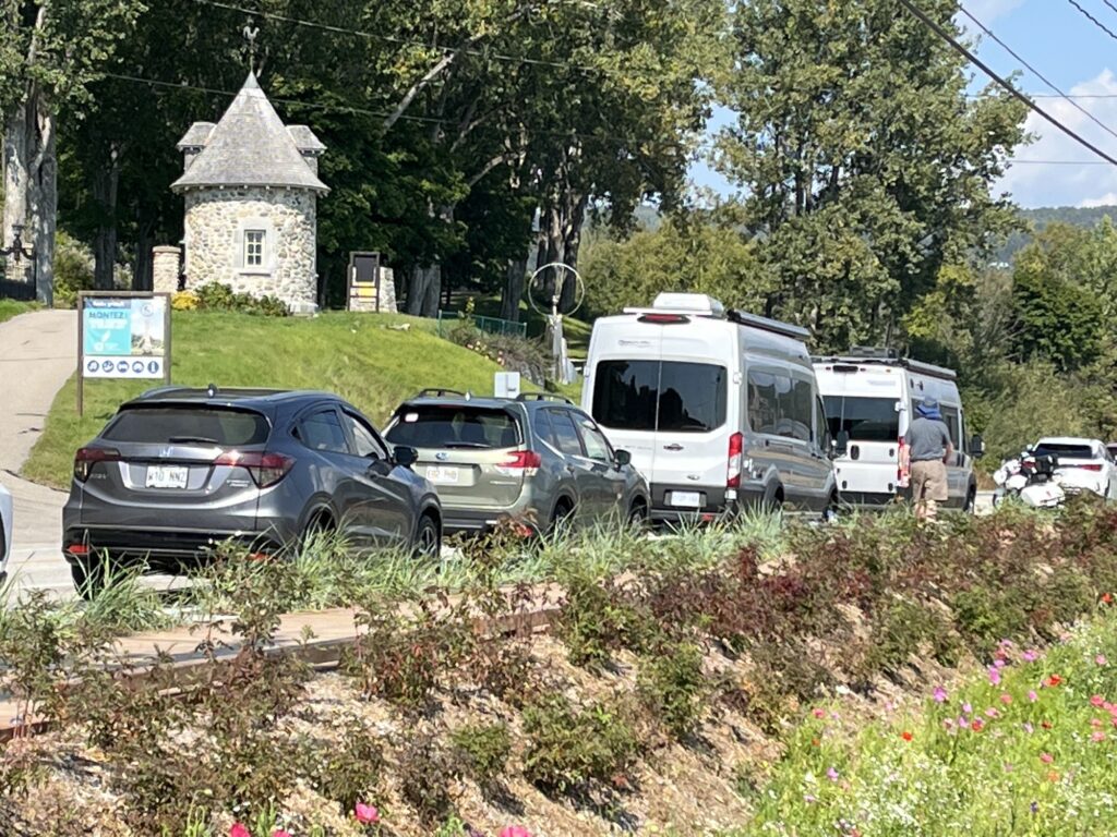
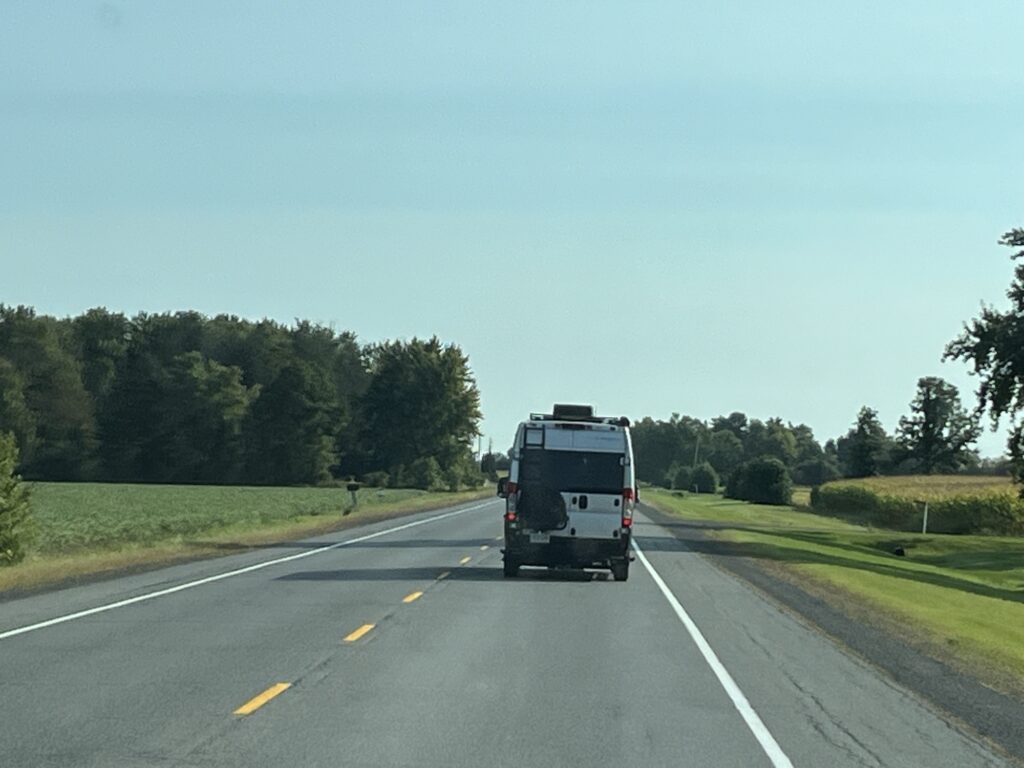
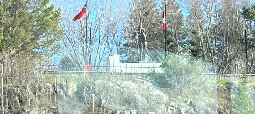
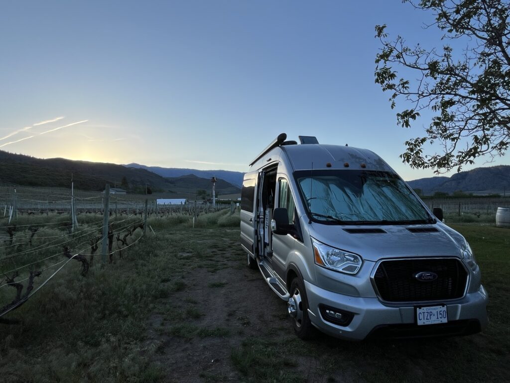
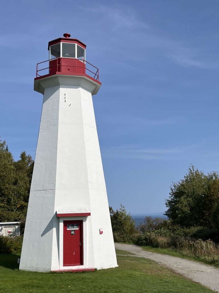
    A slow morning today started with a shower and then coffee and quiche. A second coffee was had while wandering about the campground ahead of packing up. One last look at the view and we were away… to the dump station. No issues, all clean. Yay! Gate card returned and we were back on route 138 heading East.

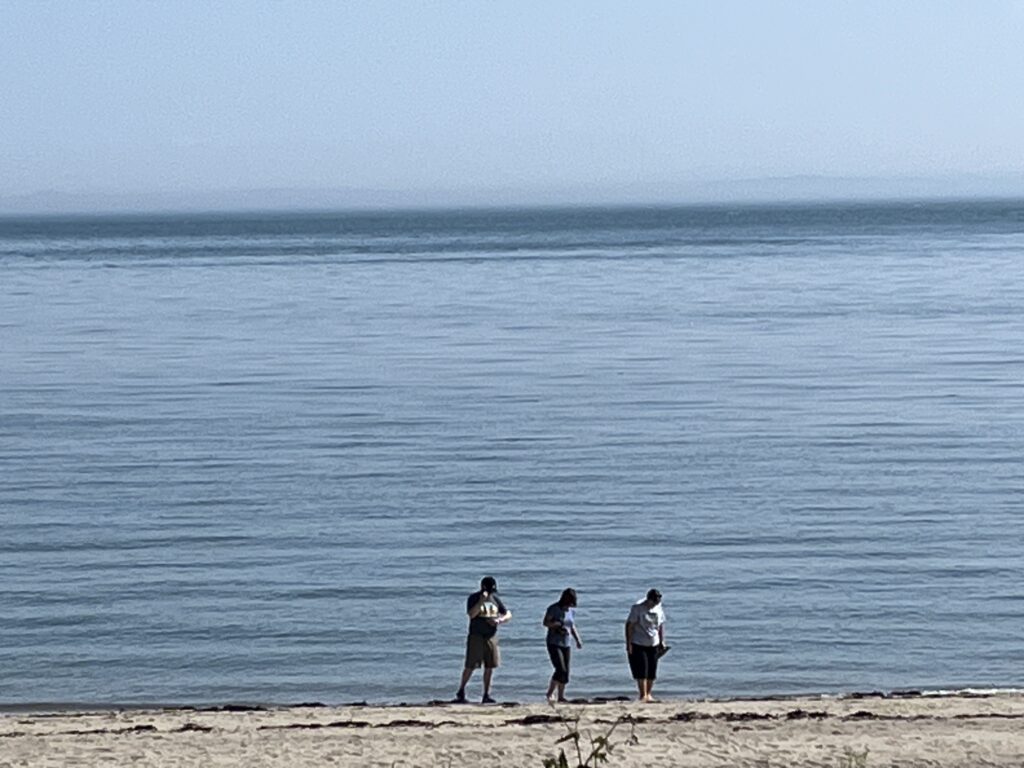
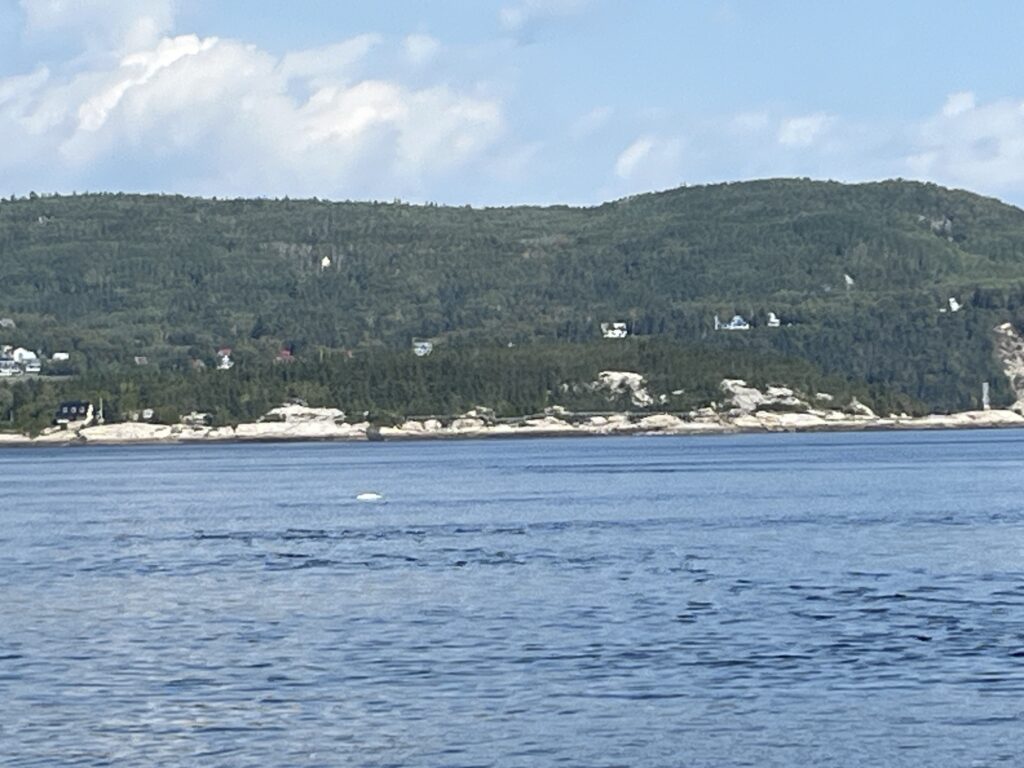
    Our first stop was at the Grandes-Bergeronnes lookout to scout for whales. By checking marinetraffic.com we could see that many of the whale watching tour boats came to this bay. We got lucky and spotted a Minke whale not far from shore. It politely travelled past us a few times probably feeding on a school of fish.

    Courtesy of Mr. Milddogs.com

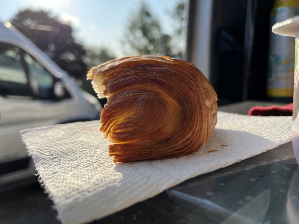
    After watching a small 2-engine airplane land at the Grandes-Bergeronnes airport which is adjacent to the lookout we headed to the Boulangerie Artisanale La “P’tite Cochonne” to get some bread and a couple of sticky treats. It’s a small bakery in a relatively hidden location but the bread is amazing and the treats delicious.

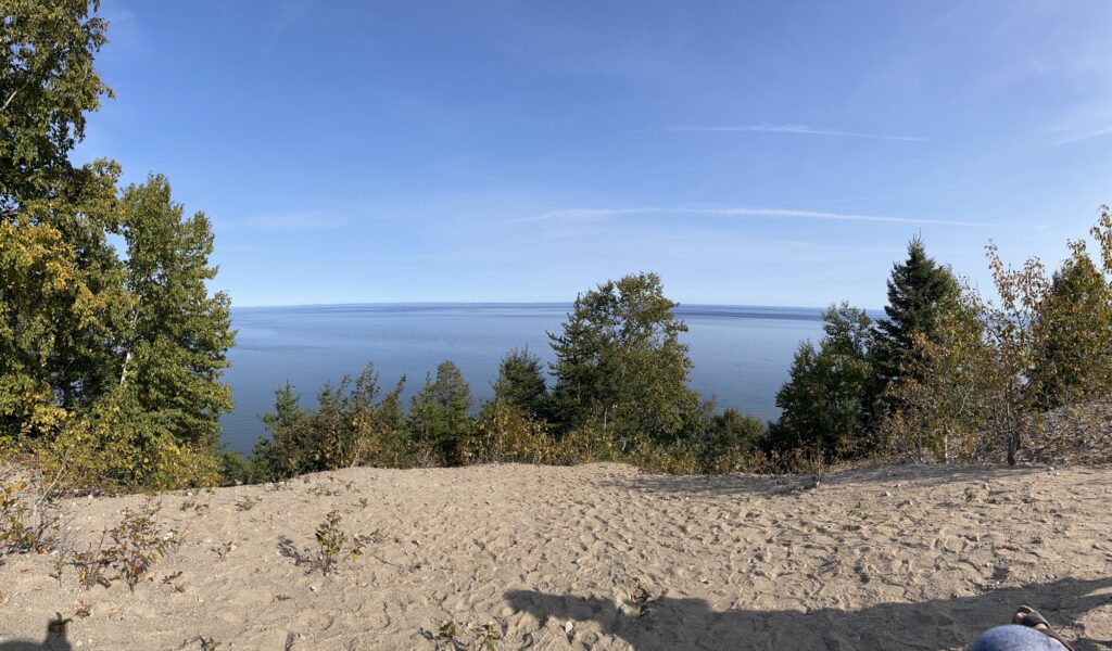
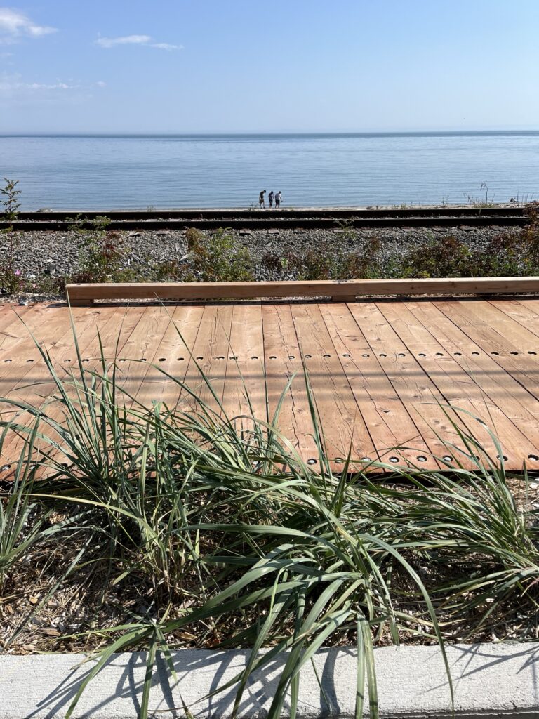
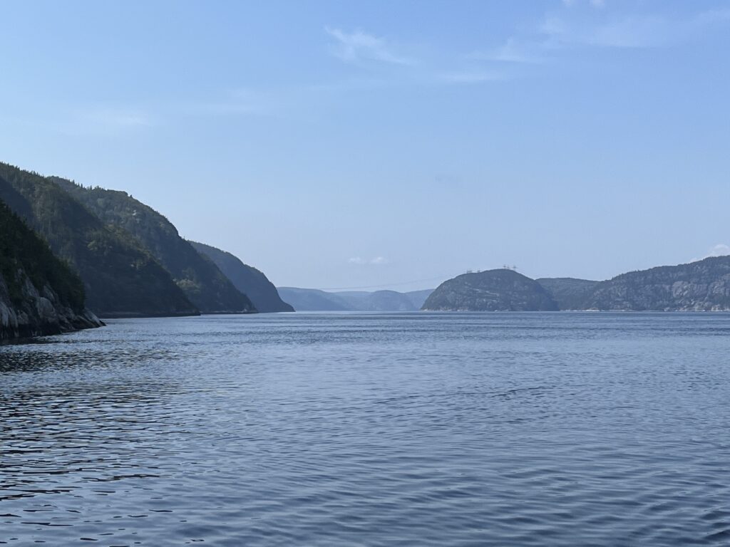
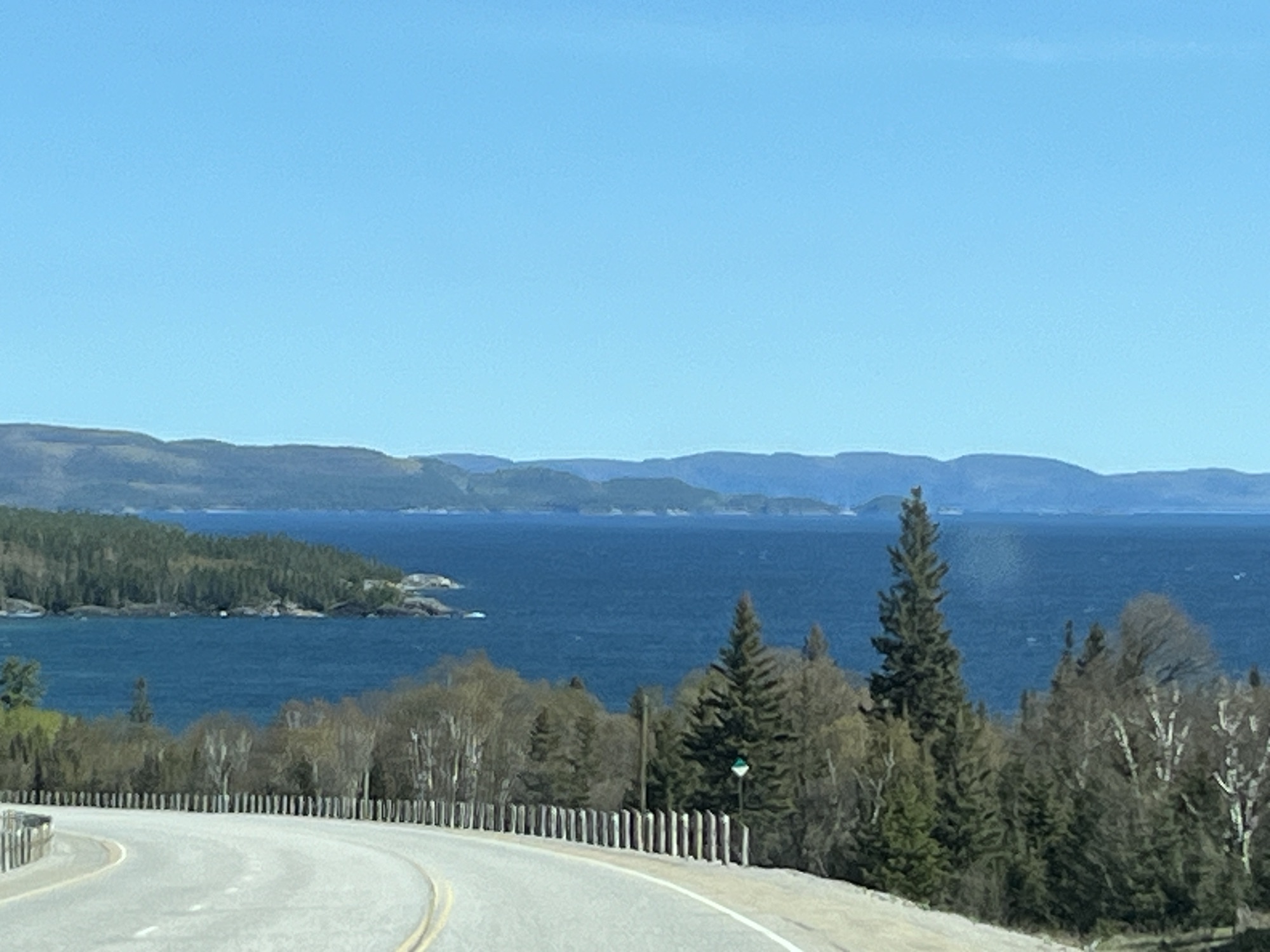
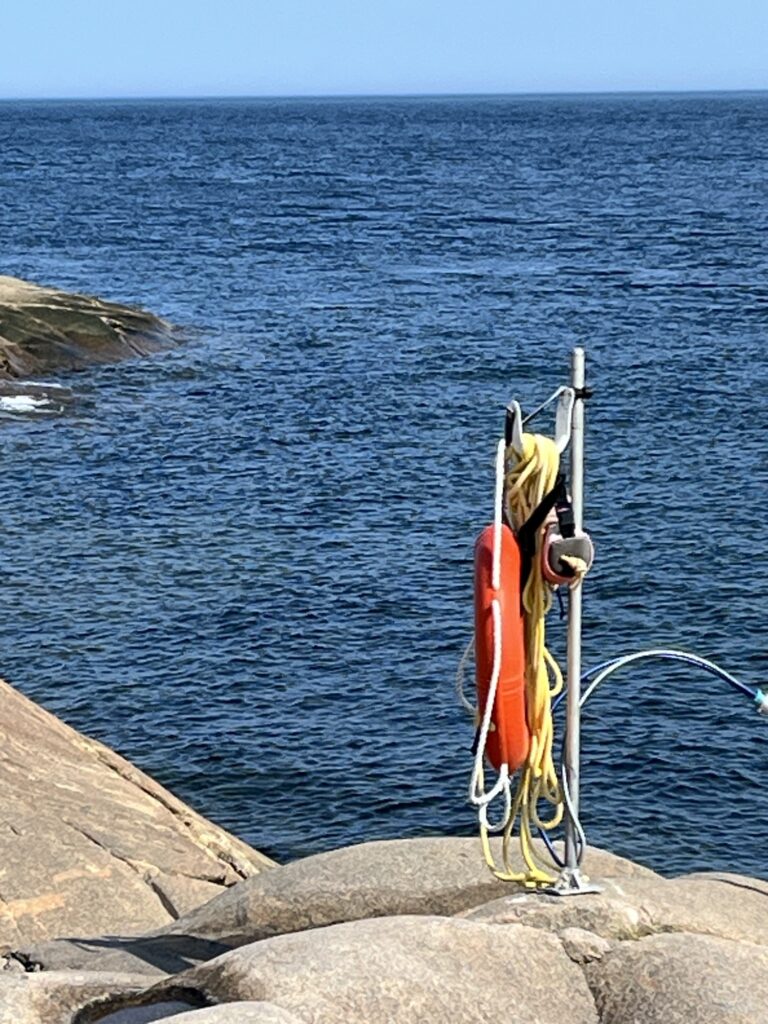
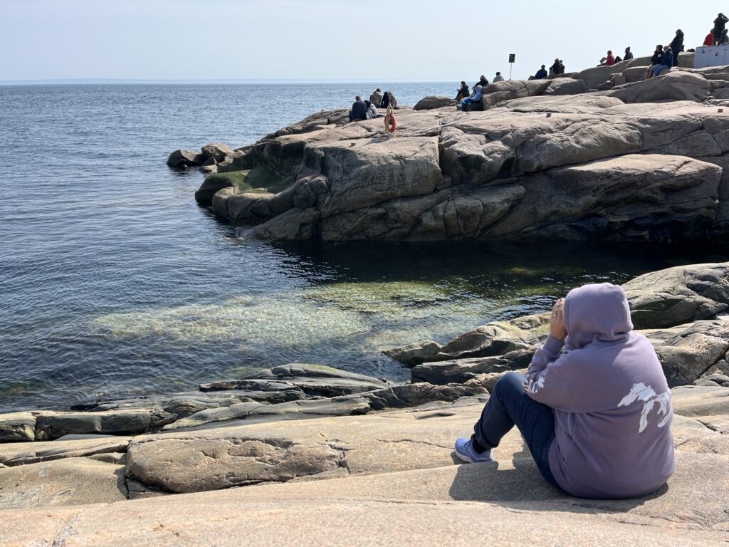
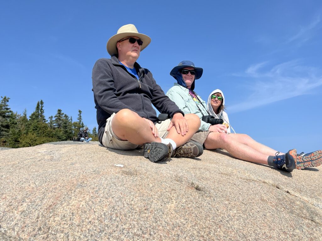
    We head a little further East to the Cap de Bon-Désir Interpretation and Observation Centre. A Parks Canada location that required payment to enter but had an amazing spot on a granite outcropping at the edge of the river. Evidently the water immediately adjacent to the shore is very deep and thus a favorite for whales to visit allowing for good photo opportunities. Today, not so much. We did see one other Minke whale closer than the last location, but after a couple of hours in the chilly wind we decided to call it and head towards Les Escoumins where we could have a late lunch. Dave & Liz decided that whale watching required a little more patience and remained on the rocks.

    Cap de Bon-Désir lighthouse

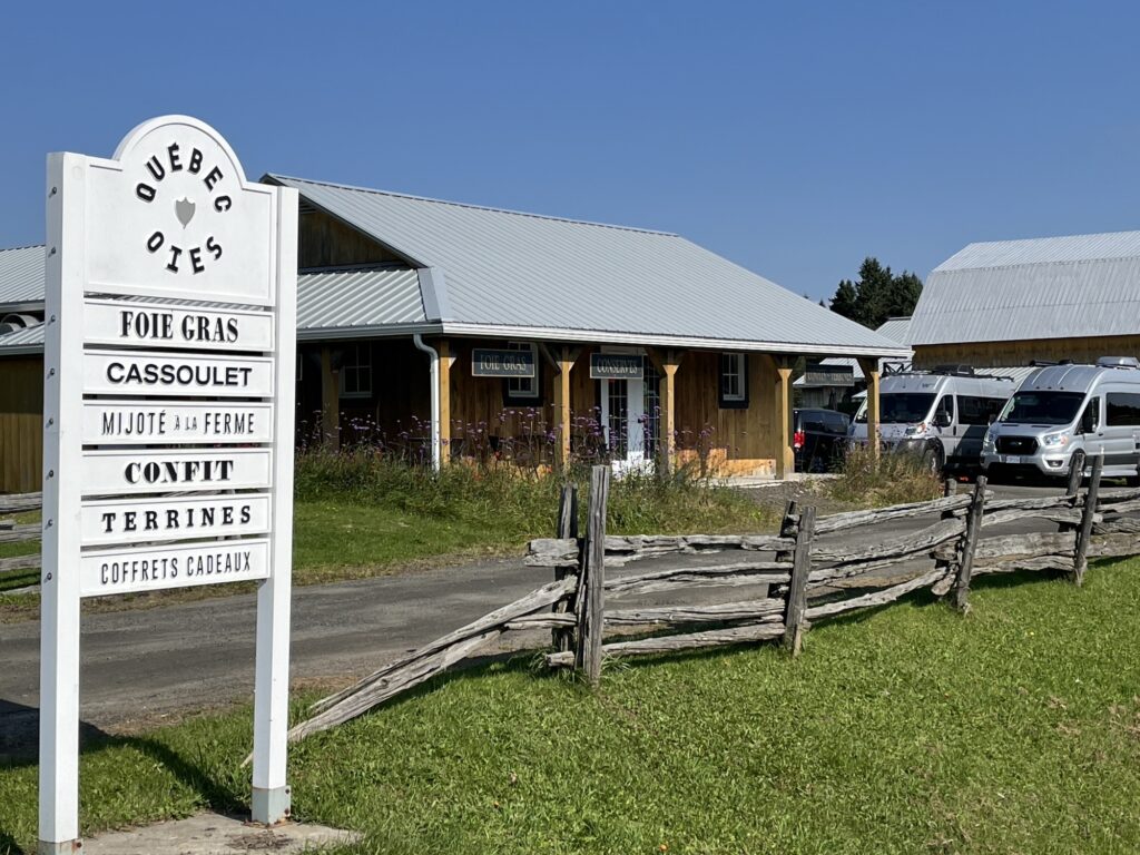
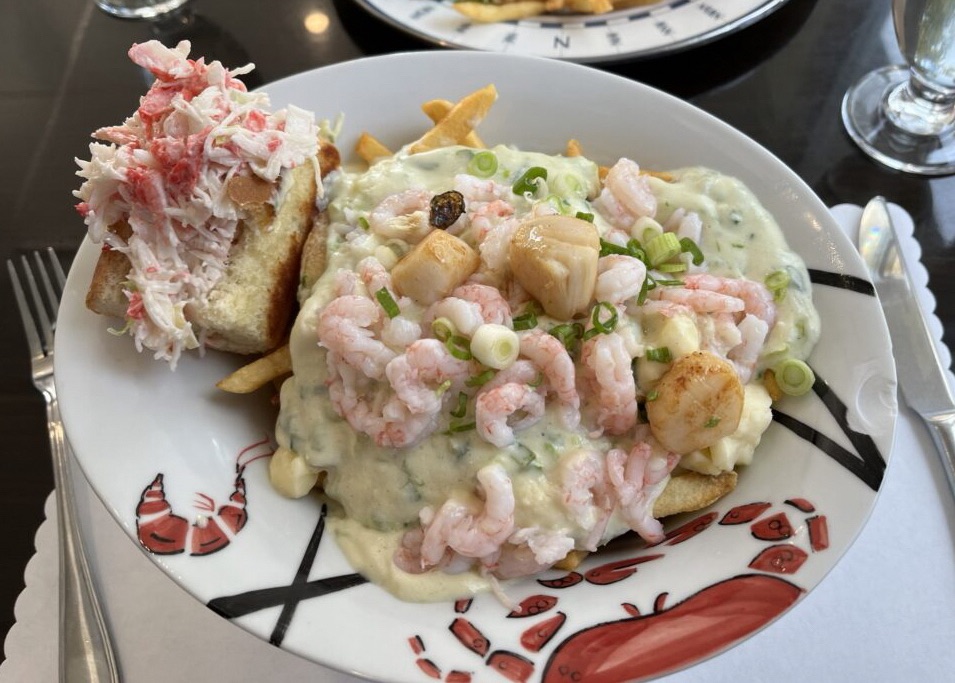
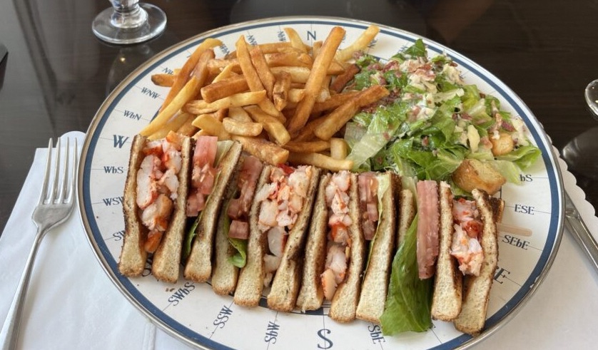
    Arriving in Les Escoumins we stopped at the Pêcheries Manicouagan for lunch and to buy some seafood. Barb enjoyed a Lobster club sandwich with fries and I the Seafood Poutine… Delish! Both plates were a little large, not short of seafood and a little pricey but it was a lovely treat. Having eaten at 3:00pm dinner was likely light snacks if we have anything all.

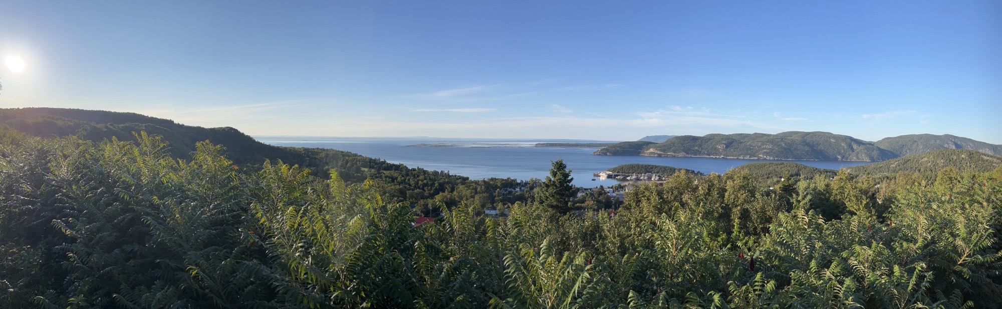
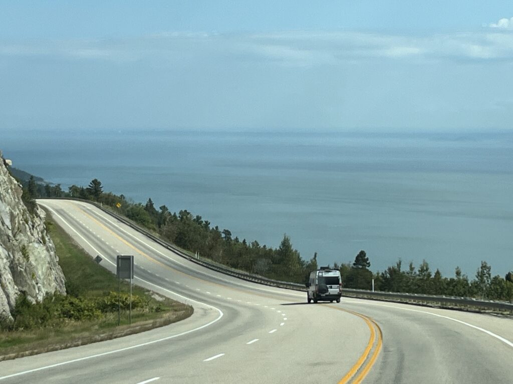
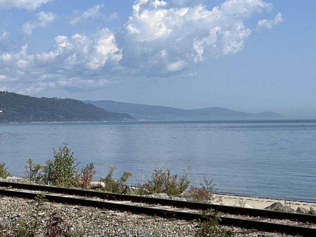
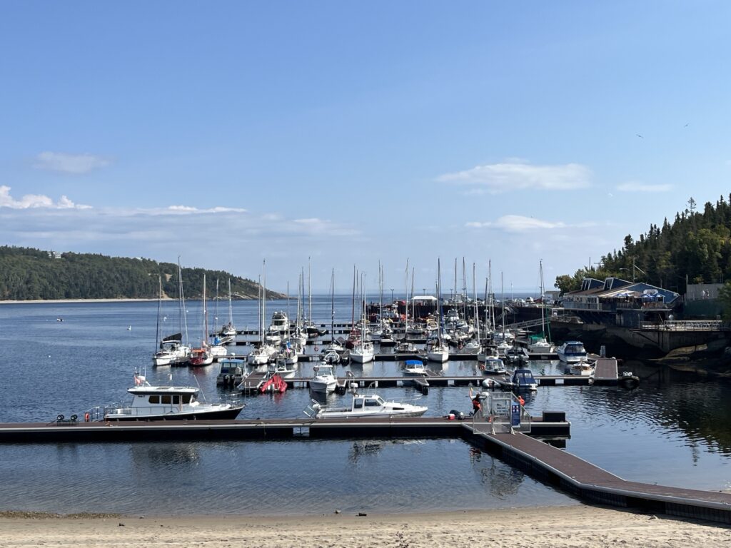
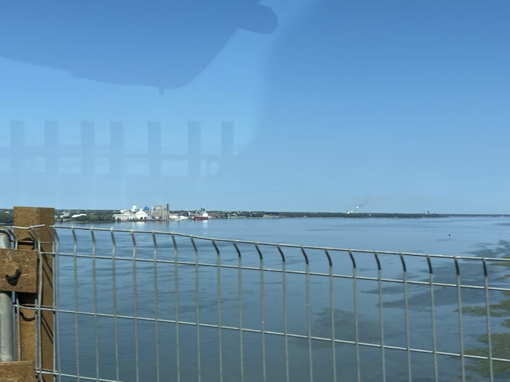
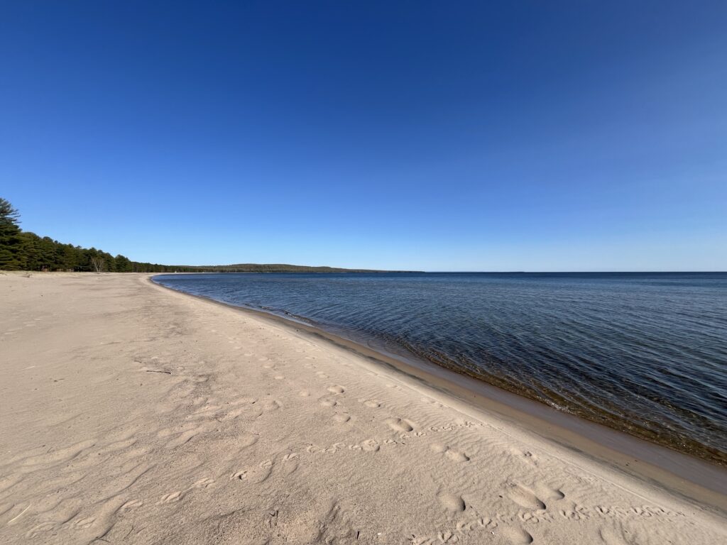
    This was as far East as we will travel on this trip and thus we turned West on route 138 towards our campsite at Camping Paradis Marin. It is only a short distance East of the Parks Canada location and has rocks that equal or better our opportunities for whale watching.

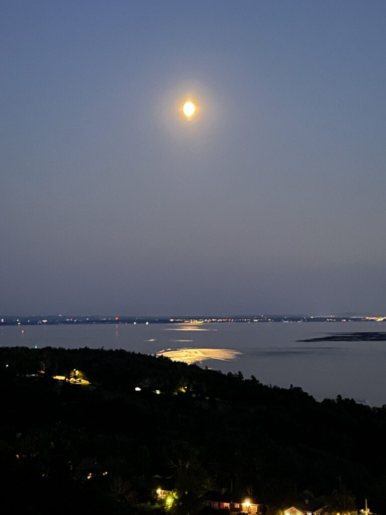
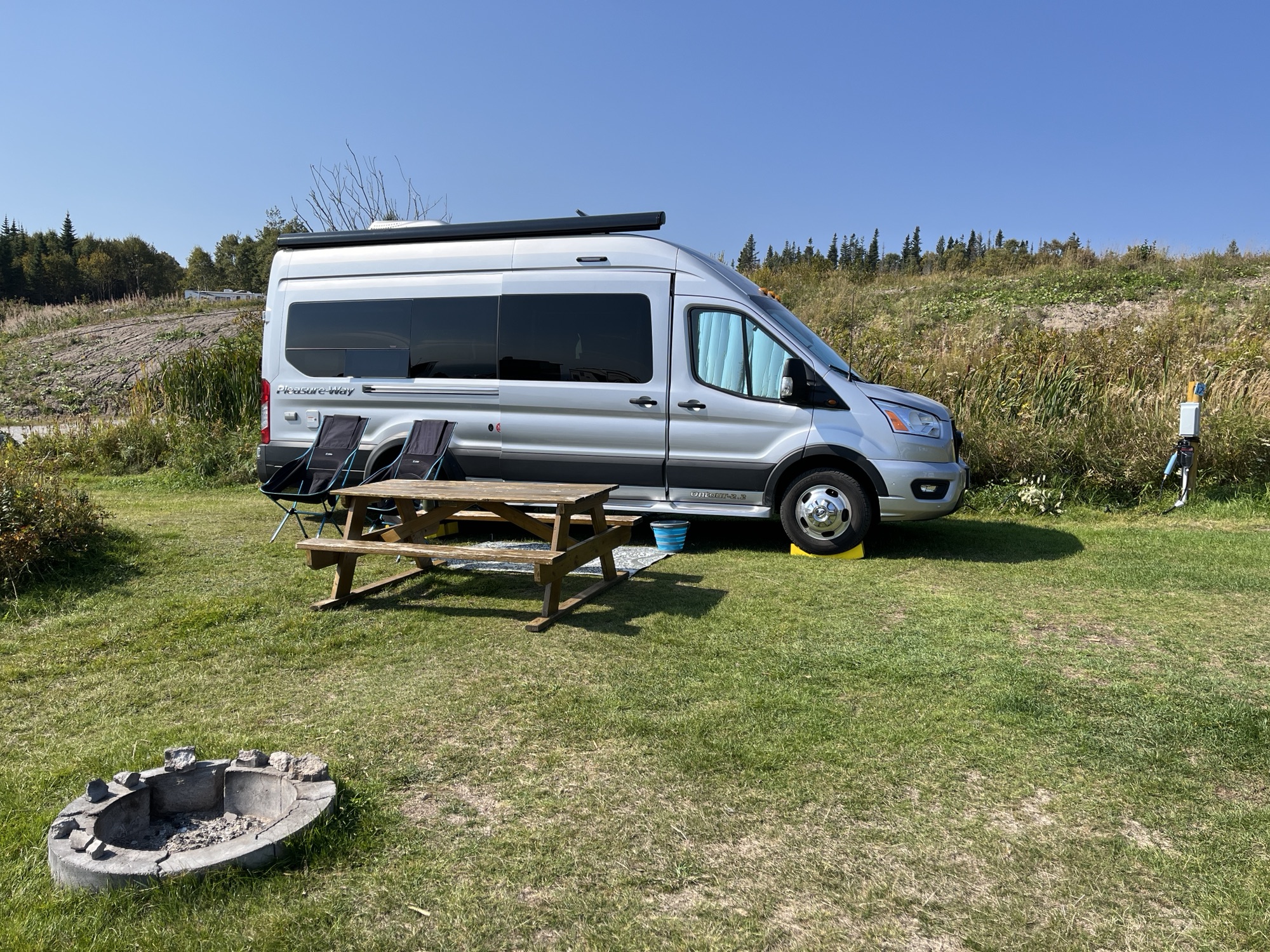
    Our campsite is grassy and we’ve been able to position the van such that we can sit inside and look out to the river between adjacent RVs. We plan on being here for a couple of nights and hopefully will see a few more whales. Time to relax and simply enjoy being outdoors.

  • Day 04: Tadoussac dunes

    Day 04: Tadoussac dunes

    We awake at Camping Tadoussac on a fairly small site (albeit level) just a few feet from the follow view across the Saguenay River looking out into the St. Lawrence River.

    There is no doubt that this view (from the fence line) cannot be beat. However, the campground was not really our ‘cup of tea’. Noisy, crowded and full of kids. There is no sense of any privacy or quiet solitude and so we decided to leave for the day and spend it a short distance from town in an area known simply as ‘the dunes’.

    Tadoussac was hosting a large trail-running event today and thus the town was bursting with all sizes and shapes of humans wearing spandex and goretex. Most of the town was closed to vehicular traffic and we are stopped a couple of times to explain that we are just passing through to the dunes and not trying to sneak into town to get the prime parking spot near the waterfront.

    Arriving at the dunes we are in awe of the views across the St. Lawrence as the dunes are huge 100m tall piles of sand left by a glacier many years ago that now perch on the edge of the river. This was a perfect place to setup our camping chairs and hopefully spot some whales.

    Tadoussac dunes

    There is lots of parking and space for people, most of whom descended the steep slopes down to the waterfront while we remained at the top overlooking the water.

    We had arrived mid-morning, the sun had marched relentlessly across the sky, the wind had come up and now gone down. The shadows were now getting long and yet, we had not seen a whale. Not one. We saw whale watching boats head out to the East and return but did not see any whales. It was however a spectacular day to relax in the outdoors.

    We returned to Camping Tadoussac and setup again for the evening. We had brought Chinese Egg Rolls from the Wing Lee Take Out in Manotick, ON for dinner which we enjoyed with a glass of red wine while the sun set.

    Before heading to bed I took a photo of the same view from this morning but with the moon and share this with you now. Good night.

    Moon over Tadoussac, QC
  • Day 03: Driving to the Côte-Nord

    Day 03: Driving to the Côte-Nord

    Our fear of being blocked-in due to street closures associated with the Grand Prix Cycliste de Québec caused us to awake early and get ready to go. As it turns out we had nothing to fear and our route was not impeded.

    Breakfast chocolatine

    I had drawn the ‘short’(?) straw and was to lead us out of the city, so I entered our destination into my GPS and we set-off. The first few corners went well & then it came time to access the highway and I was directed to turn right where there was no right turn lane. I checked my mirrors and saw that our traveling companions were in the left turn lane so I swung across 3 lanes and we made the turn. A few hundred yards later we were on the highway and my GPS told me to turn left and take the pedestrian underpass!!! I then realized that my GPS was still in walking mode and not driving mode. Yikes! A quick adjustment and we were back on track. Phew.

    As the highway narrowed from four lanes to two we passed Montmorency Falls and the Sanctuaire de Sainte-Anne-de-Beaupré, neither of which we stopped at as we visited them both when we last visited the area in the early 1980’s. A little further East we turned off of Highway 138 to visit La Ferme Québec-Oies where we bought some Foie Gras and a Tourtiere pie.

    La Ferme Québec-Oies

    Venturing back to Highway 138 we travelled a little further and then at Baie-Saint-Paul we turned onto route 362 which would take us along the north shore of the St. Lawrence. It was on this stretch that our companions passed us to lead the way as they prefer to hurl their 3.6l non-turbo van at the uphill sections of the road (quite a few of these and steep) whereas I prefer to use the power and torque of our 3.5l turbocharged engine to pull us up the hills in a less aggressive manner.

    Mr. & Mrs. Milddogs.com on the hills

    We soon arrive in Saint-Irénée-les-Bains where we stop on the roadside and take a walk out into the river on the pier. The girls paddled in the water from the sandy beach and then we enjoyed a sandwich for lunch at one of the many picnic tables.

    As we continued along the coast the scenery became more breathtaking and the hills steeper. Before long we were waiting in-line at the ferry that would take us across the Saguenay River and into the Côte-Nord region of Quebec. While waiting (only a brief wait) we saw a pod of beluga whales swimming in the river, our first whale sighting of the trip!

    The ferry is free as it is considered part of the highway system, it takes about 10minutes to cross the river and we arrive in the village of Tadoussac. This is a popular seaside resort destination in the Summer months and the nice weather had drawn people here again this weekend. We drove down to the waterfront expecting to park near the marina only to be told that as we are in RV’s we would need to go the municipal RV parking lot near the entrance to the village. Hmmm.

    So we did and we walked back down to the waterfront through the trees on a shady trail. We set ourselves up near the Marine Mammal Interpretation Centre and looked across the river looking again for Beluga whales but alas they had moved on. Barb & I decided an ice cream was in order and so bought a soft serve and enjoyed it on the boardwalk that overlooks the beach and marina. We then head back up through town to the van. Our day ended with us driving the short distance up route 138 to Camping Tadoussac where we had booked in for 2 nights.

    Bon nuit!

  • Day 02: Walkabout Quebec

    Day 02: Walkabout Quebec

    For the middle of the city, our camping location was quiet and we slept well. I took a walk around the marina to stretch my legs before everyone readied themselves for a day of walking.

    We followed a self-guided walking tour that we had downloaded and headed up into the old city learning about some of the older buildings as we passed them.

    The tour took us up to the Citadel (fort) that overlooks the river and guarded the city in the 1700’s and is adjacent to the plains of Abraham where the French army failed to defend the city from the English.

    We walked down along the Dufferin terrace towards the Chateau Frontenac and then found a patio on which we enjoyed lunch and a beverage.

    The entire city is readying for an elite bicycle race tomorrow and many of the sidewalks already have barricades setup in preparation. We started to check whether our planned exit from the city would be impeded by these blockades tomorrow morning, but all looks like it should be OK.

    After visiting a patisserie to pick up some croissants and chocolatines we returned to our vans with legs and feet being very tired and sore. In all we walked a little over 6km most of which was either up or down as there is very little in the way of flat land in Quebec City.

    Having enjoyed a large lunch out we decided to eat at the van and enjoyed a lighter meal whilst talking the evening away.

    I ended the day by taking a short walk to the train station and taking a few pictures. Barb and I arrived in the train station in 2018 when we met with our friend Mark to sail his yacht down the St. Lawrence to Newfoundland.

  • Day 01: Heading to Quebec City

    Day 01: Heading to Quebec City

    Today we start a new trip into Quebec. It will be a short trip this time with us planning only 11 nights being planned.

    After completing the loading of our gear, we head out shortly after 9:00am heading toward Montreal. We are traveling with Mr & Mrs Milddogs.com for the first few days and so it is a small 2 vehicle convoy that travels South towards Hwy401 and then turns East towards the border with Quebec.

    On the road again

    Each vehicle decides to take a different route to Tori’s-Rivières with one heading through Montreal on Autoroute 40 and the other skirting South of the city on Autoroute 30. We took the Southern route which would be slightly longer but we were hoping for much less traffic. After paying the $5.80 toll to cross the St. Lawrence River, we turned East across the southern edge of the city. The route was turning out to be as expected with light and fast moving traffic. As we approached Autoroute 20 the traffic increased and we were slowed for a few minutes with one or two cringy brake applying moments just before the exit from the 30. Autoroute 20 took us further East and the traffic again lightened and the driving was easy. The weather was perfect with clear skies and mild temperatures, we were enjoying the passing scenery as we trundled towards Drummondville wondering how our traveling companions were doing in Montreal.

    We turn North from the 20 and head towards Tori’s-Rivières. Stopping briefly to stretch our legs we head once again over the St. Lawrence and join Autoroute 40 East towards Quebec. We stopped at a small Fromagerie where we met up with Mr & Mrs Milddogs.com. Their route had been a few minutes faster as the GPS had predicted and like us they had no major traffic issues crossing Montreal.

    The Fromagerie des Grondines has a nice selection of cheeses and artisan jams, mustards, quiches, beers and wines. We got a little cheese, a quiche for breakfast and a couple of beers for later.

    After returning to the highway, we stopped again briefly to fill up with fuel before heading into Quebec City where we plan on camping for the next couple of days.

    Shortly after 3:00pm we arrived at our camping destination the Stationnement Bassin Louise VR – Port de Québec. Yep, we’re camping in a parking lot next to the Quebec marina located a short walk from Old Quebec City.

    After setting up and paying our fee for the night, we head out for a walk and end up at the Chateau Frontenac. We enjoy a beer and charcuterie on a patio enjoying the afternoon sun and watching the tourists walk by whilst catching up on life events with our friends.

    Beers and charcuterie enjoyed here

    The beer consumed we head to the Dufferin terrace where we enjoy a wonderful view down and across the St. Lawrence River before heading to an ice cream shop. The walk back down to the van took us past the train station and onto the marina.

    We spent the evening outside of our vans enjoying a beverage and watching the lights come on and illuminate the city. In all, it was a great start to the trip and I’m sure we’ll really enjoy the next week or so.

  • Recap and Statistics (revised)

    *** Revision: Turns out that I got the math wrong when converting USG to Litres which understated the amount of fuel purchased while in the U.S. I have attached a revised image below and left the original so that you can see the difference. ***

    It’s been a few weeks since arriving home after our Cross-continent tour and it’s about time I shared some statistics from the trip.

    The first question is always about where we stayed each night. Did we find suitable camping locations? So, here are the stats for that.

    • 21 nights free camping. This includes family, Harvest Hosts locations, BLM camping and parking lots.
    • 5 nights at private campgrounds.
    • 18 nights at a National, State or Provincial parks. These were all serviced sites.

    That’s a total of 44 nights of camping in our van. Which leads us to, where did we go? Here’s a map that shows you our route.

    2024 Cross-continent tour

    Lastly, how much fuel did we use and what did it cost. Here is a table for you to review.

    Original (wrong) # of liters purchased in the U.S.
    Revised # of liters purchased in U.S.

    So there you have it, a few statistics about the trip. Hoping you find them interesting.

  • Day 45: Let’s get home, shall we?

    Day 45: Let’s get home, shall we?

    This is it, our last day on the road as part of this adventure. There is a sense of sadness that it’s almost over yet we are looking forward to being home and enjoying Spring around our home.

    After a quiet night we awake fairly early and begin to prepare the van for the drive home. We enjoy a light breakfast with Kath & Al and set off shortly before 10:00am after thanking them for the wonderful hospitality they’ve extended to us over the past couple of days.

    We head through Meaford and proceed onto Collingwood before turning slightly South towards Barrie and then onto Orillia, ON. It’s Friday before the 3-day Victoria Day weekend and as such there’s more traffic on the roads as many have taken the day off work so that they can get to their weekend destinations ahead of the main thrust of traffic later in the day.

    Leaving Orillia, we head towards the Kawartha Lakes region and then onto Peterborough where we pick-up Hwy-7 and head East towards Norwood, ON. We stop for fuel and then a quick picnic lunch that empties the fridge of the last of our groceries.

    Back on the road we head towards Sharbot Lake Provincial Park where we pay a day-use fee to allow us access to the tank dumping facilities. A little while later we leave Hwy-7 and head through Perth and onto Hwy-43 towards our home.

    We stop to pick-up Shawarma for dinner and then head home where we are greeted by Mr. Milddogs who captures our return in the following picture.

    Arriving home

    And with that our Spring 2024 adventure comes to a successful conclusion. It’s been a blast and we’ve seen some wonderful places and enjoyed visiting with friends and family. Until next time, thanks for following along.

    P.S. There will be a summary post for the journey in the coming days once I’ve had a chance to catch my breath.

  • Day 44: …

    << This page left intentionally blank >>

  • Day 43: The day we took a shortcut

    Day 43: The day we took a shortcut

    Up and at ‘em by 7:00am and on the road by 8:30am and soon pass the halfway-point along the Trans Canada Highway.

    We head towards Sault-Ste-Marie and then turn East on Hwy-17. Our first stop is in Echo Bay, ON to see the giant ‘Loonie’. It’s here to recognize that the original Loon artwork used on the coin was by an artist from Echo Bay.

    Echo Bay, ON

    The drive eastward is steady and it takes about 3 hours to get to Espinola, ON. We stop for fuel and then head South on Hwy-6 to Little Current on Manitoulin Island where we stop for a picnic lunch.

    After lunch we continue further South towards South Baymouth, ON and check-in for our ferry reservation. We are heading to Tobermory, ON by way of the MS Chi-Cheemaun.

    The ferry departs at 3:50pm which gave us an hour or so to look about the ferry port. Loading was easy and the ship is carrying barely a quarter of its vehicle capacity.

    MS Chi Cheemaun arriving at South Baymouth, ON

    We depart right on-time and head out into Georgian Bay on Lake Huron. The crossing will take about 2hrs so we decide to have an early dinner on board and the spend time relaxing in the lounge.

    We were asked to return to our vehicles in preparation for arrival 15min ahead of actually arriving. As such we did not see the town of Tobermory as we arrived, instead this is our first view.

    First view of Tobermory, ON

    We passed through Tobermory and headed South on Hwy-6. We were soon driving through the familiar agricultural landscape of Ontario toward Wiarton and Owen Sound.

    Wiarton, ON the home of ‘Wiarton Willy’
    Owen Sound, ON

    We head East along Hwy-21 towards Meaford, ON where we will be visiting family and resting for a couple of nights. Catch you all in a couple of days!

    View East towards Meaford, ON and Collingwood Bay beyond.
  • Day 42: …the big lake they call Gitche Gumee…

    Day 42: …the big lake they call Gitche Gumee…

    According to Wikipedia, Lake Superior is actually called Giche-gami in Ojibwe but I’ve used the Gordon Lightfoot spelling for the title of this post.

    Ahhh, after our night in Winnipeg, last night was soooo quiet. We slept until 7:00am and could have probably slept longer if we didn’t need to keep moving it along. We showered last night (showers get 8/10) and so this morning was a simple breakfast and packing up of the van. Tanks dumped and water filled, we were on the road by 9:00am.

    First priority of the day was fuel for the van and some 5G internet so that I could finish and upload yesterdays post. Barb located an Esso/Tim Horton’s in Thunder Bay which also had a really good 5G signal. Check.

    Terry Fox memorial, Thunder Bay, ON

    Back onto Hwy-17 East towards Nipigon, ON. Construction of new 4-lane sections slowed us a few times, but as the road was fairly quiet, we had no long waits thankfully. Passing the Nipigon River bridge and the Hwy-11 turnoff that we took two years ago, we continued on Hwy-17 towards White River and Wawa, ON.

    The road is in really good condition and the weather was beautiful making the driving easy. We stopped at the Aguasabon Canyon viewpoint to look at the waterfall. We had the place to ourselves.

    At White River we stopped at the visitor center and Barb got to visit Winnie-the-Pooh as we had done with our children 21 years ago. We also enjoyed a picnic lunch in the van before returning to the road.

    The visitor center in Wawa is still closed for the Winter and so we don’t stop but Barb managed to get a picture of the Wawa goose.

    Wawa goose, Wawa, ON

    Some of the views out across the lake are stunning and you come upon them suddenly as the road twists and turns along the shoreline. We’ve included a few below.

    We end our day in Pancake Bay Provincial Park just a few kilometers North of Sault-Ste-Marie, ON. The beach here is gorgeous and Barb even wades into the (very cold) lake.

    We settle in for the evening and prepare for our last long road day tomorrow which will include a special treat.

  • Day 41: Let’s go into the woods today

    Day 41: Let’s go into the woods today

    Sleeping at a truck stop next to a busy highway and intersection was probably not the best idea we’ve ever had, but we made it through the night albeit with less deep sleep than we probably needed.

    We start by having an egg breakfast with coffee at the Denny’s on-site. This is a healthy (hmm?) dose of protein that will ensure we don’t feel hungry in an hour or so.

    Barb drives us out of the Flying-J shortly before 8:00am and we take the bypass around Winnipeg, MB heading towards Ontario. Soon the trees return and we’re no longer on the prairie. We stop at Falcon Lake, MB for fuel which we get at 20 cents / liter cheaper than we pay later in the day in Ontario. I take over driving duty for the next hour or so.

    After passing Kenora, ON we turn South onto Hwy-71 towards Fort Frances, ON where we stop to have a picnic lunch by the river looking across toward Minnesota, USA.

    Continuing East from Fort Frances on Hwy-11/17 Barb drives for a couple of hours toward Thunder Bay, ON. I take over driving again and pass back into the Eastern time zone.

    We stop for the night at Kakabeka Falls Provincial Park just North of Thunder Bay. We shower and have Buttered Chicken for dinner. A little TV and it’s time for bed.

  • Day 40: Getting the miles in

    Day 40: Getting the miles in

    Well, no aurora viewing last night, oh well. We slept really well and got off to a great start for the day before 8:00am.

    The drive starts with what we thought was an early morning haze. Later in the day we’d discover that it is actually smoke from a wild fire in Northern BC.

    Barb started driving the day until we got to Moosejaw where we changed drivers and had a bite to eat & fueled up.

    Later in the afternoon we crossed into Manitoba and made our way to Brandon, MB where we again fueled up before driving our last leg into Winnipeg, MB.

    Tonight we are parked at a Flying-J. Tomorrow we head into Ontario.

  • Day 39: Mountains, Foothills, Prairies

    Day 39: Mountains, Foothills, Prairies

    We awake at 6:00am and find that we were joined last night by two other campers in our secluded ‘wild camping’ spot behind the Independent grocery store in Fernie, BC. A few townies kept Barb awake for a while, but in general terms this was a wonderfully quiet place to spend the night. Also close to Starbucks, McDonald’s, etc. if you need/want breakfast take away in the morning before heading out. We had our usual coffee, banana & yogurt before heading out at 7:00am.

    Wild camping in Fernie, BC

    We had decided to stop at the top of Crowsnest Pass for a cooked breakfast and take the time to really start our day. The road up the pass was not as steep or arduous as some of the passes we had driven yesterday, which surprised us and as such we arrived at the top fairly quickly. Time for quiche. Yummy!

    Once fed and ready for the day we headed further into the mountains and arrived at Frank, BC the site of Canada’s most deadly rock slide. In 1904 the side of Turtle mountain collapsed and slid into the valley below. 100 lives were lost in the town of Frank and the valley was changed for ever. The debris pile is huge and from the interpretation center you can imagine the noise and dust that would have been produced that day.

    We traveled on to Fort Macleod in the Alberta foothills where we visited the “Head Smashed-In Buffalo Jump” museum. This is a World Heritage Site and goes into amazing detail of how the Blackfoot people used the cliffs as a killing ground for herds of buffalo (bison) for thousands of years until the 1800’s. Built into the cliff, the museum building is worth the visit by itself; however, the stories of the people are the real captivating reason to visit. Highly Recommended.

    Head Smashed-In Buffalo Jump

    Continuing East on Hwy-3 we head to Lethbridge, AB where we stop under the railway viaduct in a park for a picnic lunch in the van. No trains passed over the viaduct while we were there unfortunately.

    The day was heating up into the low 20’s as we headed further away from the mountains. Shortly before Medicine Hat we stopped in Seven Persons, AB for ice cream! Yummy, again.

    Ice cream break!

    We drove around Medicine Hat and headed toward the Saskatchewan border on Hwy-1, the Trans-Canada Highway. Shortly after crossing into Saskatchewan we stopped at the “Cypress Hills Winery” in Maple Creek, SK. This is another Harvest Host destination and we enjoyed a fruit wine tasting and had a glass of Rhubarb Wine with pizza for dinner. A couple of bottles might also have found their way back to the van as well.

    Tonight we are hoping to see the Aurora Borealis that so many saw last evening but we missed due to cloud cover. Fingers crossed!

  • Day 38: The Crowsnest Highway

    Day 38: The Crowsnest Highway

    Another early start to the day. I blame it on the early rising of the sun. Away from our wonderfully quiet campsite in the vineyard by 7:30am. Today we will spend the day traveling along Hwy-3, also known as “The Crowsnest Highway” towards Fernie, BC.

    Leaving Osoyoos you immediately begin to gain elevation and the views across the valley are stunning.

    Of course, what goes up must come down and sure enough it not long until we are descending at a rapid pace into another valley in Southern BC. This is repeated several times today with the climbs being just long enough to allow the brakes to cool from the last descent before being called on again. Utilizing the lower gears in the gearbox helps on these descents, as does having an eight-speed gearbox.

    We stopped for a quick break in Grand Forks, BC and then again in Cranbrook, BC. Between Cranbrook and Fernie we crossed into the Mountain time zone and as such are now just two hours behind Ontario. Our final destination is the town of Fernie, BC where we are ‘wild camping’ for the night.

    Tomorrow we enter Alberta and will leave the Rocky Mountains behind us.

  • Day 37: & so Eastward we are bound

    Day 37: & so Eastward we are bound

    5:30am rise & shine to get ready to depart Galiano Island. The ferry leaves at 8:30am but we have no reservation and so need to arrive at the dock early to have the best chance of boarding.

    After a very nice and relaxing six days visiting my parents we say our goodbyes and head toward the ferry at 7:00am. 7:25am and we’re first in-line. A coffee, yogurt & banana while we wait. Turns out that that there was no issue of space and we could have probably slept in for an extra hour or so. Oh well, better safe than sorry.

    As we cross the Strait of Georgia towards Vancouver, we think back on where we have been so far on this adventure and the varied weather that we have seen. This morning it was around 10°C when we woke, it will be 27°C when we stop later this afternoon!

    Our drive across the Fraser River valley is uneventful and after a couple of hours we pull into Hope, BC for fuel & to dump our tanks at a municipal Sani-dump ($free).

    For those that don’t know, Hope, BC was the filming location for “Rambo: First Blood”. The town has embraced this notoriety and there are several landmarks about the town that you can visit from the movie. The bridge, across which Rambo walks at the beginning of the movie is gone (2011) but a new bridge has replaced it and there are still signs, but it’s not quite the same knowing that it’s not the same bridge.

    Not the ‘Rambo’ bridge in the same location as the original ‘Rambo’ bridge

    Everyone’s favorite stop is downtown near where the Police station was in the movie. In the park there are a number of chainsaw carvings of the characters from the movie. We snapped a picture of Rambo (below).

    Rambo chainsaw sculpture

    We head East on Hwy-3 towards the Okanagon valley. The road, although windy and hilly as it passes through the mountains, is really very good and well maintained. There are lots of passing lanes on the hills (including one that is 38km long!).

    Eventually we notice the trees thinning and the flora around us changing to be more desert-like as we approach Osoyoos, BC. It reminds us of the Southern California desert in some ways with the slope of the hills and the sagebrush. It’s also now quite warm and the A/C in the van is very welcome.

    Pulling into Osoyoos, we stopped at a roadside produce stand which happened to have a Mexican food truck next door. Lunch time!

    Lunch was delicious and we both highly recommend “Sofia’s Mexican Food”. I enjoyed a chimichanga and Barb had 3 chicken tacos. Barb also picked up a few treats for another time from the roadside produce stand.

    Our stay tonight is at a vineyard just north of Osoyoos called Mythology vineyard. The wine is very good and our camping spot is amongst the grapevines behind the tasting room. Our view is West towards the mountains and we look forward to enjoying a glass of wine as the sun sets.

    Campsite view
  • Days 32 to 36: …

    << This page left intentionally blank >>

  • Day 31: Nothing to declare

    Day 31: Nothing to declare

    Oooof…. 5:30am. We’re up & heading for a shower (which gets 4/10 because of very small size & clingy shower curtain). Why so early you ask? We have an early reservation for the Port Angeles, WA to Victoria, BC ferry. Yep, we are leaving the U.S. after almost a month of travel, it’s time to head back into Canada.

    Showered we get the van ready for the day and are driving off site by 6:45am. Traffic is fairly light and this makes our drive back into town to the wharf easy and quick. Black Ball Ferries require us to check-in a minimum of one hour before the ferry “Coho” departs at 8:20am, we make it with a few minutes to spare.

    A cup of coffee and a banana are enjoyed while we wait to board which begins shortly before 8:00am. We make our way up to the top deck in order to have the best views back across town to the Olympic mountains.

    The ferry is relatively full with most passengers having walked-on. The Salish Sea is mill pond calm and we see a few seabirds fishing for breakfast but no whales or seals today while crossing. Arriving in the Victoria inner harbour, our departure and clearance through Canada Customs takes about 30min. We head towards Langford, BC where we enjoy breakfast at a White Spot restaurant before getting groceries for the week.

    The weather for today is predicted to go from sunny this morning to rain later in the afternoon. As such we have changed our plans to try to avoid the heaviest rains and are now heading to my parents home a day ahead of schedule for a few days of rest and relaxation.

    Arriving – Galiano, BC

    We’ll catch-up with you again when we resume our journey next week. All the best and thanks for following our adventures.

  • Day 30: To the state of Washington

    Day 30: To the state of Washington

    Oregon was wet, it rained a lot. Of course if you’ve been reading along you will have already observed this, but it does feel like I need to say it again, Oregon was wet.

    Fort Stevens State Park has the best showers of the Oregon state parks we stayed at. 8/10. They only lose points for being push-button (timed) showers and bare concrete floors. All other requirements of a shower were easily met, especially privacy & cleanliness.

    Today is a driving day, we leave Oregon and head across Washington to Port Angeles. Astoria, OR is the last town that we pass through on our way to Washington. Today there is a cruise ship docked in port, visitors are likely on a ‘Goonies’ sightseeing tour.

    Driving from bridge towards Washington

    Washington state has a lot of trees, it’s about all you see as drive through it. We took pictures as you will see below, but didn’t stop at any touristy places. The drive was about the destination as it was 4 hours plus a break for lunch.

    Arriving in Port Angeles we went down to the wharf and ate an early dinner at the Downriggers on the Water restaurant and enjoyed a clam chowder and a sandwich.

    On our way to our campsite we topped off with fuel and then arrived at the KOA campground just East of town. Tonight we get everything in order to re-enter Canada.

    Tomorrow will be an early morning as we are booked into the 8:20am ferry heading for Victoria, BC.

  • Day 29: Fort Stevens State Park

    Day 29: Fort Stevens State Park

    Our last day in the U.S. without driving anywhere. We slept in and enjoyed a relaxing morning while we waited for things to dry out from last nights rain. The sun was supposed to appear today and the afternoon was going to be glorious.

    Barb prepared a delicious brunch fry-up after which I finished reading a second book on this trip and then we retrieved the bikes from the bike rack and prepared to go for a ride about the park.

    Campsite at Fort Stevens State Park, OR

    From our last visit here in 2022 we know that the park is laced with paved bike paths making cycling a great way to get about this rather large park. We started by heading towards the dunes and then cycling down to the beach access allowing us to ride on the beach. The tide was out and the sand wonderfully flat. The cool weather was keeping most people hunkered in their trailers, this meant that the cycling trails and the beach were very quiet.

    Beach panoramic

    Oddly I was able to utilize 3 bars of 5G connectivity on the beach but only 1 bar of LTE while on our campsite. I took the opportunity to complete and post yesterday’s blog post from the beach while sitting on a driftwood log. The wind was biting (no sunshine) and so shortly after I had posted the entry we headed back inland toward the campground.

    After securing the bikes back onto the bike rack we relaxed in the van for the afternoon as yet another brief shower passed over the area. For dinner, chicken fajitas were followed by an evening of TV. Tomorrow we head to Port Angeles, WA where we will spend our last night in the U.S.

  • Day 28: To Fort Stevens State Park

    Day 28: To Fort Stevens State Park

    One last leg along the Oregon coast awaits us today. Surprise! It rained overnight and continues to drizzle as we get ready for the day. Showers are the stock same as the other Oregon state parks but these seem to have been renovated slightly with new fittings and lights making them feel brighter and cleaner. Hot water (good) so they get a 7/10.

    We depart our site at 10:00am and join the line-up to dump our tanks. We leave the park at 10:30am. Our first stop of the day is at “The Devils Punchbowl”. It’s a natural rock arch through which the waves break into what was a large cave before the roof collapsed. Now in certain conditions the waves break and shoot skyward. Not when we arrived however as the tide was not yet at its highest, although the weather and sea conditions made it look like it might have been quite a spectacle later in the day.

    The road along this section of US-101 has at times subsided and as such it was quite bumpy and we had to pay attention to the warning signs regarding speed or suffer the consequences of our belongings being flung about the van.

    Whale sculpture

    Arriving in Tillamook, OR we stopped first at “The Blue Heron French Cheese Company” where we sampled some lovely cheeses and picked a few pieces up for eating later. We then, of course, made our way to the “Tillamook Creamery” where we visited their museum and viewed the creamery workers making and packaging cheese. The visit concluded with a trip through the gift shop and finally lunch at their cafe where cheese was prominent in all menu choices. Yummy!

    The coast ‘softened’ as we headed further North with more of the coast now being wide open sandy beaches dotted with Summer getaway towns such as Rockaway Beach (not the one made famous by The Ramones). We made a stop at a viewpoint high on a cliff top and captured some beautiful shots of this portion of the coast.

    We make a quick detour into Warrenton, OR to get a few groceries & fill up with fuel at Fred Meyers. Maybe, just maybe better than H.E.B. in Texas. Barb is smitten.

    A short drive from Warrenton we arrive at Fort Stevens State Park where we will camp for the next two nights. This is our second time here as we camped here two years ago and had a great time.

    Settling in the for the night under the trees. Good night everyone!